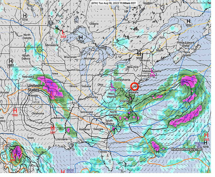
Update Sat 08/13 @ 8:26 AM — We may be disappointed with the amount of rain that had been expected for Monday into Tuesday. The low pressure system and upper trough are forecast to set up in a position that would minimize precip in our area. The latest ECMWF captures it well—
ECMWF shows upper low with the rain mainly to our south, west and east; essentially the same pattern for the past two months. (Click on image for a larger view.)
Updated Fri 8/12 10:49 PM —It looks like we’ll have some cloudiness move in during the mid afternoon on Sunday, somewhat earlier than previously forecast.
Previously Posted Fri 5:46 PM —
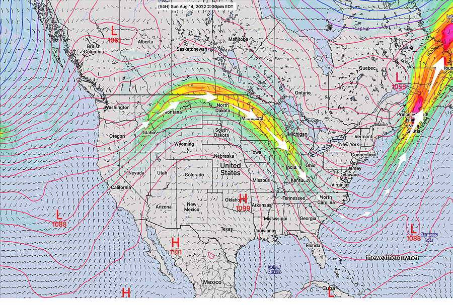
This weekend, we’ll be under the influence of a cool, low humidity high pressure system that has pushed the jet flow into a trough pattern. We haven’t seen a trough pattern here for many weeks—
GEFS (mode) 250 mb winds showing rather deep trough over the eastern US. (Click on image for a larger view.)
The forecast for this weekend will be relatively simple. Mostly fair skies and low humidity.
Following the weekend, the same upper trough will produce unsettled weather.
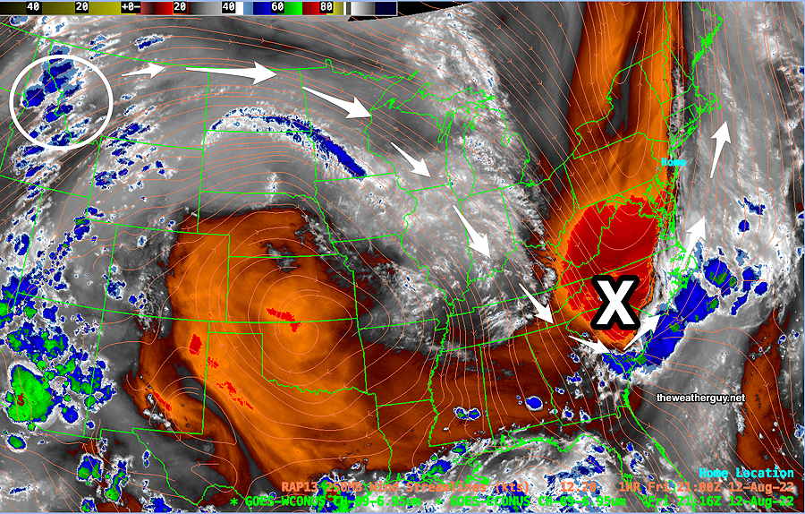
As shown in the current water vapor image below, an upper air disturbance in Idaho will move along the jet flow and develop into a surface low pressure system late Sunday evening through Monday and possibly lingering into Tuesday—
Current Water Vapor Image (Friday 5 PM) with RAP model jet wind contours shows upper air disturbance (blue areas in white circle) will move along the jet flow and spawn the development of a surface low pressure system (X) that may bring much needed rain Monday and possibly into Tuesday.
Saturday
Sunny and very pleasant. Breezy.
High temperature 81.3º ± 1.8º NBM model Blue Bell, PA
(Seasonal average high 84º Blue Bell, 85º Philadelphia)
Sunday
Continued sunny and pleasant. Light winds. Increasing cloudiness late afternoon and early evening.
High temperature 82.7º ± 2.5º NBM model Blue Bell, PA
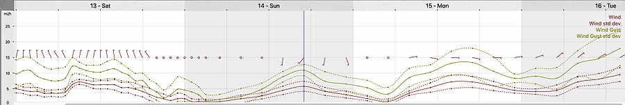
19z NBM Wind Meteogram for Blue Bell, PA (Click on image for a larger view.)