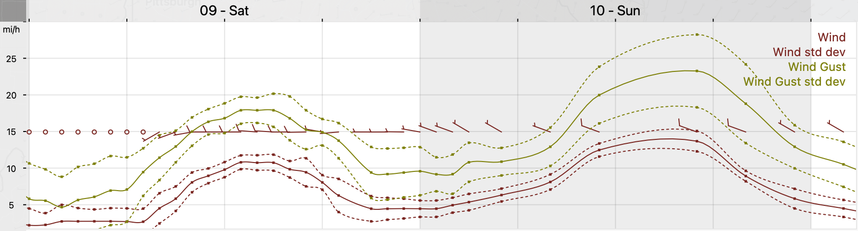
Update Sat @ 9:56 PM — For Sunday, today’s models show a significant amount of mid-level cloudiness developing towards noon Sunday and dissipating mid to late afternoon. There will still be plenty of breaks sunshine. It will be windy and chilly; the high temperature of 51° will be reached late in the day.
There’s even a chance of more sprinkles in the late afternoon, especially north and west of our area.
This cloudiness is the result of continued instability and a stream of upper air disturbances passing over us, rotating around the departing upper air low.
GFS 500 mb vorticity at 3 PM Sunday. The western back edge rotates through our area about 4-5 PM, allowing clearing (Click on image for a larger view.)
A deep upper trough over our area will bring unsettled conditions on Saturday and cooler than seasonal average temperatures. The trough gradually moves away on Sunday, but still affects us. A upper ridge with milder temperatures moves in next week.
Saturday
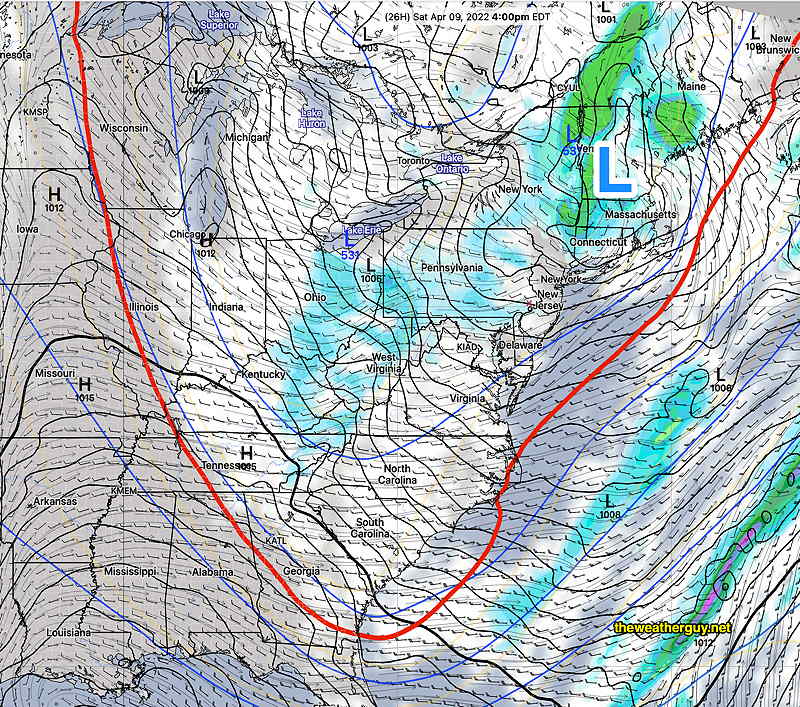
The upper trough will result in considerable instability cloudiness and showers. Showers will be widely scattered, more numerous early morning, then breaking out, scattered again, in the afternoon. There may be significant sun late morning before instability clouds develop.
Today’s 18zNAM forecast for 4 PM Saturday. A low pressure system over Vermont and an upper low over Lake Erie with a deep trough, indicated by the red 540 thickness line. Showers and clouds over our area. (Click on image for a larger view.)
A mix of clouds with breaks of sun, not very different than last Saturday. We’ll have widely scattered showers, especially in the afternoon. The cold air aloft may again result in some frozen form precipitation (graupel), much like last weekend. WINDY at times. High temperature 53.3º ± 2.1º NBM model, Blue Bell. (Average seasonal highs are 60-61º)
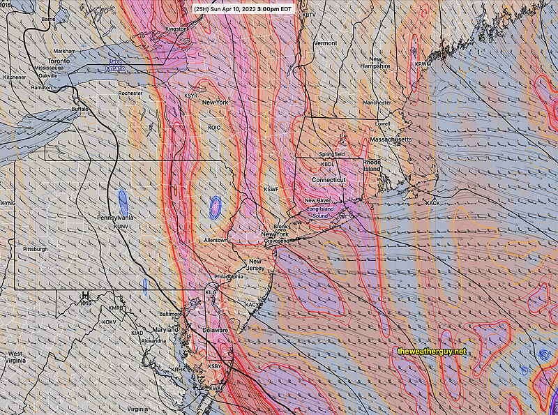
Sunday
The trough begins to lift, but the cold air will still be over our area.
Today’s 18z NAM forecast for Sunday at 5 PM. Surface low still over New England, upper trough (red line) moving up and away. Some clouds but dry weather here. Upper ridge poised to move in from the west for next week. (Click on image for a larger view.)
Mostly sunny skies with still cool temperatures. Gusty winds at times. High temp 50.3º ± 2.0º NBM model, Blue Bell.
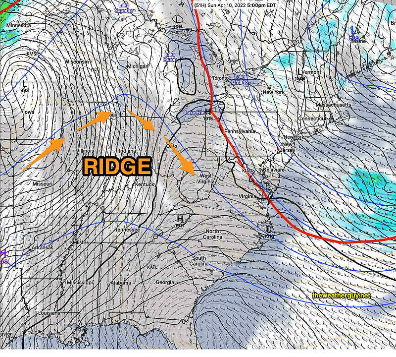
A ridge moves in next week with warmer temperatures.