WEEKEND WEATHER FORECAST

[su_note note_color=”#d9f2da”]Sat 7:30 AM Update: High temperatures Saturday updated to about 86-87. Scattered thunderstorms still expected mid to late afternoon as depicted in last night’s model data below.

Sunday looks to be considerably drier and somewhat warmer with a high of 88-89. [/su_note]

A typical summer weather pattern with a diffuse stalled frontal boundary to our south.

Summer daytime heating combined with  the entrance of areas of vorticity and moderately high moisture (precipitable water values about 1.6 inches) will result in instability and mostly afternoon and early evening thundershowers.

The sky conditions will be similar to today (Friday) with most areas seeing considerable sunshine mixed with clouds.  Highs around 85.

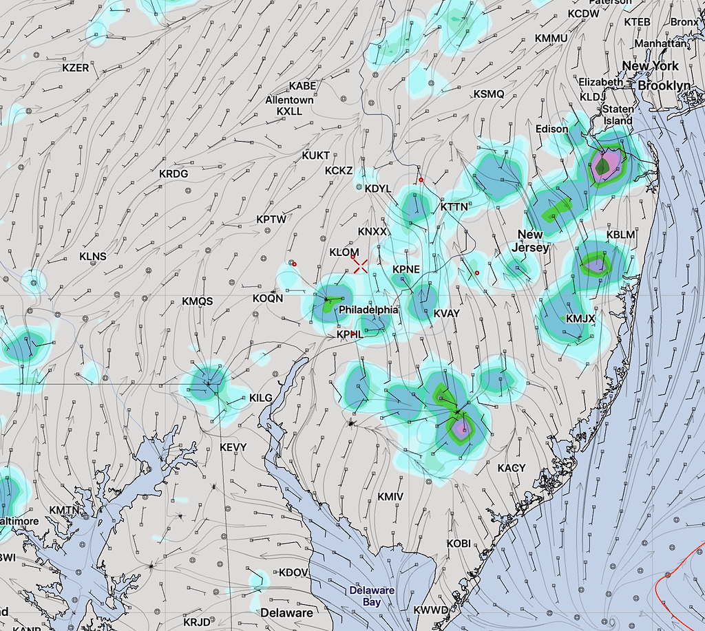
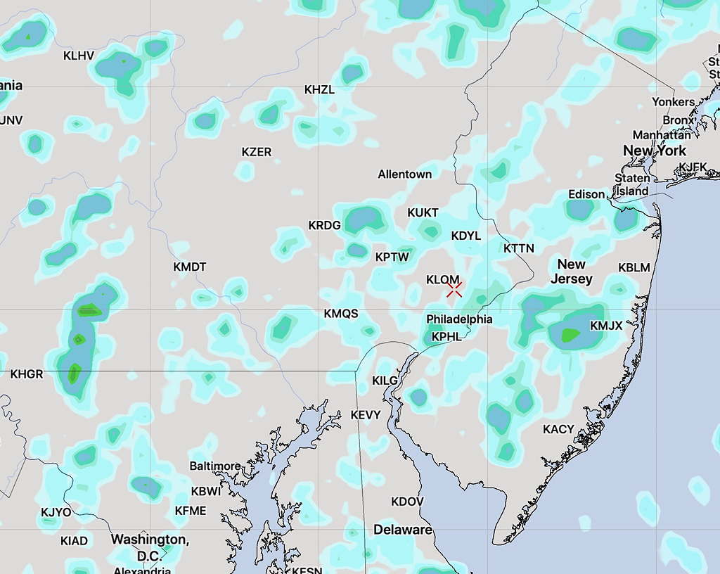
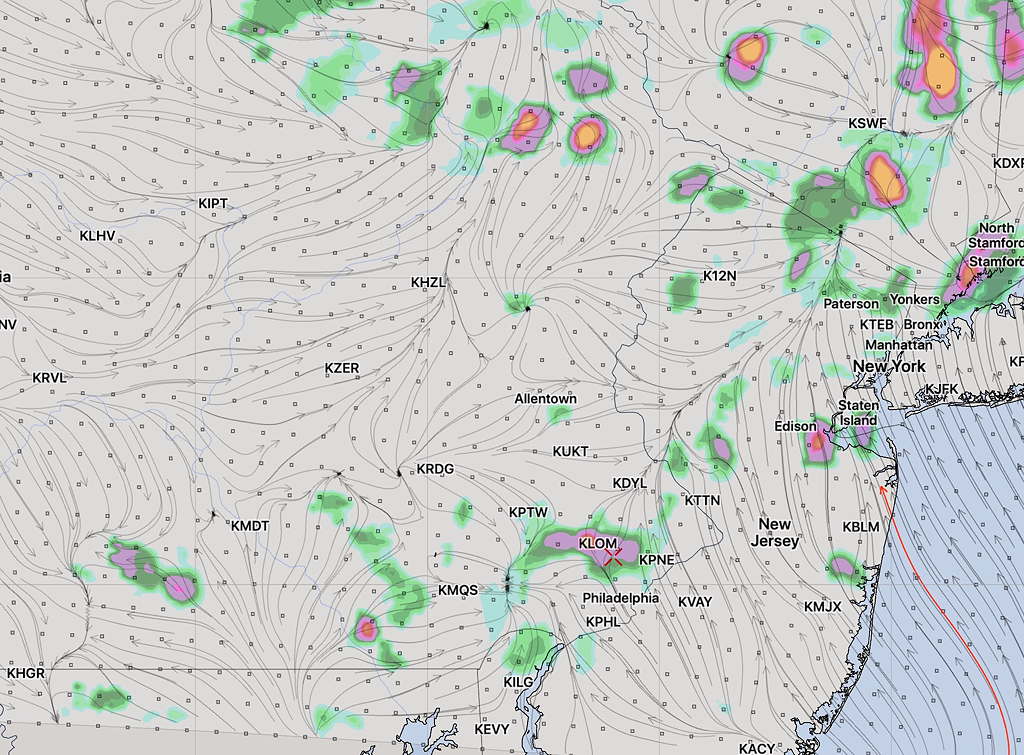
What everyone wants to know— when will these showers develop where?  Unfortunately,  the weather models are just not that capable in this situation, but I’ve looked at the models that did fairly well with the showers today and I’m providing a sampling of what I think might capture the answers.  (Three high resolution models, including the new Canadian HRDPS.)

As shown below, the models are showing the period between 2-5 PM Saturday as having the highest areal precipitation coverage.   These areas are now closer to Philadelphia than had been showing on my Thursday’s Outlook post.

WRF-ARW precipitation forecast 3-4 PM Saturday afternoon
HIREF precipitation forecast 3-4 PM Saturday afternoon
Canadian HRDPS precipitation forecast 3-4 PM Saturday afternoon

For Sunday, the larger scale models (NAM, GFS) show things drier with a similar mix of sun and clouds.   High 86.


WEEKEND WEATHER OUTLOOK – THURS

The slow-moving front that moved through Wednesday with thunderstorms will become a stalled, diffuse frontal boundary to our south; it will serve as a track for weak disturbances (areas of vorticity)  to move near our area from west to east over the weekend.

The summer daytime heating combined with these areas of vorticity and moderately high moisture (precipitable water values  about 1.5 inches) will result in instability and mostly afternoon and evening thundershowers, some which may be slow moving causing considerable downpours.  Many areas will also see a fair amount of sun, especially east of the Philadelphia into NJ.  Highs both days near 90.

Currently,  the models show areas to the west of Philadelphia to be the most impacted by this setup on Saturday.

The current GFS shows showers to our west Saturday afternoon, but significant sunshine in other areas. (see graphic)

GFS Forecast Precipitation Rate and Cloud cover for 1 PM Saturday (green lavender =rain)

Sunday shows more clouds but fewer areas of showers—

GFS Precipitation Rate and Cloud forecast Sunday 4PM

This sort of scenario is impossible to nail down to specifics, despite the pretty graphics; it’s presented to provide an approximation of what to expect.

What will be interesting to see is whether some showers break out around 3-4 PM today (Thursday) in Philadelphia.  My view of weather models- if the short range forecast shows to be inaccurate, the longer range forecast should be taken with a grain of salt.