[su_note note_color=”#d9f2da”]Saturday AM Update: Today’s high temperatures will be near their current range (39-41F) and windy. Still unclear how much instability stratocumulus will develop, although the models maintain sunny skies.
Sunday will be more tranquil.
The latest FV3-GFS has brought back the chance of snow flurries (no accumulation) for Tuesday night after the coastal low departs. [/su_note]
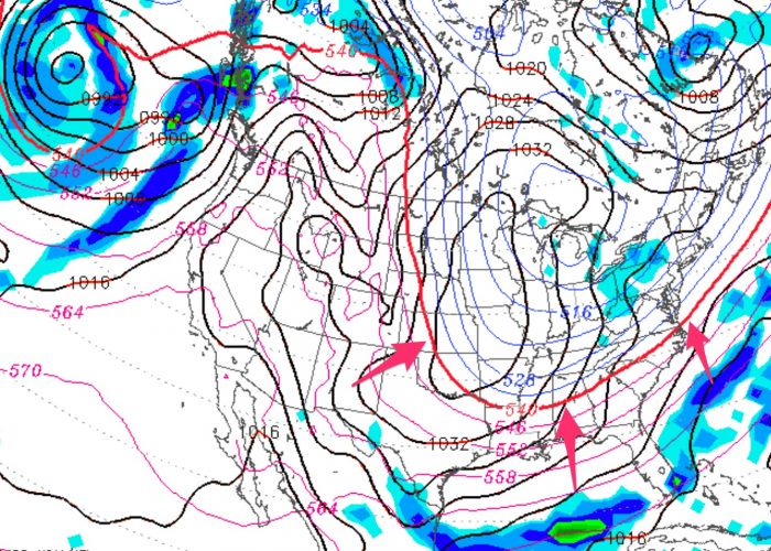
A strong cold front will approach Friday afternoon and move through Friday night. Heavy rain is expected Friday afternoon.
Much colder weather will arrive for the weekend as high pressure builds in on Saturday. However a strong upper cyclonic flow from the departing low pressure system bring windy conditions for Saturday. Winds 15 mph with gusts to about 30mph are possible. Temperatures will struggle to reach 40.
With the cold air and cyclonic flow, instability stratocumulus clouds may also develop on Saturday, limiting the sunshine, although the models are down-playing this right now.
For Sunday the winds calm down but still expect unseasonably cold temperatures with highs about 44 with sunny skies.
Looking ahead:
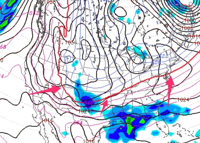
A significant coastal low will develop and approach early Tuesday , giving us another round of windy, rainy conditions for all of Tuesday. Current track is that we will get heavy rain, but areas in Western PA may receive snow.
The FV3-GFS and NBM were suggesting the possibility of wet snow squalls or flurries moving through with the cold frontal passage Tuesday night, although today’s FV3-GFS has backed away from that.
Wednesday will be winter-like with very cold temperatures in the 30s!


