WINTER WEATHER UPDATE

Just a quick update,based on tonight’s NAM model data that just became available.

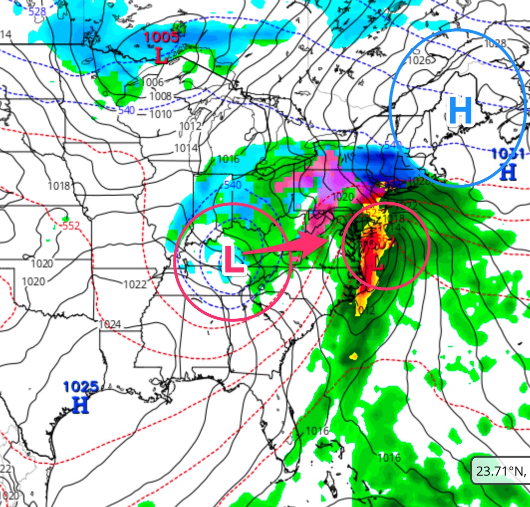
Much of what I wrote about earlier today still holds.  While the lower levels of the atmosphere remain below freezing for an extended period on Thursday due to “cold air damming”, the upper levels of the atmosphere are forecast to be too warm to support snow Thursday.

I believe this will be a sleet event, eventually changing to sleet and rain; rain possibly heavy in the afternoon. While some early snowflakes are possible, it should quickly change to sleet.

I’m sure there are forecasts out there for snow, based on preset precipitation type algorithms. But thermal profiles have worked well for my forecasts in the past and I’m going to stick with it this time. This forecast is for Philadelphia and immediate suburbs. Areas far north and west may have more freezing rain and sleet accumulating.

The scenario with the upper low enhancing a secondary surface low Thursday night into Friday morning is also supported by tonight’s NAM.  However, it’s looking less likely that enough cold air will allow a changeover to snow .

Things will clarify by tomorrow evening.


DOUBLE JEOPARDY STORM FOR THURSDAY INTO FRIDAY

An interesting weather setup is being forecast by most models for Thursday into early Friday for our area.

There’s a blocking high pressure system and an upper cut off low in the midwest.

NAM Model
Upper Low- Blocking High Setup NAM model-  Thursday evening.

The blocking high pressure will give us the low level cold damming effect, trapping cold air at the surface.  This is what will give us the chance of sleet/freezing rain Thursday morning.

The upper low in the midwest will merge with the surface low on the coast.  This will cause intensification of the surface low Thursday night, bringing in enough cold air to turn precipitation to snow Thursday night into early Friday morning.

Let me start by saying that Thursday early morning rush hour should be OK, but moisture moving in from the south during the morning will fall mostly as sleet and freezing rain, especially north and west.  (There may be a few snowflakes at the very start.)

I do NOT think we will get snow in the immediate PHL area and surrounding suburbs on Thursday morning or afternoon.   This is a sleet/rain event for much of Thursday.  Despite the fact that the GFS is calling for snow, based on critical atmospheric thickness levels and the NAM, I think this will be sleet/freezing rain to rain event for early Thursday into Thursday afternoon.

Here’s where things get interesting for late Thursday into Friday,  something I alluded to yesterday—

Sometime late Thursday into Thursday evening, the upper cut off low is expected move and merge with the coastal system, causing rapid intensification.  The increase in the precipitation rate and the cold air associated with the upper low will cause precipitation to change to snow in the immediate PHL area Thursday night into daybreak Friday.  Too early to determine if there will be any accumulations.  (The latest GFS doesn’t bring in that much cold air aloft.)

As stated in recent posts, the models have been anything but consistent over the past week.  But this scenario has been solidifying over the past two days.    Stay tuned.