#weather #paweather #wx #pawx #philadelphia #phillywx
Friday Update- Rain on the way
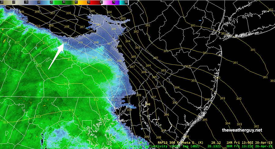
Update Fri 04/28 @ 9:28 AM — The latest radar has the rain somewhat closer to us than predicted by last night’s models. Nonetheless, the RAP is showing a bit of push-back of the rain advance, based on isentropic (thermal energy) analysis.

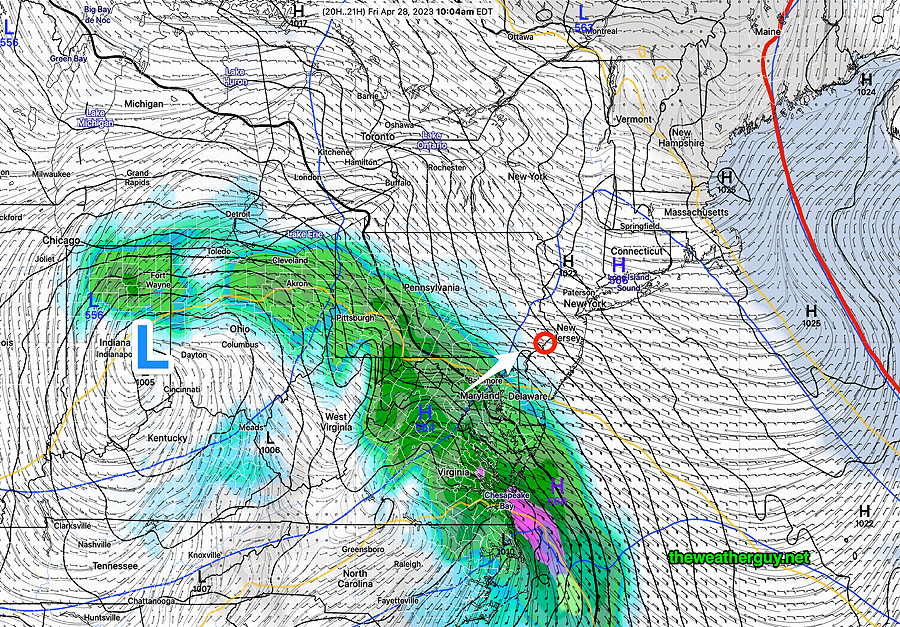
The models are still showing light sprinkles possible here about 11 AM, but the main area of rain moves in about 1-2 PM.
Rain: Parts of Friday, Saturday, Sunday
Update Thu 4/27 @ 9:08 PM — Several models have over two inches of rain falling Friday night alone.
Update Thu 04/27 @ 7:51 PM —The blocking pattern described below is setting up for this weekend and at least into Tuesday.
Rain moves in on Friday early afternoon, but some scattered sprinkles are possible during the morning.
The main slug of rain moves in from the southwest around 11AM to 1PM according to the latest GFS model—

On Friday, once the rain starts, it will become moderate to heavy at times.
The bulk of the rain will be departing on Saturday morning, but the models maintain some scattered showers around during the day, especially northeast of our area.
Heavier rain moves in on Sunday.
This weather will be generated by circulation around a upper level closed low pressure system near the Great Lakes that will remain almost stationary. Timing the breaks in the rain will be challenging as the impulses circulating the low are tough to model exactly.
We may get enough of a break Saturday afternoon to salvage the day.
Sunday doesn’t look as promising at this time.
Total rainfall may exceed 2 inches for the weekend.
I’ll try to nail it down in my regular Weekend Weather Forecast.
Update Thu 04/27 @ 10:01 AM — — Updated Thursday forecast here.
Previously Posted Wed 5:24 PM —
Developing Omega Block Pattern
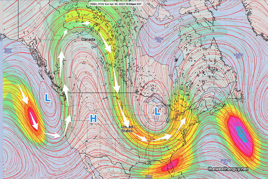
The upper air flow is moving towards a blocked pattern, specifically an “Omega Block” pattern. Unlike the recent “Rex” block named for the meteorologist who identified it, the “Omega” block is named for the Greek letter omega Ω because the wind flow resembles this letter.
Here’s the jet stream wind flow (at level 250 mb) for late Sunday. The Omega Ω resemblance is clearly visible—

All blocked patterns result in stalled or slowly moving systems. In this case, we’ll be stalled in a cool, wet, cyclonic pattern with a closed upper low over the Great Lakes rotating disturbances towards us.
The developing block will bring rain to us by Friday afternoon. Periods of rain will be with us through the weekend and even through next Tuesday! There will be breaks in the rain and timing these breaks will be the challenge for this weekend’s forecast. It’s going to be a good weekend for ducks and flowers.
Rest of this week
Thursday
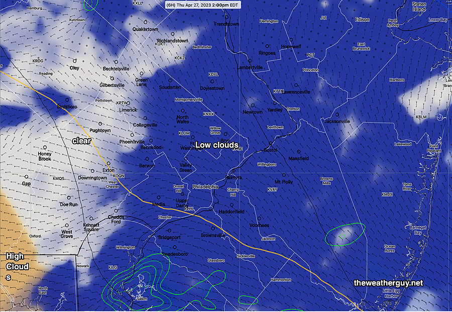
Update Thu 04/27 @ 10:02 AM — The latest HRRR forecasts even more lingering cloudiness today. We may not see any sun in the city until after 2 PM.

Update Thu 04/27 @ 8:35 AM — It looks like we’ll get some sunshine about 1 PM in the city and earlier west of the city. Clouds move back in about 6 PM. High temperatures about 61º but a high standard deviation of 3.5º based on the uncertainty in the cloud cover.
Update Wed 4/26 11:06 PM — Tonight’s models have clouds and light sprinkles lingering possibly past noon.
Before we get to this pattern, Thursday should start cloudy, but considerable sunshine expected around noon. A mix of sun and clouds for the afternoon. High will be near 65º
Friday
Friday will be cloudy and rain moves in about 2-4 PM from the west.
