
#Phillywx #Philadelphia #weather #PAwx
The forecast for this weekend has been essentially unchanged for several days. As described earlier this week in This Week’s Weather, the frontal system moving through tonight will transfer its energy to a coastal low in New England. Much of the dynamics that go into precipitation will be lifting away from us and we’ll have very little rain.
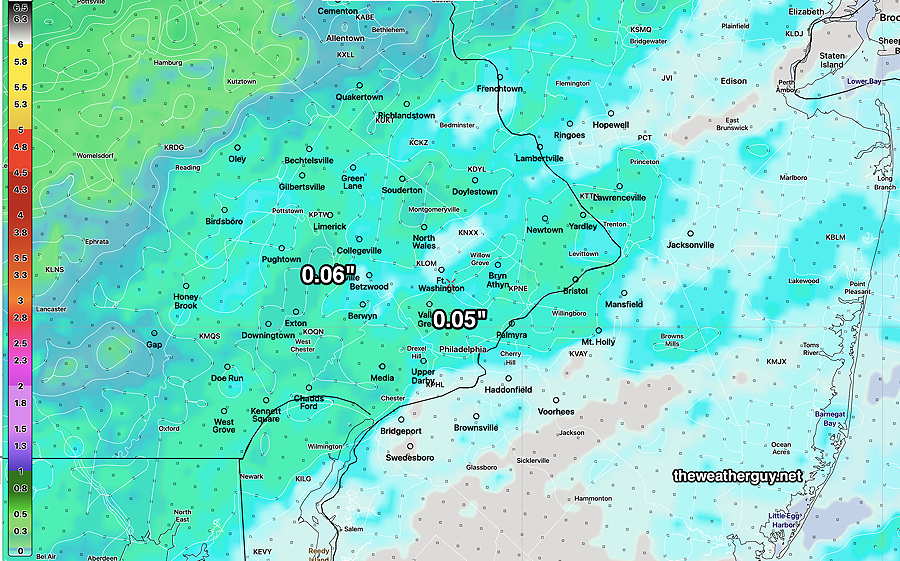
The latest forecast from the NBM shows a bit more rainfall tonight than previous forecasts—
The front comes through tomorrow morning around daybreak with clouds breaking for sunshine by 9-11 AM and winds picking up late morning.
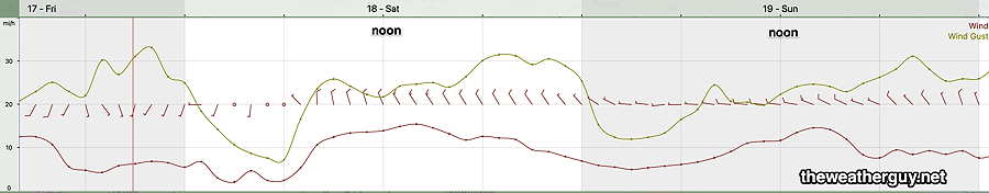
With a strong pressure gradient from the intensifying low pressure off the New England coast, our winds will be the big story on Saturday and to some extent Sunday.
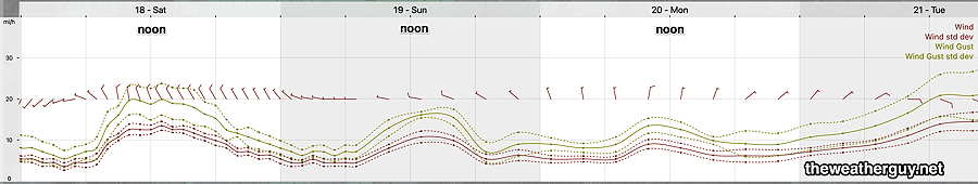
As mentioned last night, I’ve begun playing with the RRFS model still under development. Here’s its wind forecast for the weekend—
Saturday
Cloudy early, then sunshine breaks out about 9-11 AM, earlier far west. Windy. High Temperatures will occur about noon, then decline
High temperature 55º ( NBM model— location Blue Bell, PA)
High temperature 57º ( NBM model— location Philadelphia, PA)
Uncertainty ± 1.7º which is average.
Sunday
Sunny and still somewhat windy. For the start of the Philadelphia Marathon 37º at 7 AM. By 10 AM 47º Still windy with gusts to about 18 MPH by 11 AM.
High temperature 53º ( NBM model— location Blue Bell, PA)
High temperature 55º ( NBM model— location Philadelphia, PA)
Uncertainty ± 1.3º which is higher confidence.
A large storm expected Tuesday through much of Wednesday with rainfall about 1.3″ in much of the area.