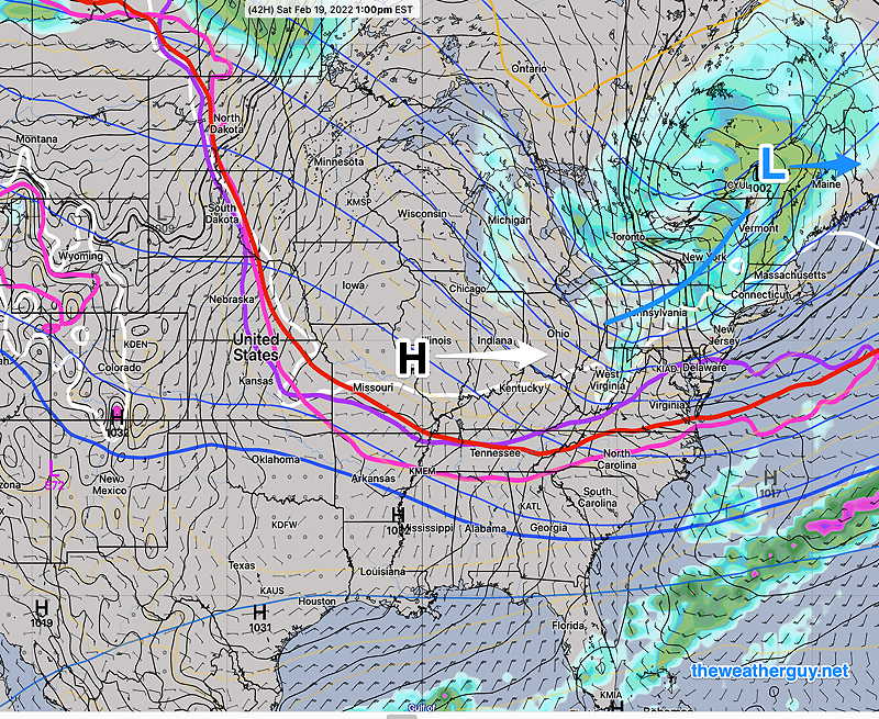
A low pressure system in Canada will drag a cold front through on Saturday. High pressure builds in for Sunday. Milder temperatures for Monday as high pressure departs.
ECMWF forecast for 1 PM Saturday. Low pressure in Quebec will drag a cold front through Saturday. High pressure moves in for Sunday and Monday. (Click on image for a larger view.)
Saturday
A cold front and upper air trough moves through about noontime. While temperatures will be well above freezing at the surface, temperatures at critical levels above ground will support snow. Snow showers or squall will move through about noon to 3 PM. A dusting accumulation is possible in northwest suburbs. (Some high resolution models show some additional, earlier light snow flurries in the late morning.)
Sunny early, then increasing clouds
Snow showers between noon and 3 PM with gusty winds.
Clearing and increasingly cold for the balance of Saturday.
Windy
High temp 43.3º ± 1.6º NBM model Blue Bell. Windy conditions will keep apparent temperatures (wind chill) in the low 30s.
Today’s 12z NBM model forecast temperatures Blue Bell PA
Sunday
High pressure builds in
Sunny breezy and cold. A period of clouds late morning.