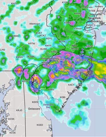
Update Sat 8:10 AM— Some areas had heavy rain after midnight. For Saturday, the HRRR continues with areas just to the west of Philadelphia being relatively rain-free with most of the rain from PHL into NJ. The NAM-NEST have a more westward extent.
The HREF which blends these models shows the rain today as just that, a blend—

No change in Sunday’s forecast below.
Update Fri 10:40 PM — The axis of predicted heavy rain tonight has fallen about >50 miles to the south. Tonight’s HRRR optimistically keeps the rain on Saturday out of the western suburbs.

The NAM-NEST and HIRESW-ARW are not as optimistic—

The weather on Saturday may be better than previously forecast.
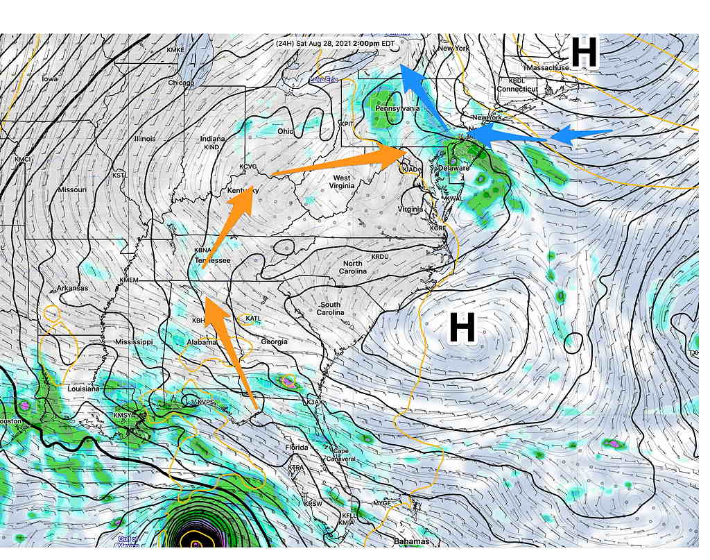
A frontal boundary is attempting to move to our south Friday evening. The boundary is resulting in showers and thunderstorms as had been expected. These chance of these storms will linger through the evening and night as the front barely makes it south of our area.
Unfortunately, the high pressure system behind the frontal passage will remain to our north as it encounters a firmly entrenched upper air high over the middle and southeastern section of the country.

The NAM-NEST shows maximum moisture convergence and upward vertical velocity about 9 AM Saturday. The NAM-NEST also shows a weak coastal low pressure system forming off the Delaware coast on Saturday, lingering into Sunday.

What does this all mean?
Saturday
Clouds, rain and thunderstorms from Friday night into at least the early afternoon of Saturday with a lower chance later in the afternoon. High 77.9º ± 2.8º NBM Blue Bell PA
Sunday
The low pressure system that forms off the Delaware coast will remain nearly stationary Saturday night into most of Sunday. Considerable cloudiness in the morning. Some bright skies and sun in the afternoon with a chance of showers/thunderstorms on Sunday afternoon. High 82.4º ± 1.8º NBM Blue Bell PA
Update Fri 7:30 PM : I’ve gone with the NBM model for cloud cover on Sunday. Some models have much more cloudiness Sunday afternoon.
