Updated Sat 8:10 AM highlighted below
Updated Fri 9:45 PM highlighted below
Updated Fri 7:45 PM highlighted below
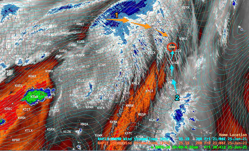
The setup—a quasi-stationary front northwest of Pennsylvania will have a wave of energy move along it, causing the front to temporarily sag closer to us early Saturday along with a disturbance (1) moving through from the northwest in the upper levels.
At the same time, moisture from coastal disturbance (2) moves up from the south at the mid levels of the atmosphere. High pressure follows with warm/hot and humid conditions later Saturday and Sunday.

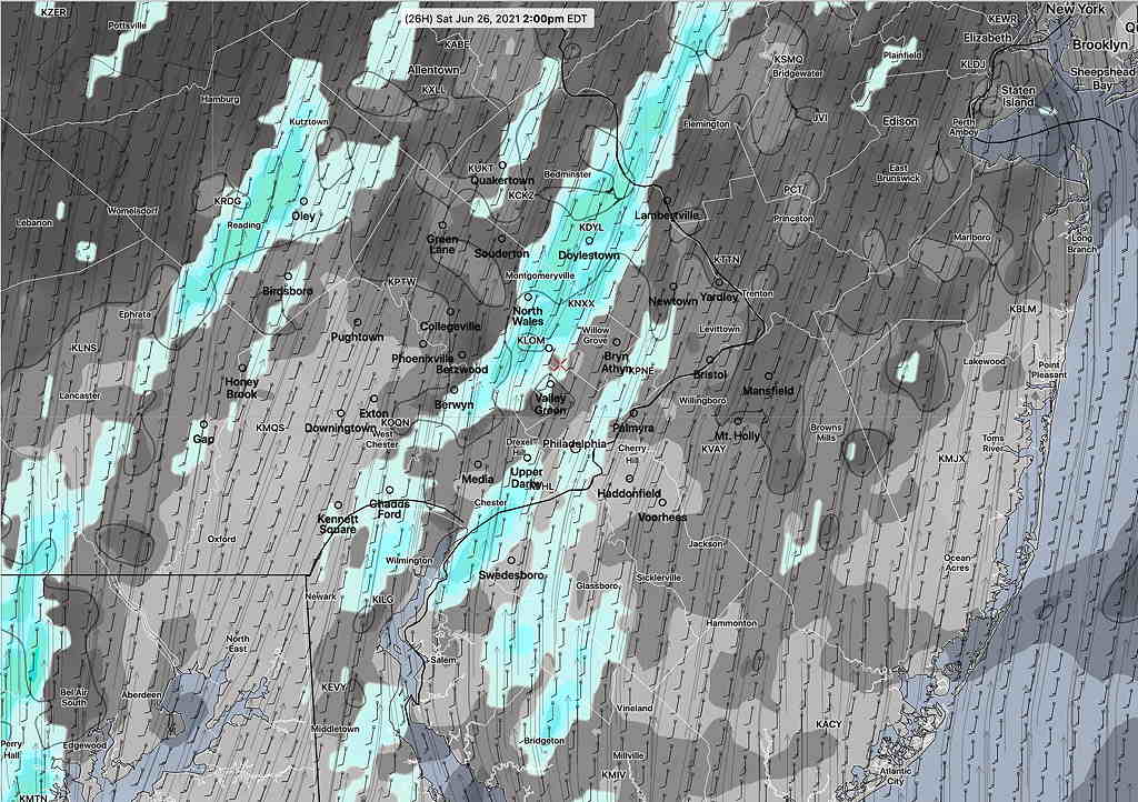
A few days ago, Saturday looked like it would be sunny. Less so now. A mid-level area of moisture associated with this coastal disturbance will affect us on Saturday as an upper air disturbance moves through. This disturbance is weak and the forecast for showers may be over-done but several models currently show showers.
Periods of clouds and possibly a light, widely scattered shower late morning or early afternoon, especially from Philadelphia westward. Sunshine increases after 2 PM. Windy/Breezy as the disturbance moves through. Increasingly humid. High 86.5º sd 1.7º (NBM Blue Bell)
Updated Fri 7:45 PM: Friday afternoon’s GFS, just available, maintains a possibility of light showers early afternoon Saturday. It is slower with the sun reappearing, so the 1-2 PM forecast of sunshine above may be unrealistic.
Updated Fri 9:45 PM: Tonight’s early models, the RAP, HRRR and NBM, all show showers mid-day on Saturday, moving from south to north. Highest probability is from about noon to 2 PM (± 1 hour.)
Updated Sat 8:10 AM: Despite the early sunshine, the models continue to to predict widely scattered showers, developing in the noon to 2 PM timeframe today. I’m not so sure, but I generally won’t go against the forecast of several models.

Following. this wave, high pressure will build back, pushing the frontal boundary northward again. A flow of increasingly hot and humid air, typical for the end of June and beginning of July, will begin to affect us on Sunday and beyond.
Mostly sunny , very warm and increasingly humid. (Dew points in the uncomfortable upper 60s) High 90.2.º sd 1.2º (NBM Blue Bell)
Winds

