
7 pm Saturday-Well, I wrestled with this storm and my usual approach led me to a somewhat poor forecast . Snow has picked up in intensity and temperatures have dropped to 32. Temperatures in the lower levels of the atmosphere prevailed Maybe I’ll get another chance this season?
The forecast from last night and this morning remains on track- “After an initial start as light snow between 4-6 pm, it appears to be a mostly sleet and rain storm in Philadelphia and its immediate suburbs before changing back briefly to snow before ending about 2 AM.”
While the lower levels (below 6000 feet) of the atmosphere are below freezing causing sleet and some snow to mix in, the average temperature of the mid level of the atmosphere (below 18,000 feet) is too warm to support snow formation. Add to that the warm ground conditions from earlier today and little accumulation is expected in PHL and the immediate suburbs.
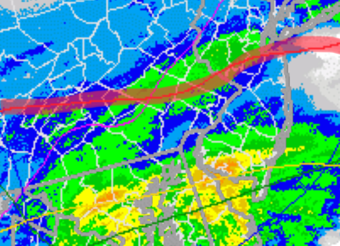
Below is the current radar at 5:51 PM with the area of mostly rain/sleet south of the red line. (Sorry, difficult to see the county boundaries)
Just snow here in Lansdale with an inch on the road. I’ve got a baby Oregon Scientific weather station that’s rooting for snow with its super limited instruments. Maybe March will hold a decent snow like last year.
Fun to watch and no shoveling is nice too though. Thanks for the updates!
Yes, Landsdale is apparently far enough north (and somewhat higher elevation) to have more snow. The models still have a shift to more rain, even in your neck of the woods.
Yeah I saw NWS revised to 6”. Probably 3” down here now. Until the last hour or so most seemed to agree on an inch or so and then a changeover. A warm snow though. Showing 32.7 degrees here
Well, it seems the models didn’t get this right either. It’s 9 pm and radar seems to show the precipitation ending. That would be 4-5 hours sooner than forecast.