
#Philadelphia #weather #PAwx
Forecast Update- Thursday
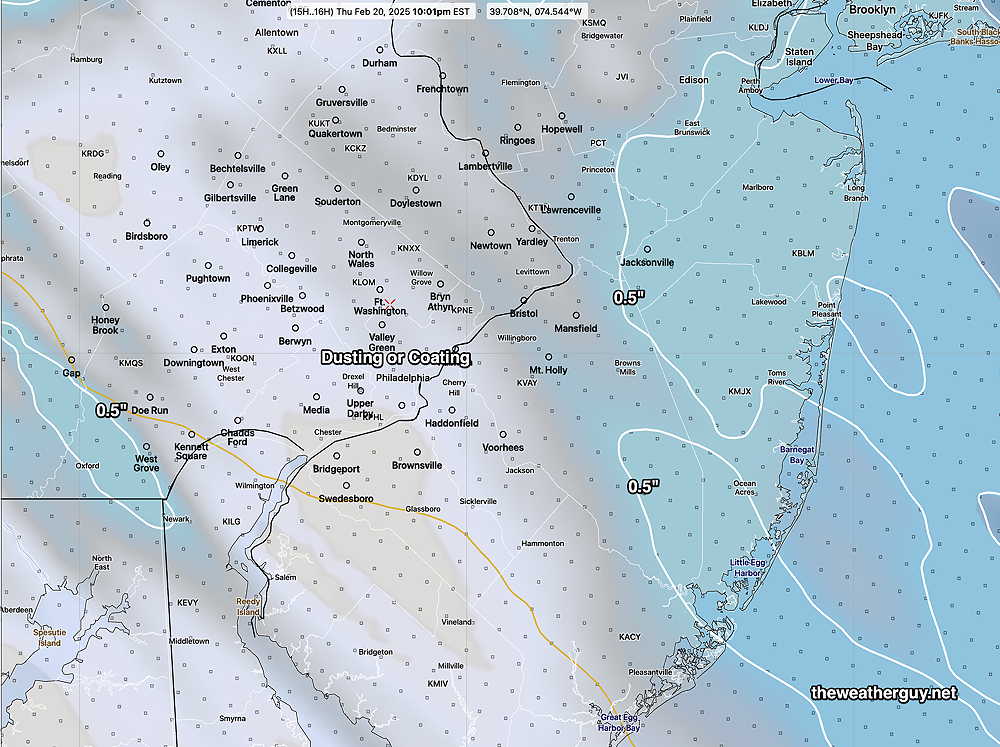
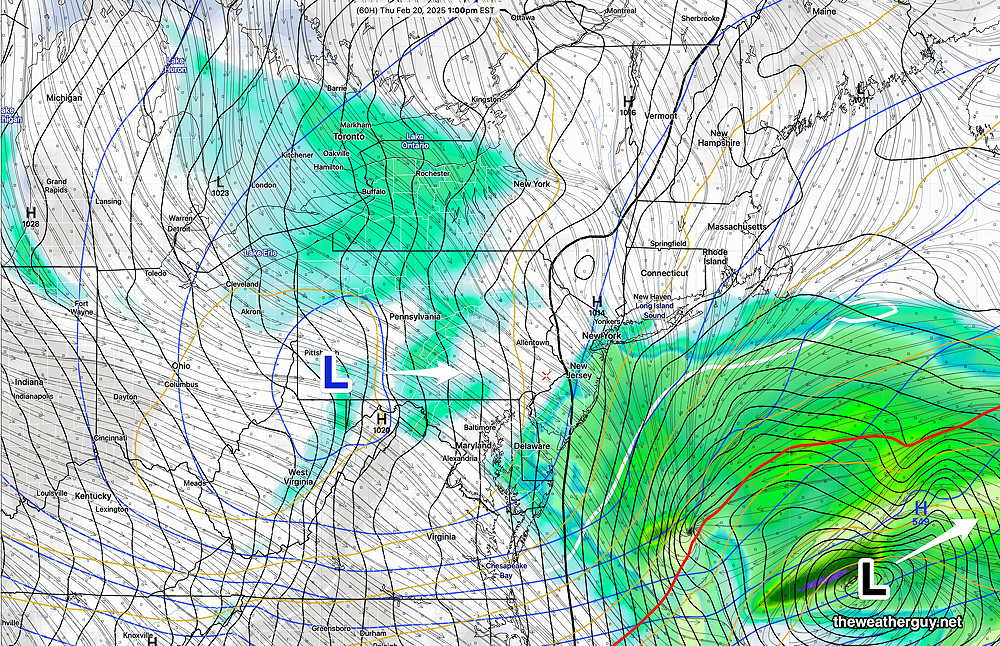
Posted Thursday 02/20/25 @ 11:03 AM — The models continue with spotty light flurries or snow showers for today, beginning about 3-4 PM and ending by 8 -10 PM. Total snowfall is expected to be very light with little more than a dusting or coating in most areas. Here’s the latest HRRR—
Thursday Forecast Update
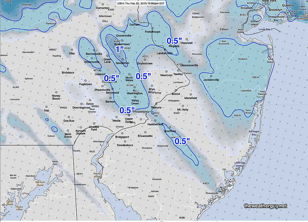
Posted Wednesday 02/19/25 @ 9:20 PM — As posted late afternoon, any light snow/snow showers/flurries on Thursday will occur in the afternoon into the evening due to an an upper level low. The afternoon models and this evening’s latest HRRR/NBM are showing varying amounts of light accumulation, from a dusting and coating to 1/2″ accumulation.
Here’s tonight’s HRRR—
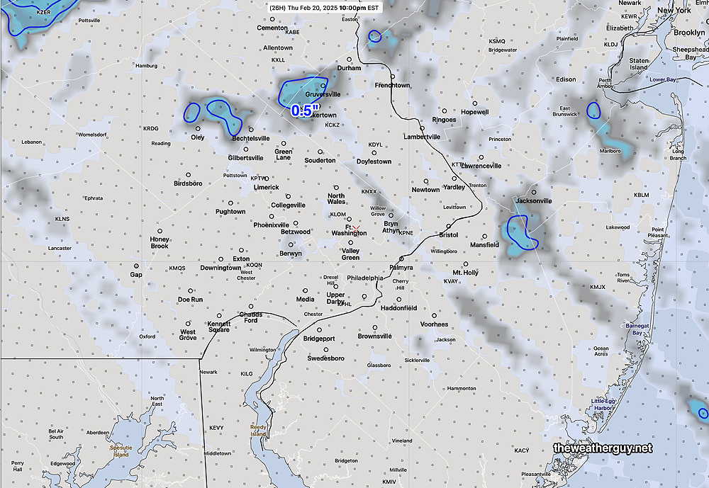
Here’s the latest 01z NBM, showing even less—
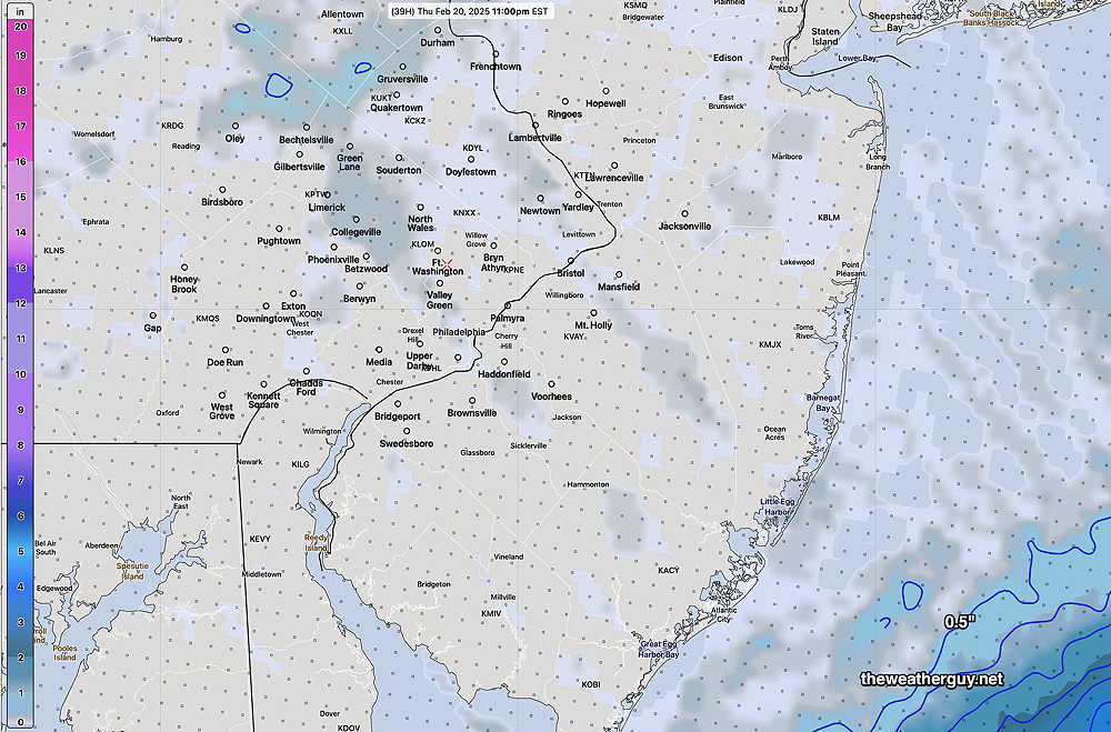
Right now, I don’t see any additional snow likely in the short range or even next week, which may have two periods of rain.
Thursday Forecast Update
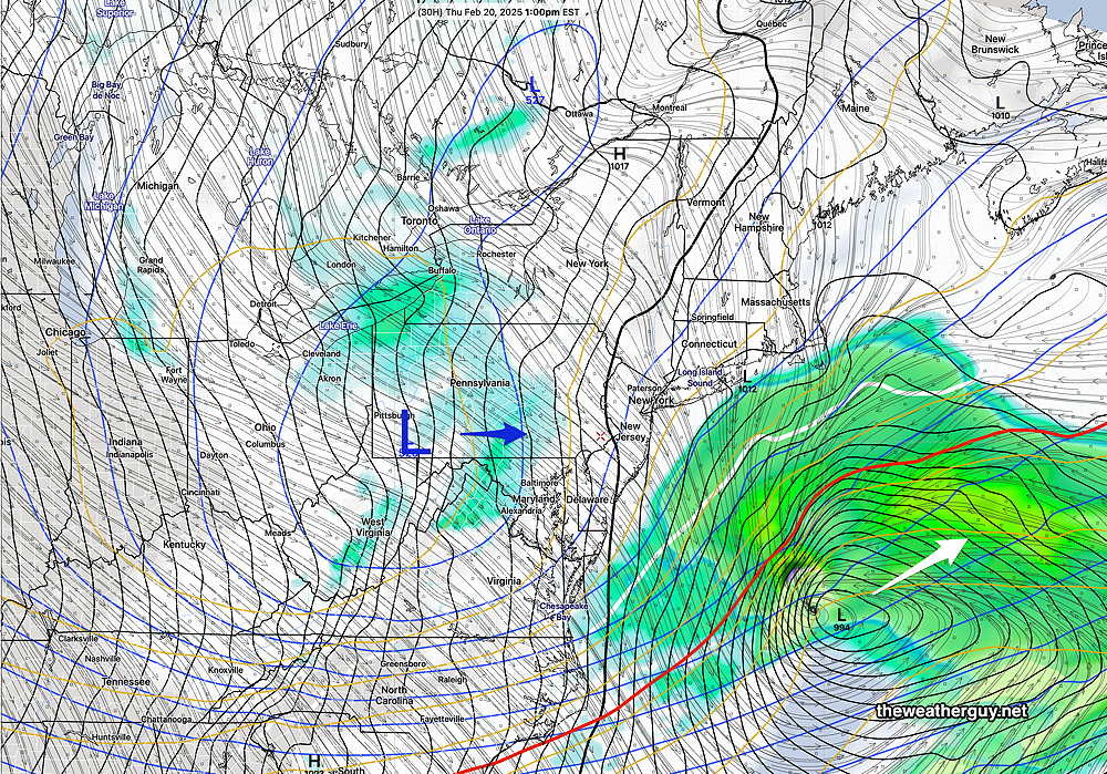
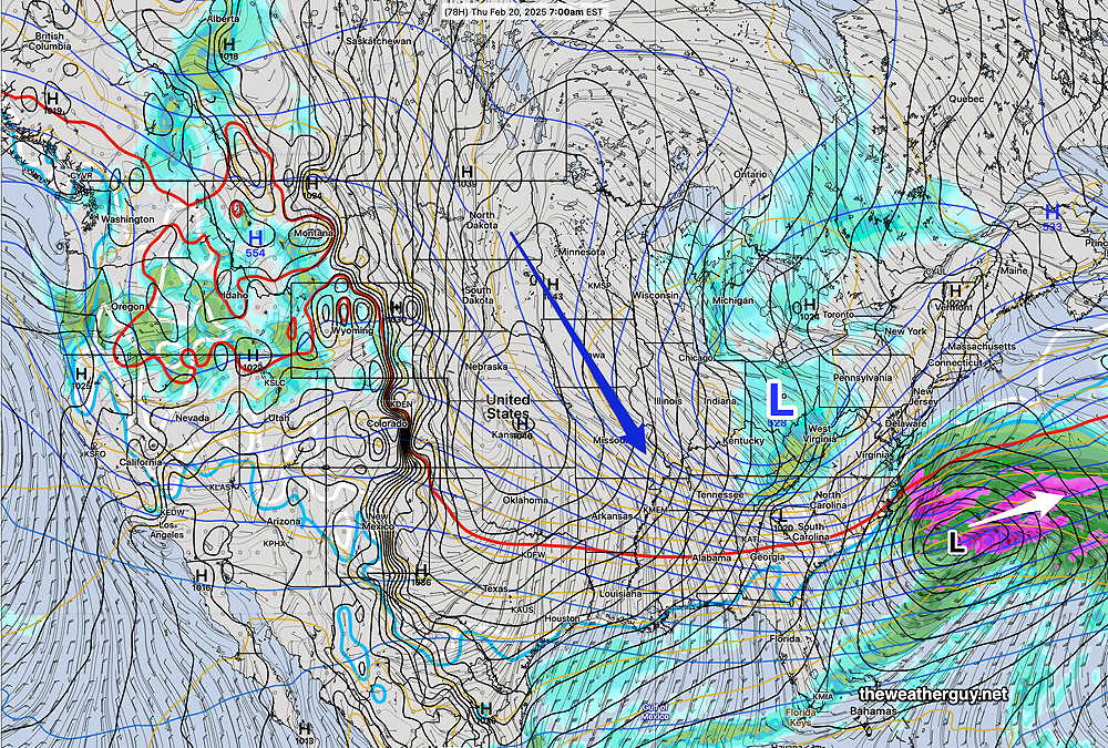
Posted Wednesday 02/19/25 @ 5:12 PM — The storm, forecast days ago for Thursday, completely misses our area. No real surprise, since that trend had been captured by the majority of the models for days.
The NBM, perhaps influenced by the NAM forecast, kept snow in the forecast for Southern NJ longer than it should have. (Regardless of when the NAM is retired, the next version of the NBM scheduled for release in April 2025 will be excluding NAM model precip data.)
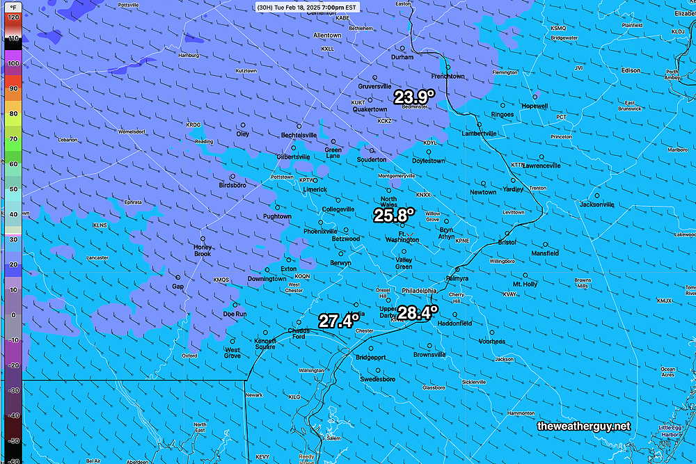
Thursday will still be cloudy due to an upper air low that passes over our area. A few flurries are possible. Still cold with a high temperature in Philadelphia about 30º-31º and about 2º colder in Blue Bell.
Yet Another Forecast Change
Posted Wednesday 02/19/25 @ 9:38 AM — Last night’s 01z, 07z and the latest 13z NBM model forecasts show a constant evolution towards the southern storm entirely missing us .
Any snow in the immediate Philadelphia area (and parts of South Jersey) being the result of an upper air low. The light snow/flurries/snow showers will occur late in the afternoon Thursday. Here’s the latest NBM—
The NAM forecast shows the upper low—
Thursday Forecast Update
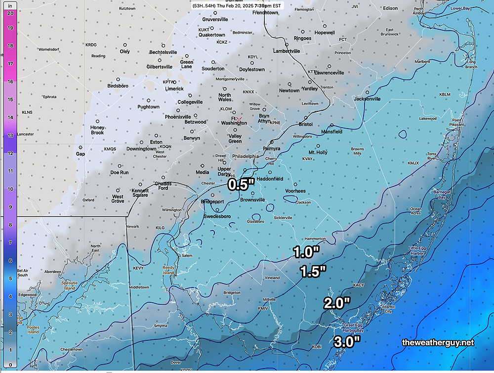
Posted Tuesday 02/18/25 @ 6:06 PM — The afternoon NAM has backed off from its morning forecast. The model blend (NBM) captures the general trend, with just a coating in the immediate PHL area and 1-3 inches in NJ.
I’m keeping an eye on the models and look for an update either this evening or Wednesday morning.
A Change in the Forecast?
Posted Tuesday 02/18/25 @ 9:15 AM — Last night’s models continue forecasting Thursday’s main surface low tracking off to our south and east missing us. The models have been on-again off-again with showing some light snow showers from the upper low that will pass over PA on Thursday.
Of some interest is the latest NAM forecast. (FYI, development of the NAM was discontinued in 2017 and is scheduled for “retirement” in 2025. The NAM has a history of over-forecasting snow in the 48-60 hour time range.)
That said, it is the only model showing the precipitation shield covering South Jersey on Thursday, with some significant accumulation. It’s currently an outlier with this storm. Here’s the current NAM forecast for Thursday—
With most models at most showing snow showers for Philadelphia on Thursday, I’ve posted the NAM as food for thought. I’ll update later if the other models join in on its forecast.
Due to the highly unbalanced political environment on X, I’ve considerably cut back auto-posting there. To receive all forecast postings, I recommend following me on mastodon.social or bluesky.social
Dry and Cold
Posted Monday 02/17/25 @ 5:08 PM — Cold high pressure continues to build in. Tuesday and Wednesday will be quite cold and it appears that there may be some cloudiness mid day on Tuesday due to an upper air disturbance.
Winds will be subsiding compared to Monday, but wind chills during period of maximum temperatures (3-4 PM) will be in the 11º -17º range.
Those looking for a snow day will be disappointed on Thursday. ALL models are forecasting the over-advertised storm on Thursday to track too far to our south and east. We may see some flurries and the NJ shore may see some light snow.
Originally Posted Mon 9:47 AM —The intense pressure gradient between the low pressure system that departed Sunday and building high pressure continues to create wind gusts in excess of 35 mph. (Gee, I hope no one on TV uses the expression “wind tunnel effect” to incorrectly explain the cause of these winds.)
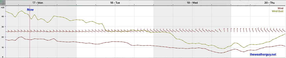
For today, a brief period of cloudiness may develop early afternoon due to instability and an upper air disturbance. Otherwise sunny.
Cold high pressure will be with us through at least Thursday. Low pressure that was advertised as bringing us snow Thursday increasingly appears to move too far off to our south.
It wasn’t too long ago that forecasters would keep an uncertain view of this forecast. A big change has been the development of AI models. With both the GFS GraphCast AI and the ECMWF AIFS models showing this storm moving far southeast of our area, it seems increasingly unlikely that a shift closer to the coast will occur.
Coastal South Jersey may be brushed with some snow on Thursday from this system. And the Philadelphia area may see some snow showers from an upper low pressure system moving over PA. But a significant snowstorm seems very unlikely at this point.