#Philadelphia #weather #PAwx
Sunday Snow Update
Due to its highly unbalanced political environment, I’ve considerably cut back auto-posting there. To receive all forecast postings, I recommend following me on mastodon.social or bluesky.social
Posted Friday 01/17/25 @ 9:49 AM — This update is a bit delayed to allow me to review some of this morning’s models. Here are the general trends—
- The NAM has finally joined the other models in forecasting some snow, but it’s snow totals are still low compared to the other models: in the 1-2″ range.
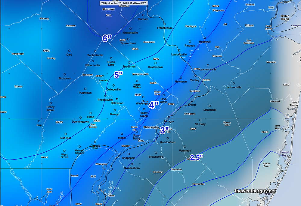
- The GFS continues to forecast a moderate snowfall (see graphic below)
- The ECMWF continues to forecast snowfall less than the GFS
- The Canadian continues to forecast a western track, heavier on precipitation with more rain than snow.
Here’s the latest GFS snow accumulation based on its built-in snow algorithm—
I’m going to leave the heavy-lifting to the model blend (NBM). Here’s its forecast based on all-snow with an 11:1 snow ratio—
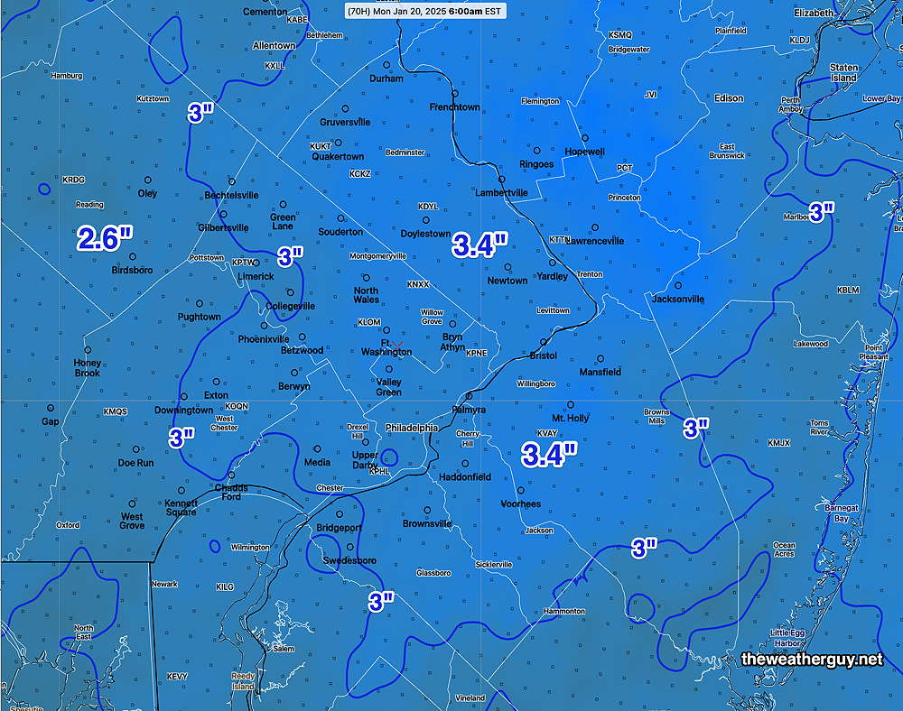
The storm looks to be a fast mover, with snow starting as early as mid to late Sunday morning. The Eagles (and more so the Chargers) will have an additional challenge.
Updates later this afternoon after the latest GFS becomes available (after 5:20 PM) with my regular “Weekend Weather Forecast”
Forecast Update and Sunday Outlook
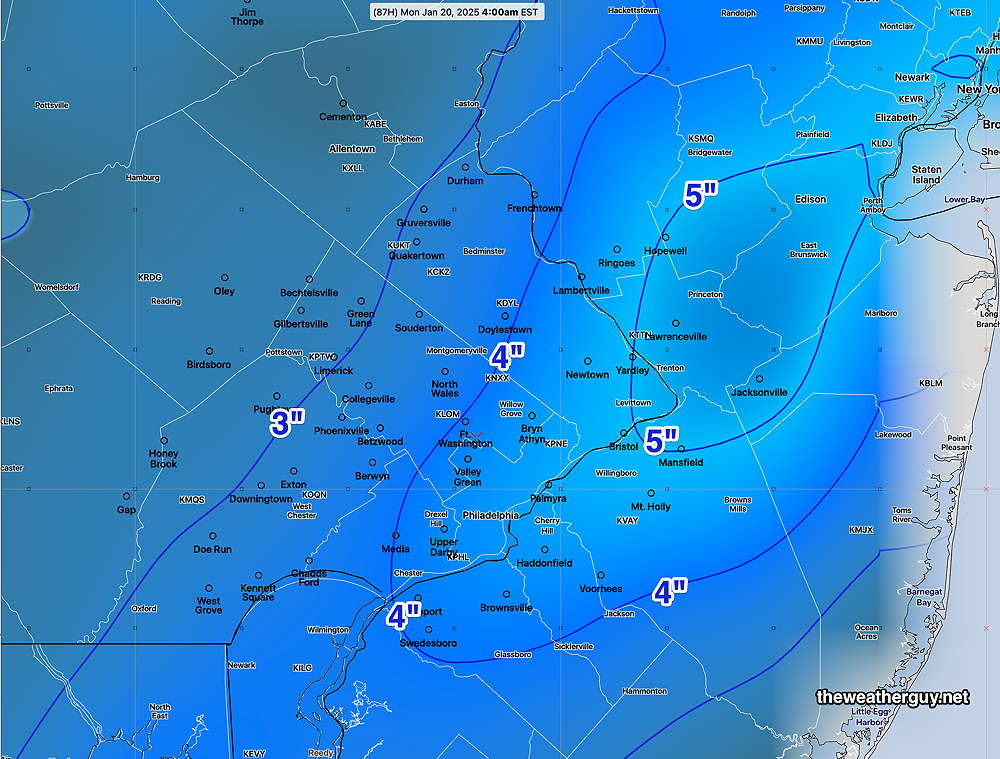
Posted Thursday 01/16/25 @ 6:04 PM — As mentioned below, the latest GFS has become available and it’s forecasting a significant snow storm for us on Sunday. There’s still much uncertainty with this storm but I wanted to share with you the latest GFS forecast snow accumulation—
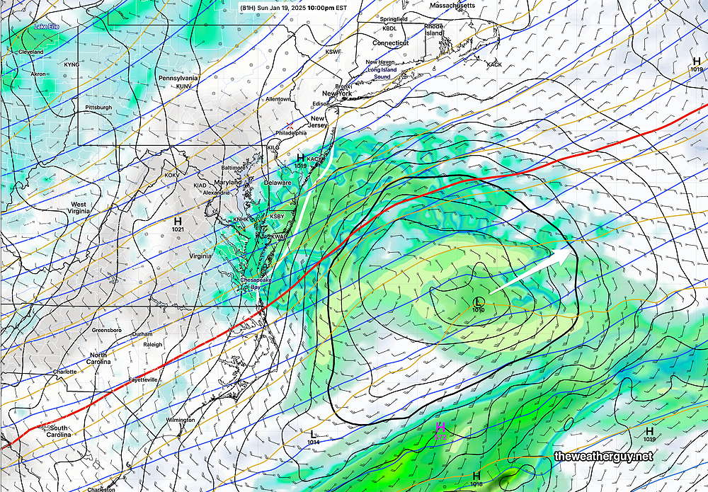
To be balanced, here’s the latest NAM which has the storm totally missing us—
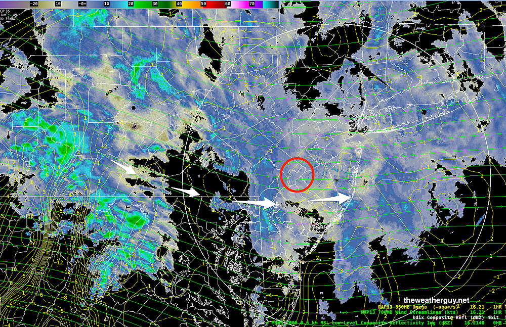
Posted Thursday 01/16/25 @ 5:17 PM — The light snow we’ve been having started a bit earlier than forecast and the coverage is a more widespread than forecast yesterday. The snow should be ending between 10 PM and midnight.
Current Radar/MRMS—
Milder temperatures on Friday will give way to some very light showers on Saturday.
A potential snowfall is still in the cards for Sunday. There’s still a wide range of forecast tracks with the Canadian model showing the most inland (warmer- more rain, less snow) and the ECMWF showing a colder, easterly track with little rain, mostly snow but light accumulations.
Of interest is the NAM which has the storm moving easterly, away from us. giving us neither rain nor snow!
If the model consensus of the model blend is correct, the light snow may start as early as the late morning on Sunday.
Here’s the latest model blend forecast snow accumulation by Monday morning.
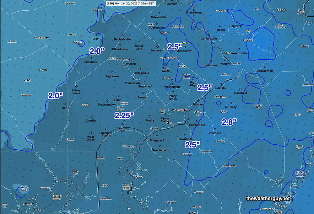
The latest GFS just became available as I write this and it is forecasting amounts similar to the above model graphic, although if the GFS is correct, we might see as much as 3-5 inches of snow.
Stay tuned.
Due to its highly unbalanced political environment, I’ve considerably cut back auto-posting there. To receive all forecast postings, I recommend following me on mastodon.social or bluesky.social
Snow Showers this Afternoon – Some Snow likely Sunday
Posted Thursday 01/16/25 @ 10:06 AM — Today’s forecast of snow showers moving in remains intact. Current radar shows considerable light snow, but most is not reaching the ground at this time—
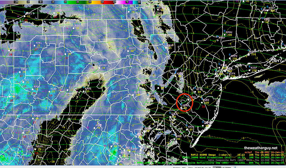
Current snowfall expected today is similar to the graphic posted below. The light accumulation is not expected to begin until 3 PM or later.
As for Sunday, this looks to be “interesting”, as several models have switched places forecasting snow for us. The usual “track” of the storm is “what’s up in the air”.
The latest ECMWF had been most consistent forecasting snow, but now has backed away from that forecast with a more easterly track. The GFS which had not forecasting snow, is now forecasting some snow for us.
The Canadian models now show an inland storm with plenty of precip, not all in the form of snow. Likely an outlier.
The German ICON is somewhere between the ECMWF and GFS, forecasting some snow. (“Some snow” is 0.5-1″.)
Here’s the latest model blend (NBM) cumulative snowfall forecast, likely too high—
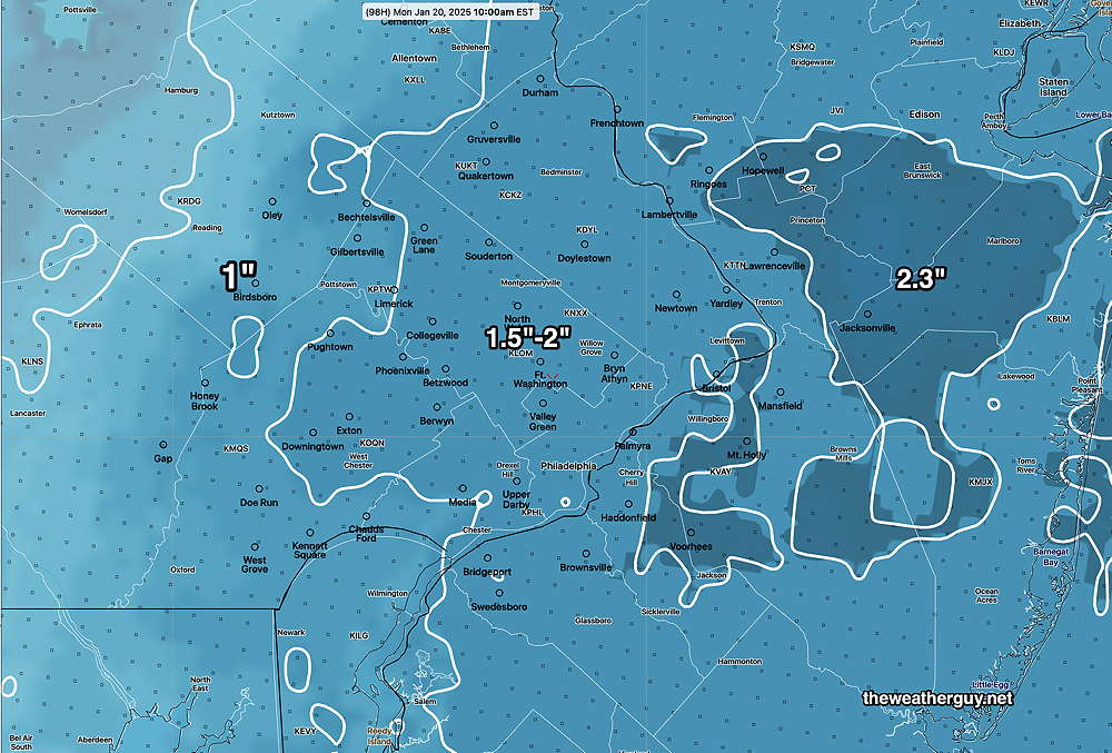
So there’s still too much uncertainty with this forecast. Hopefully by this evening’s update, things get clarified.
Snow Showers Thursday Evening – Some Snow Sunday
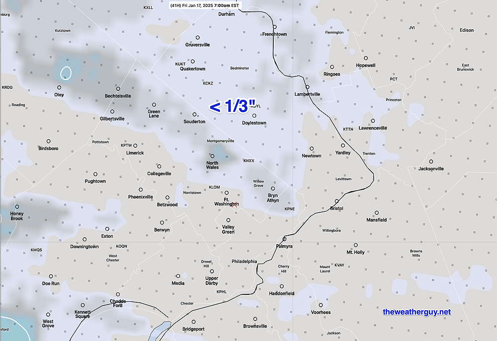
Posted Wednesday 01/15/25 @ 4:47 PM — Today’s models continue with a forecast of light snow/flurries for late Thursday afternoon. Accumulations will be minimal (under 1/3 inch) and spotty. Here’s the model blend forecast for snow coverage Thursday evening—
As for Sunday, it appears that light snow may be falling during the Eagles game Sunday afternoon. The latest ECMWF and GFS AI models have similar forecasts and support the deterministic ECMWF forecast. The German ICON model has joined in with a similar snow forecast.
The model that is not on-board is our own GFS model, which consistently shows no snow for us.
It’s too far in future (more than 96 hours) to really talk about details, and it’s beyond the range of many models. But the best guess is for light snow to start as early as 1 PM and continue through the afternoon and evening. By the time the Eagles win, there may be as much as 0.5″ of snow on the ground.
Here’s the latest model blend (NBM) total snowfall forecast—
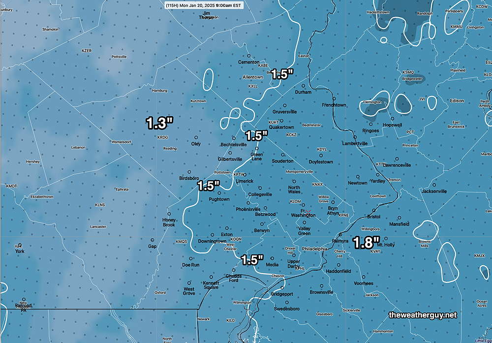
Total precipitation, rain and snow-water equivalent, continues to be low. The heaviest precipitation continues to move off to our northwest and to our south. Just something to keep in mind. There’s still time for things to change before Spring.
Posted Wednesday 01/15/25 @ 7:53 AM — Time this morning for just a quick update.
• The chance of light snow (coating) has increased for late Thursday afternoon and evening with a warm front expected to move across our area.
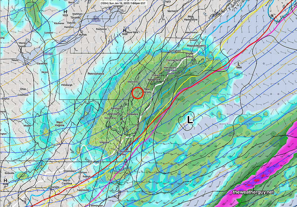
• A secondary coastal low, hinted at by various models, for later Sunday may bring as 1-3 inches Sunday mid afternoon and evening. I’m basing this forecast on the latest ECMWF and ECMWF- AIFS models. There may be some impact on the Eagles game, based on current timing.
Initially, falling as snow as early as 3 PM and melting on some surfaces, temperatures drop late afternoon below freezing, allowing some accumulation of 1-3 inches of snow. Further details later this afternoon. Stay tuned.
Update- This Week’s Weather
Posted Tuesday 01/14/25 @ 5:00 PM — There have been no major changes in the forecast for this week from my post earlier today. Snow showers look less likely for late Thursday and rain is more likely for Saturday afternoon and evening.
There hasn’t been much clarification on the potential light snow later Sunday into Sunday night. The ECMWF is still forecasting 2 to possibly 3 inches of snow, while the GFS is not showing any snow. With the exception of the ECMWF, the trend is towards little (or no) snow as supported by the NBM model blend.
Of interest is the AI version of the ECMWF, which has joined the regular ECMWF in forecasting some snow for us late Sunday—
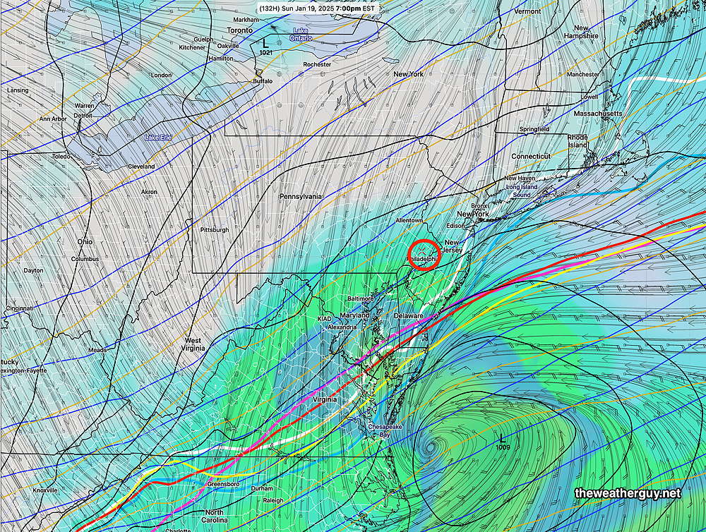
There’s too much model spread and uncertainty to have confidence in late Sunday’s forecast.
Highlights -This Week’s Weather
Posted Tuesday 01/14/25 @ 7:25 AM — Current highlights for this week’s weather:
- Colder temperatures will be with us for today, Tuesday, and Wednesday
- A weak clipper disturbance may bring some light snow showers Thursday evening.
- Somewhat milder temperatures late Friday.
- By Saturday, milder but with some rain likely.
- A strong cold front moves through on Sunday.
- There remains much uncertainty and model spread regarding low pressure expected to develop late Sunday afternoon. Depending upon the position along the coast, we may see up to 3 inches of snow by Monday morning. We may also see little to no snow.
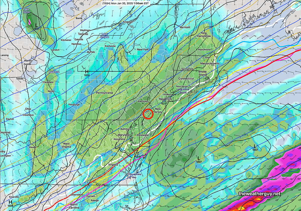
There remains little agreement with the models regarding the second low expected to form later Sunday. Here’s the latest ECMWF—
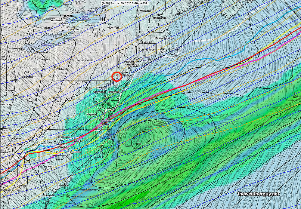
Here’s the latest AI version of the ECMWF forecast—
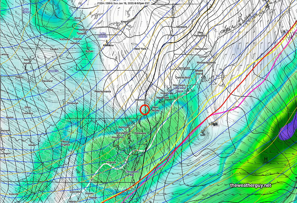
The GFS had been forecasting something even stronger than the ECMWF, but the latest run has moved closer to the ECMWF-AIFS,
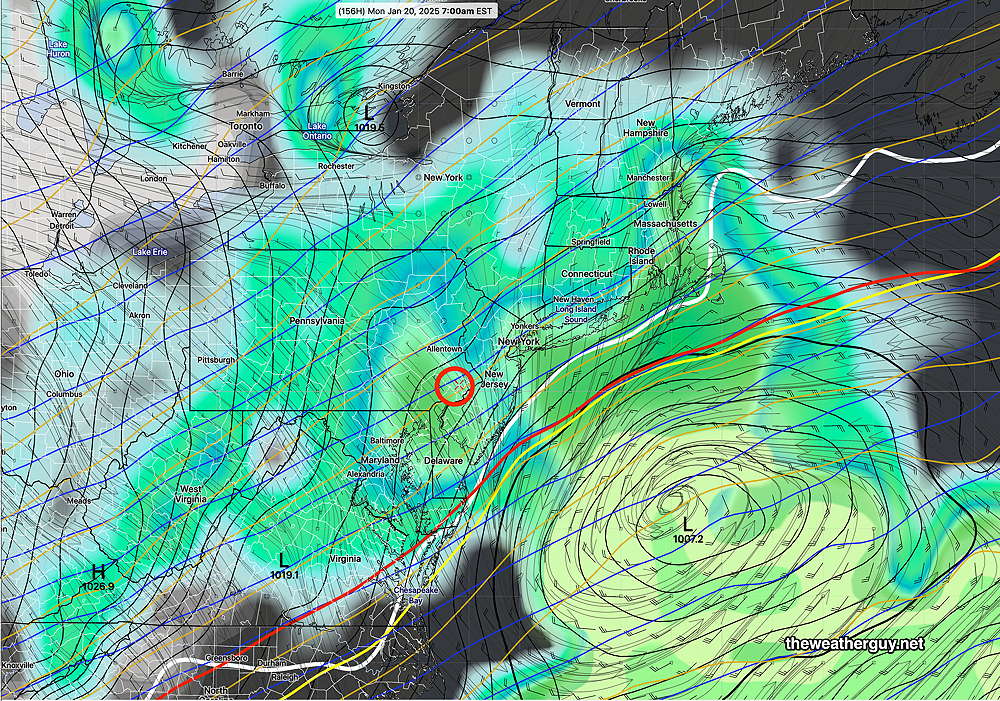
Of interest is the ICON which is very similar to the ECMWF—
.
So, there’s a range of forecasts and it’s too soon to call. Stay tuned.
Monday’s Weather
Posted Monday 01/13/25 @ 10:16 AM — Today’s clouds weren’t in any of the forecasts I heard last night and for good reason: the models didn’t forecast this level of cloud cover for today. The clouds are ahead of the first cold front expected to move through this afternoon—
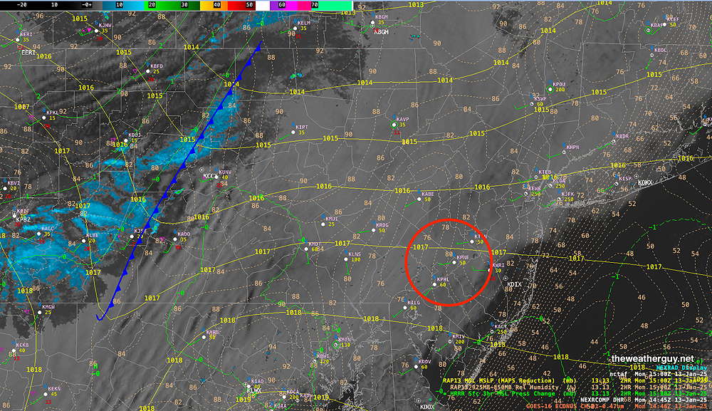
Based on GFS relative humidity, (but not the built-in cloud algorithms) this cloudiness may last through 4-5 PM today. Some scattered sprinkles or snow flurries are possible late this afternoon, mostly in far western areas.
The possible storms mentioned in yesterday’s Week Weather Outlook are more uncertain, with the GFS still predicting the Saturday rain and possible change to snow Sunday, while the ECMWF has most of it sliding off to our south, similar to the most recent light snowfall we had. With the models in such disagreement, there’s too much uncertainty to forecast this period.
The latest GFS -AI model (“GraphCast-GFS”) still shows a snowstorm possible next Tuesday instead of Sunday. With the limited experience I’ve had to date with the AI weather models, I haven’t seen them to be the magic bullet for predicting snow storms here that they’ve been touted to be.
Previously Posted Sun @ 10:13 AM — —Following two near average cold temperature days (Sunday, Monday), a series of cold fronts will bring much colder temperatures back to our area.
Generally dry, cold, windy weather will be with us through later Friday. Mostly sunny, but clouds at times due to upper air disturbances and instability.
There may be some snow showers Tuesday evening with the first front.
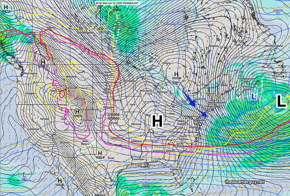
The position of the cold air boundary will spawn a series of low pressure systems that will affect our area late Friday into Saturday and into the following week.
The first surface storm, late Friday through Saturday, will likely bring rain to our area, but may start as a mix in the northwest suburbs and may end as a mix or wet snow late Saturday or early Sunday.
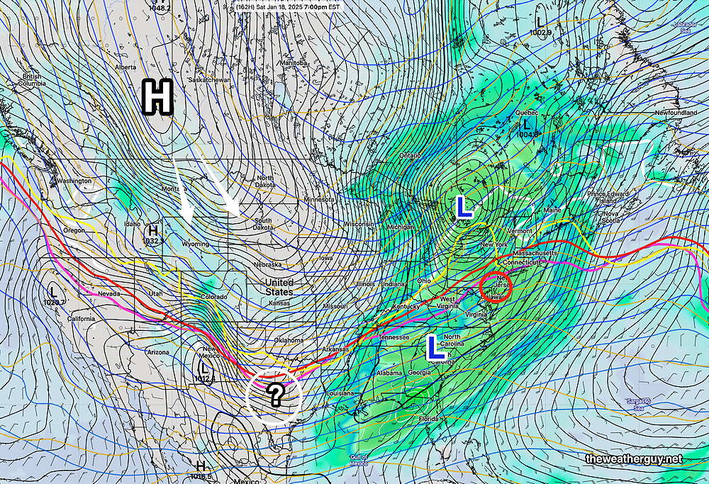
This week’s cold dry weather will likely be a prelude to more active weather systems after Saturday. Possible snow in the period Sunday through Tuesday.
