#Philadelphia #weather #PAwx
Cold and Dry
Posted Thursday 12/12/24 @ 7:39 PM — We’ll have cold and dry weather Friday through most of Sunday. Sunny skies Friday and Saturday, cloudy on Sunday. An area of rain will move towards us later Sunday, likely not moving in until late evening or after midnight Sunday.
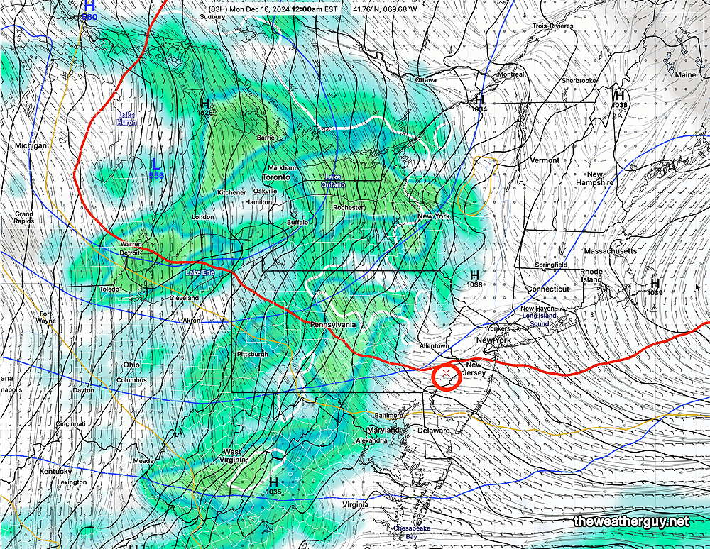
More active weather expected next week.
Rain early Monday and again Monday night into Tuesday. Another possible rainstorm next Thursday ahead of another cold front. No clear signal for any snow seen in the long range
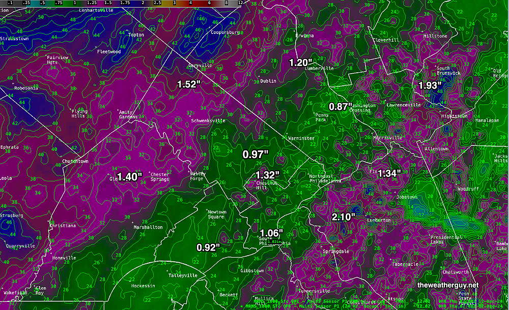
Here’s the MRMS though 9 PM tonight—
Wednesday Forecast Update
Posted Wednesday 12/11/24 @ 11:14 AM — The models have backed down on the severe 50-60 mph wind gusts forecast yesterday but are still showing gusts near 40 mph. They’ve also backed off on some the extreme precipitation amounts.
Based on 3 hour pressure changes, several areas of low pressure are expected to develop and move northeastward—
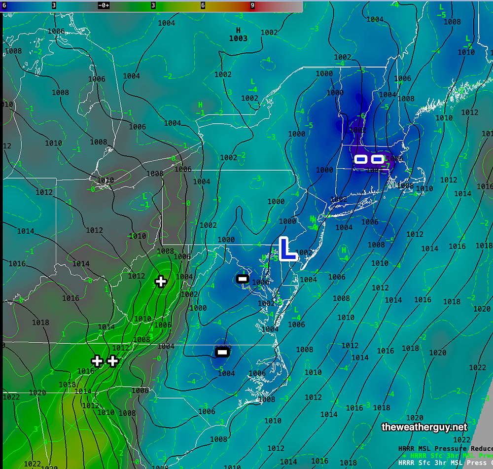
++ indicates the front moved through and high pressure is building in.
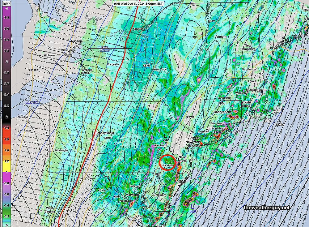
The cold front moves though Philadelphia about 4 PM, earlier to our west according to the latest hourly HRRR model. The heaviest activity is forecast for east of us, in NJ about 3 PM, less severe near Philadelphia and western suburbs. Rain continues until about 7-9 PM. There may be a mix of rain and wet snow showers in the northwest suburb about 10 PM to mid night.
Wednesday Wild Weather
Posted Tuesday 12/10/24 @ 4:58 PM — Some light showers have moved into western suburbs ahead of the main disturbance that will move in later this evening with heavy rain and high winds on Wednesday—
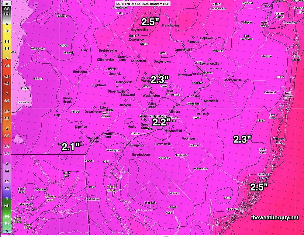
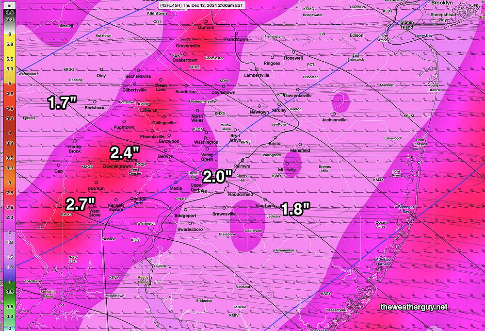
The latest ECMWF and the latest GFS has raised their rainfall forecasts for our area. Here’s the ECMWF (the GFS is very similar)—
The GFS is showing high wind gusts in the morning in PA —
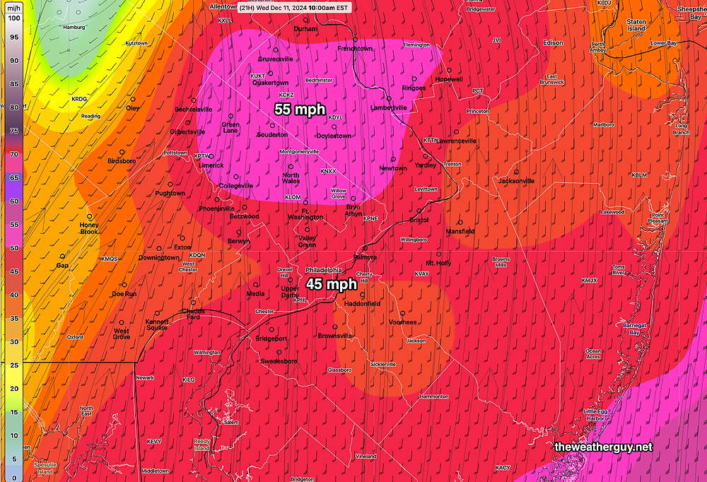
Both the ECMWF and the Canadian RGEM are showing very high wind gusts, especially in New Jersey during the mid to late afternoon—
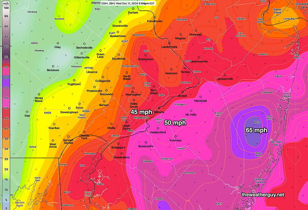
The latest GFS shows high wind gusts near Philadelphia during the morning hours—
Rain tapers off and ends 9 PM Wednesday evening Some wet snow flakes may mix in with the rain as it ends in the western suburbs.
Scattered snow showers possible Thursday morning.
Forecast Update
Posted Tuesday 12/10/24 @ 8:37 AM — A quick update. Here are the forecast trends—
- Fog lifts and visibility improves later this morning (Tuesday). Low clouds hang tough.
- Light sprinkles move in from southwest between 5 PM and 8 PM
- Heavy rain with increasingly strong wind gusts (35 mph) on Wednesday
- Trend is for greater rainfalln now to be near 2″ but the ICON and Canadian RGEM still maintain a band of 3″+ through Philadelphia.
- Rain tapers off earlier with winds,between 6 PM and 8 PM Wednesday.
- Some wet snow showers possible near the end of the precip.
- Falling temperatures Wednesday evening and night.
Updated Forecast Wednesday-Thursday
Posted Monday 12/09/24 @ 7:54 PM — Fog and low clouds may hang on during the early morning hours Tuesday. The GFS has some bright skies Tuesday morning after the fog lifts; the NAM-NEST keeps us in low clouds. Either way, it becomes cloudy in the afternoon and some light sprinkles develop from the southwest as early as 5-6 PM around Philadelphia ahead of the main system.
The system for Wednesday is already visible on radar and water vapor imagery—
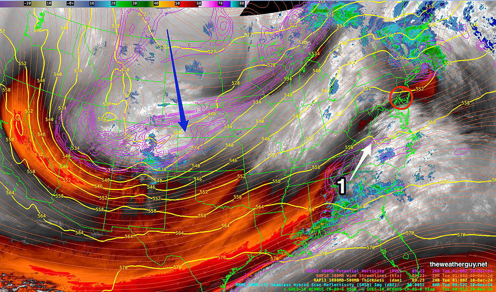
Wednesday will be cloudy and rainy and increasingly windy as the day progresses. Heavy rainfall expected throughout the area and continues into the evening.
The NBM has backed off from the 2.2″ rainfall and is now predicting 1.8″ over much of the area. The GFS and ECMWF are in that ballpark, about 1.6″. The latest ICON model and Canadian show well over 3 inches for our area. There will be the usual banding of the heavy rainfall, difficult to predict in advance.
The cold front moves through about about 6 PM and the rain tapers and ends towards midnight Wednesday.
Posted Monday 12/09/24 @ 8:47 AM — For today, Monday, light rain and has just moved into western Chester County moves into the rest of our area between 9 AM and 11AM . Heaviest rainfall today in about 2 PM and tapers off and ends between 5 PM and 6 PM.
The system to affect us on Wednesday now appears to move in as early as early as Tuesday evening with light scattered rain. Rain on Wednesday throughout the day, but especially heavy late afternoon into early evening, ending about midnight. The range of forecast rainfall accumulation is large, with the ECMWF 1.2″ GFS- 1.8″ and Canadian RGEM 3.3″. The latest model blend (NBM) is essentially unchanged from what was forecast last night.
The model blend is also forecasting a possible change to wet snow showers as the precipitation ends around midnight Wednesday with possible coating on grassy surfaces Thursday morning. Not all models are on board with this, but the latest ECMWF shows instability snow showers Thursday morning.
Heavy Rain on Wednesday
Posted Sunday 12/08/24 @ 5:17 PM —The latest NBM forecasts heavy rainfall for us on Wednesday—
Some models (Canadian) are forecasting much greater amounts, in the 3.5″ range, while the latest GFS and ECMWF are forecasting total rainfall in the 1.6″ range.
This is in addition to Monday‘s light drizzle/rain forecast totaling 0.13″- 0.28″.
Active Pattern Change
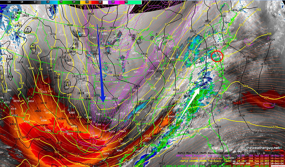
Originally Posted Sun 11:21 AM —This week’s weather will be active, as cold high pressure dives south, pushing the jet flow into a sharp highly amplified trough.
The current satellite water vapor image captures the main elements and the graphic’s caption below goes over the details—
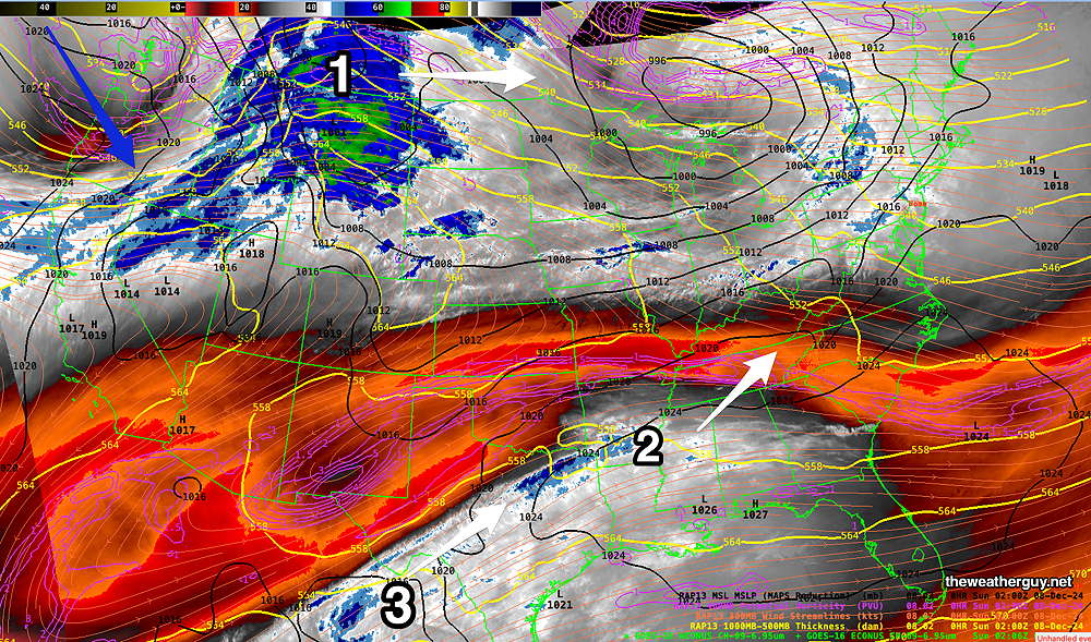
A disturbance (1) will move eastward as another disturbance (2) moves up from the southwest. This will bring drizzle and rain Monday as part of a warm front. At the same time, cold high pressure will be pushing the jet flow southward (blue arrow) creating an amplified jet trough. Disturbance (3) moves up from the Gulf ahead of the developing trough to bring heavy rain Wednesday. (Click on image for a larger view.)
By Monday, the NAEFS captures the beginning of the rapid pattern change. Drizzle and rain with a warm front and developing low pressure system. About 0.20 inches of rain expected —
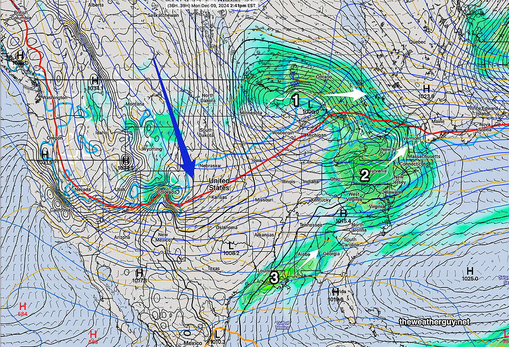
By early Wednesday afternoon, a deep trough and strong cold front moves through—
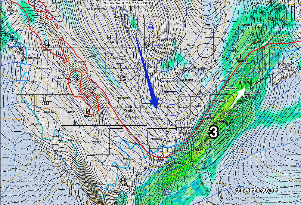
Heavy rain expected late Tuesday night into Wednesday. Perhaps as much as 1.5-2 inches of rain with some localized higher amounts! High winds behind the front later Wednesday.
Stay tuned this week for updates.

