#Philadelphia #weather #PAwx
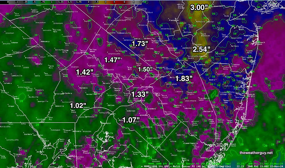
Updated Rainfall Totals
Posted Friday 11/22/24 @ 7:19 PM — Updated Rainfall totals for the past 48 hours—
So Where’s the Snow?
Posted Friday 11/22/24 @ 8:11 AM — So where’s the snow? The atmosphere above 3000 feet is cold enough for snow, BUT surface temperatures are not below the critical 36.5º right now here in the Philadelphia area. The models predicting snow were assuming a high precipitation rate and total precip (water equiv) of 0.4″-0.6″ today with dynamic cooling.
Unfortunately, the latest NBM is only cranking out less than half of that (0.18″) so the dynamic cooling from previously expected higher precipitation rates isn’t occurring.
Somewhat higher precipitation rates are expected this afternoon, so some snow flakes may mix with the rain. But no accumulating snow for most of our area, except far northwest. The NAM model proves to be correct again.
I’ve recently used the NAM for fewer forecasts, putting more emphasis on the experimental RRFS, but winter weather here is still often best predicted with the NAM.
Forecast Change
Posted Thursday 11/21/24 @ 10:00 PM — Tonight’s models have returned to previous precipitation levels of about 0.4” to 0.5” water equivalent here for Friday. A difficult forecast, as temperatures are still forecast to be in the mid 30s, reducing chances of accumulation. Temperatures aloft are cold enough to support snow much of the time from the city north and west and even parts of NJ in the early morning.
Despite the return to higher water precipitation amounts, the range of model snow accumulations remains similar to those posted earlier this evening, including the HRDPS which I had cast off as likely being too high. Any heavy burst of precipitation could cause enough dynamic cooling to reduce surface temperatures and allow more accumulation than forecast. Again, a tough forecast.
Posted Thursday 11/21/24 @ 7:33 PM — I had a chance to look at more of the afternoon models. I see a trend towards less total precipitation on Friday, especially with the AI models.
Long time followers here might be asking, “What about the NAM?” And what about “Never Ignore the NAM”, my long time mantra when it comes to snow here.
Well, looking at the NAM, it has little to no snow accumulation in the immediate Philadelphia area and captures the trend of the AI models that show lesser amounts of precipitation here than forecast yesterday.
Here’s the afternoon NAM—
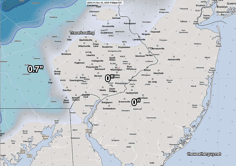
So while many will see snow flakes tomorrow, especially from the city north and west, the lower amounts of precip falling translates into no accumulation for much of the immediate Philadelphia area.
This is supported by the afternoon RRFS, also just available. So, while the Canadians certainly know their snow, I think we need to ignore the HRDPS posted earlier.
Interesting Storm Continues
Posted Thursday 11/21/24 @ 5:08 PM — With cold air aloft as a result of a closed upper low and a northeasterly surface flow of chilly air, precipitation that’s expected to continue through much of Friday will be a mix of snow and rain, especially from the city north and west.
Areas near the ground (actually, what we call the “temperature” is measured at 2 meters (6 feet) above ground level) will be in the low to mid 30’s during the morning and early afternoon. As mentioned below, 36.5º F is often considered the minimum temperature for snow.
Of course, for snow accumulation, we really need lower temperatures to be closer to 32º to 33º unless the precipitation rate is very high.
Here’s the very latest Canadian high resolution (HRDPS) which did well previous seasons but I think they’re on the high side—
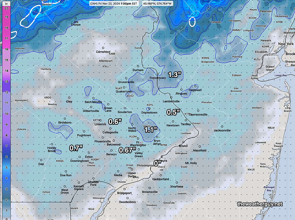
Here’s another take on the snowfall, this time from the experimental REFS, (ensemble version of the RRFS) —
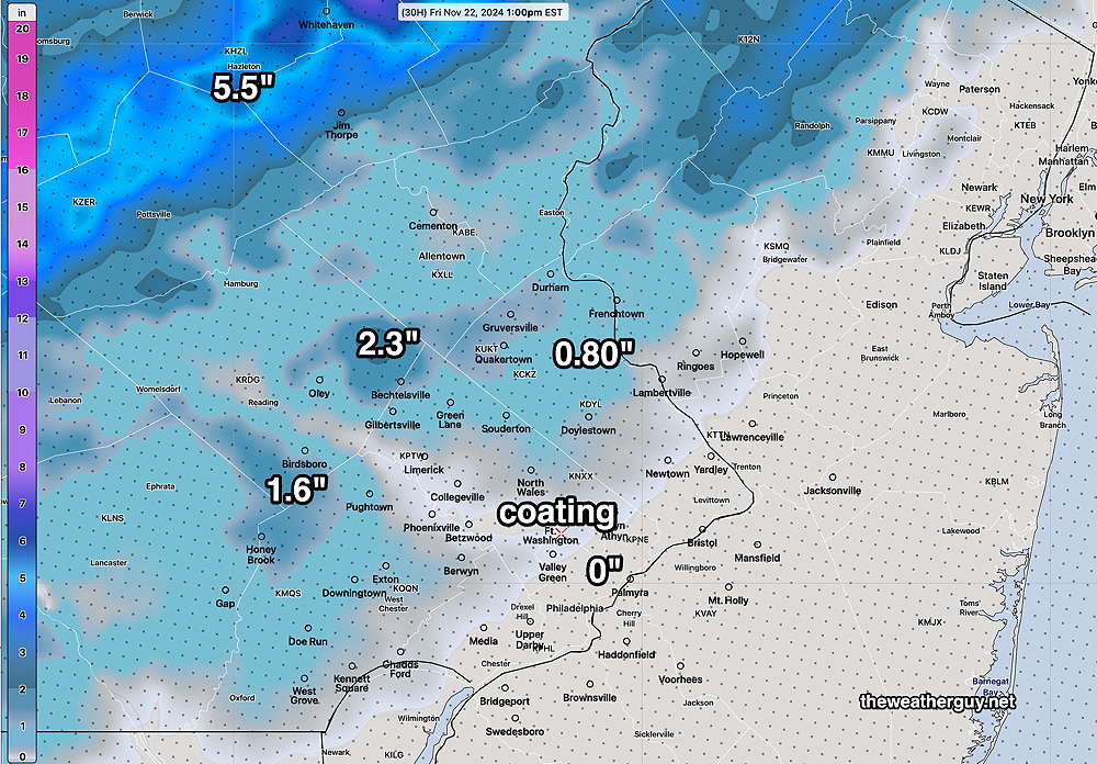
Frankly, I don’t think any of models are going to get this right, with so many unknowns and temperatures above freezing.
On top of that, the AI models seem to show less precipitation than the operational models, which, if correct, pulls the rug out of any snow totals forecasts.
Continued “Interesting” Weather
Posted Thursday 11/21/24 @ 1:43 PM — The scenario described for several days is occurring with a surface low wrapping around an upper low pressure system.
Cold air aloft is already causing some precipitation to fall as melted snow and the models are suggesting that much of the additional precipitation (expected to be an additional 0.6″ to 1″ water equivalent) to fall through Friday into Friday evening will be a mix of rain, rain and snow and snow in some colder, higher elevated areas around Philadelphia.
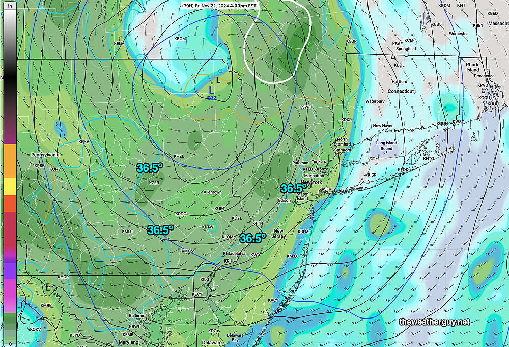
The latest Canadian HRDPS model has some measurable snowfall for us on Friday, albeit quite little—
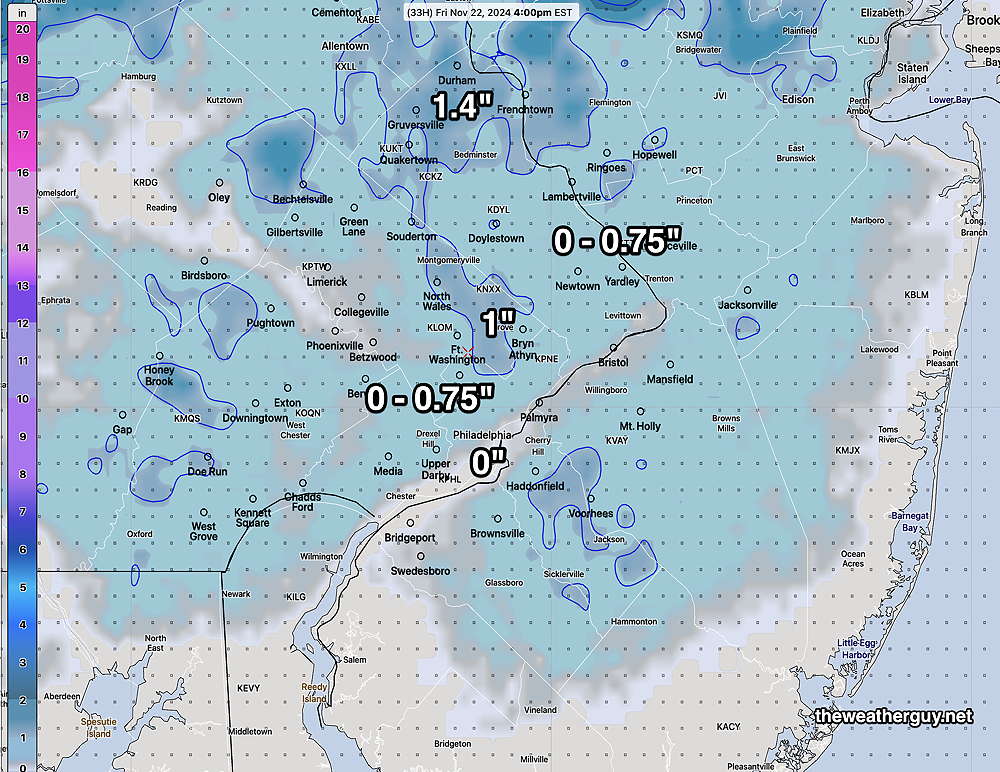
The HRDPS has done well in previous winters, but I think it might be overly aggressive with the snow accumulation, if you consider 1/2″ or less aggressive.
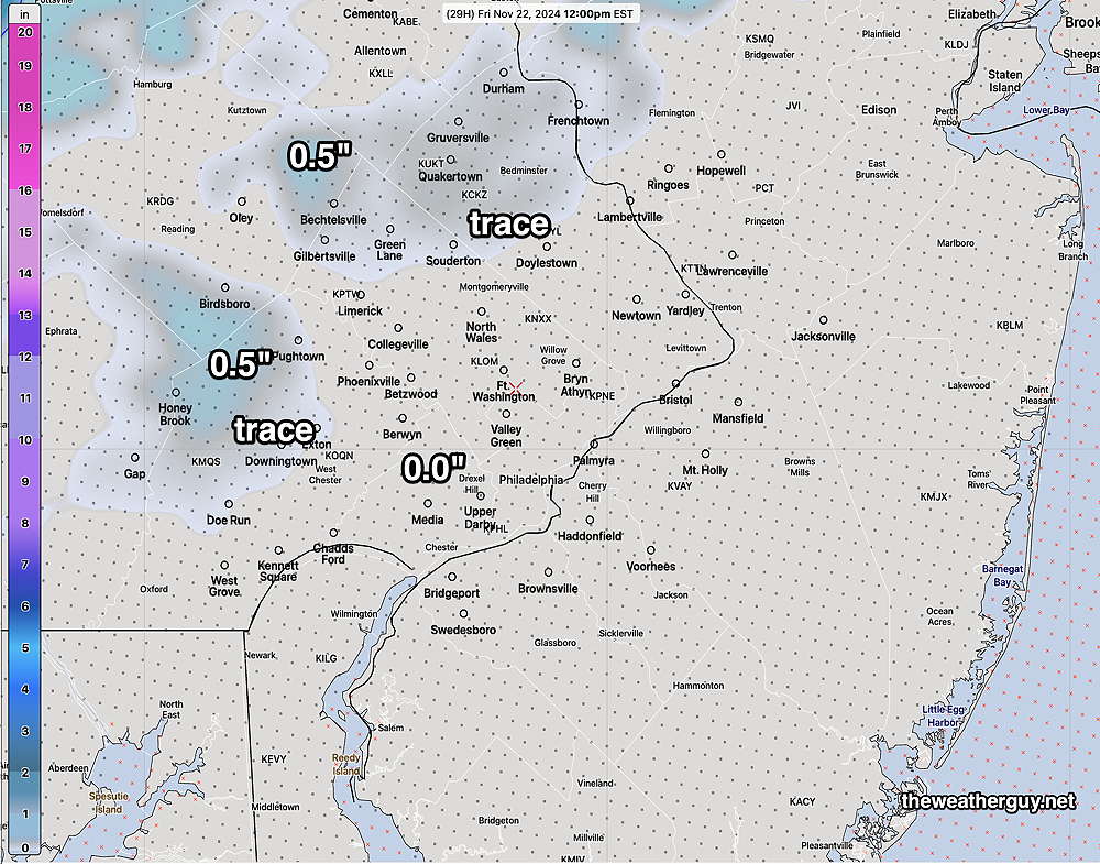
The experimental RRFS seems to ring true, but it’s unproven—
The NBM has this amount, based on my own “technique”
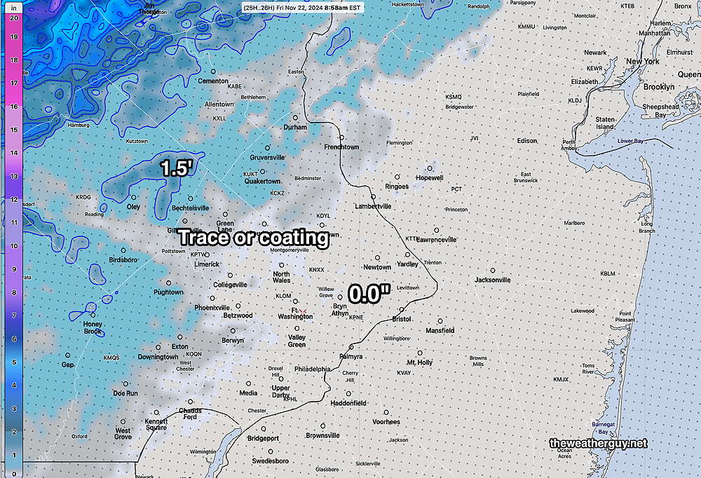
With high precipitation rates causing dynamic cooling and with temperatures at or below 36.5º, snow and snow mixed with rain is forecast by several models. Warm ground surface temperatures will limit accumulation.
These accumulations assume heavy precipitation rates. It should be noted that the latest ECMWF-AIFS has the storm exiting much faster with less precip here. That would make these snow accumulations moot.
I’ll try to nail it down further this evening.
Finally Some Rain
Posted Thursday 11/21/24 @ 9:16 AM — The Philadelphia area finally got some rain last night and rainfall totals were similar to those forecast by the NBM.
Here’s the latest MRMS rainfall totals—
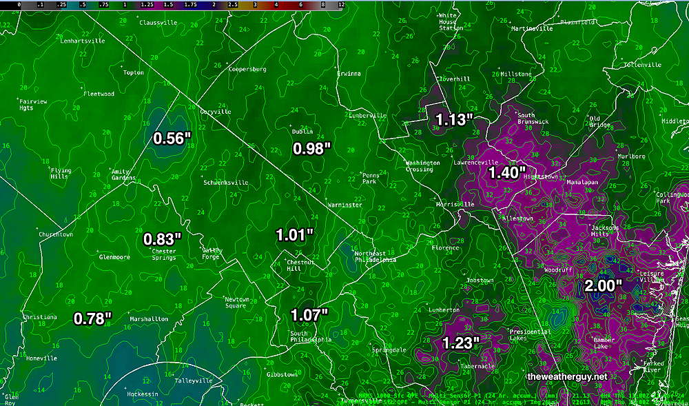
The models are still showing a rain-snow mix Friday, with little if any, accumulation in the immediate PHL area. There’s quite a range of timing and location and the ensemble models show considerable uncertainty with the position of the surface low on Friday.
I’ll update around noon today with the latest model data. Stay tuned.
Wild Interesting Weather
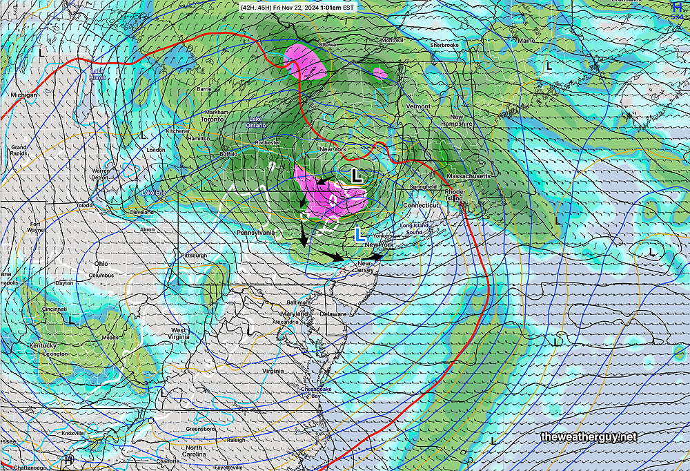
Posted Wednesday 11/20/24 @ 4:47 PM — As posted Tuesday, the models are showing an upper air low pressure system which will link up with the developing secondary surface low and this secondary surface low will rotate around the upper low until they become vertically stacked, likely to occur Friday. Cold air aloft may result in a mix of snow/rain (non-accumulating snow) even in the northwest part of the city Friday morning.
For Tonight: The rain will move in about 10 PM in western Chester/Montco/Bucks and will arrive in Philadelphia between 11 PM and midnight. Rain will become heavy as a squall line type feature develops and winds shift abruptly from the southeast to the northwest with gusts of 40 mph. The abrupt wind shift could be damaging.
Total Rainfall Thursday is slightly more than that posted earlier today. Here’s a new NBM run—
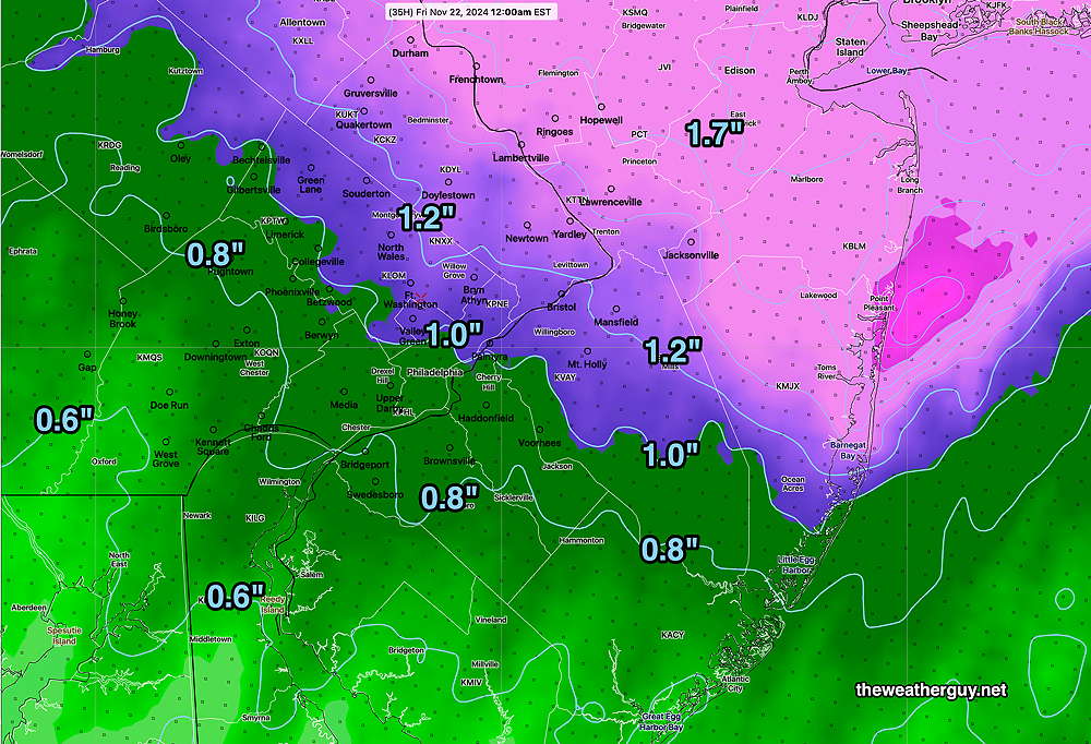
Rain tapers off Thursday during the morning hours southwest of the city but areas northeast of the city may continue to have rain.
As the surface low rotates around the upper low and moves westward, then southward towards us and more rainfall is expected on Friday. As much as an additional 0.35 + inches of rain.
Rain Forecast Update
Posted Wednesday 11/20/24 @ 10:53 AM — This morning’s models have trended even later with the onset of rain tonight. While the latest HRRR has the line of heavy rain moving into Philadelphia with a few showers out ahead of the main line between 11 PM and midnight, the experimental RRFS is even further delayed. Rainfall totals look to approach those forecast by the AI models several days ago.
Here’s the latest experimental 12z RRFS which just became available—
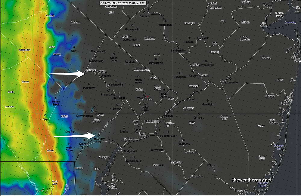
There’s a sharp shift in winds with this line of storms with gusts forecast to approach 35-40 mph.
Here’s the 12z model blend total rainfall through 36 hours—
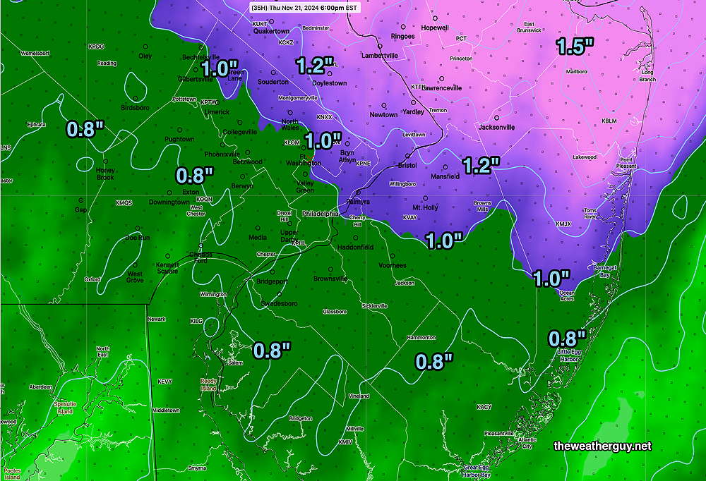
Posted Wednesday 11/20/24 @ 8:29 AM — A quick update. Here are the current trends. Most of today (Wednesday) will be cloudy, although some areas, especially south and west may see some periods of sun.
Rain moves in from west to east between 7 PM and 11 PM, trending later about 10PM or 11 PM.
Rainfall is expected to be as originally forecast by the AI models.
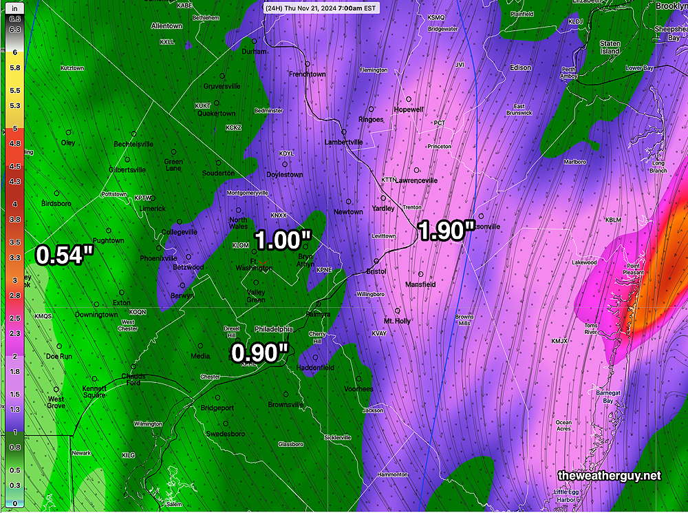
Showers may continue northwest areas on Thursday.
Additional rainfall (0.35″) on Friday as the surface low rotates around the upper low.
An Interesting Storm Expected
Posted Tuesday 11/19/24 @ 4:50 PM — A weak warm front moves through tonight. Some very light scattered showers are possible this evening with this warm front. Some of the moisture is streaming up from a tropical system near the Gulf coast.
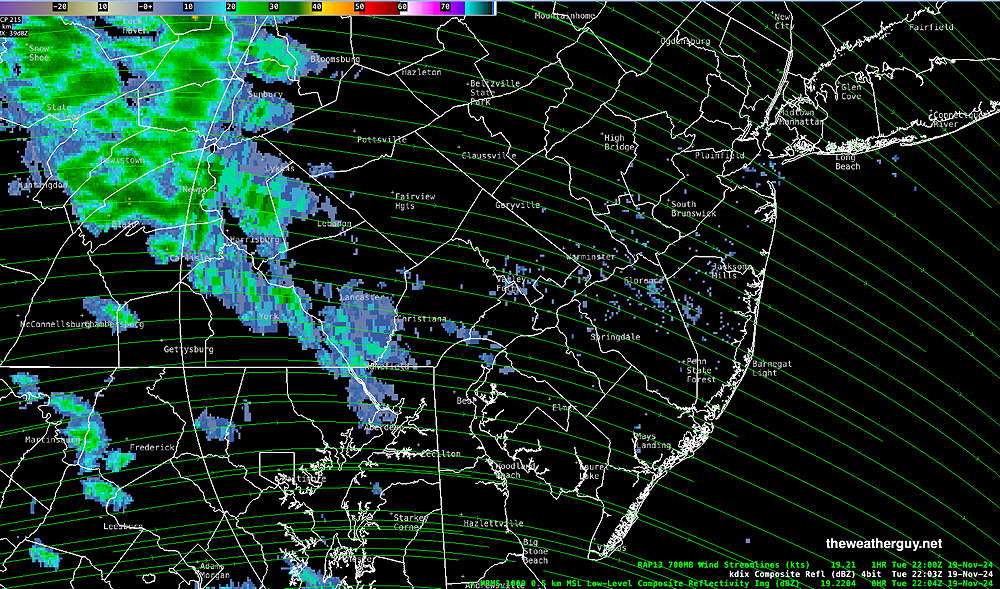
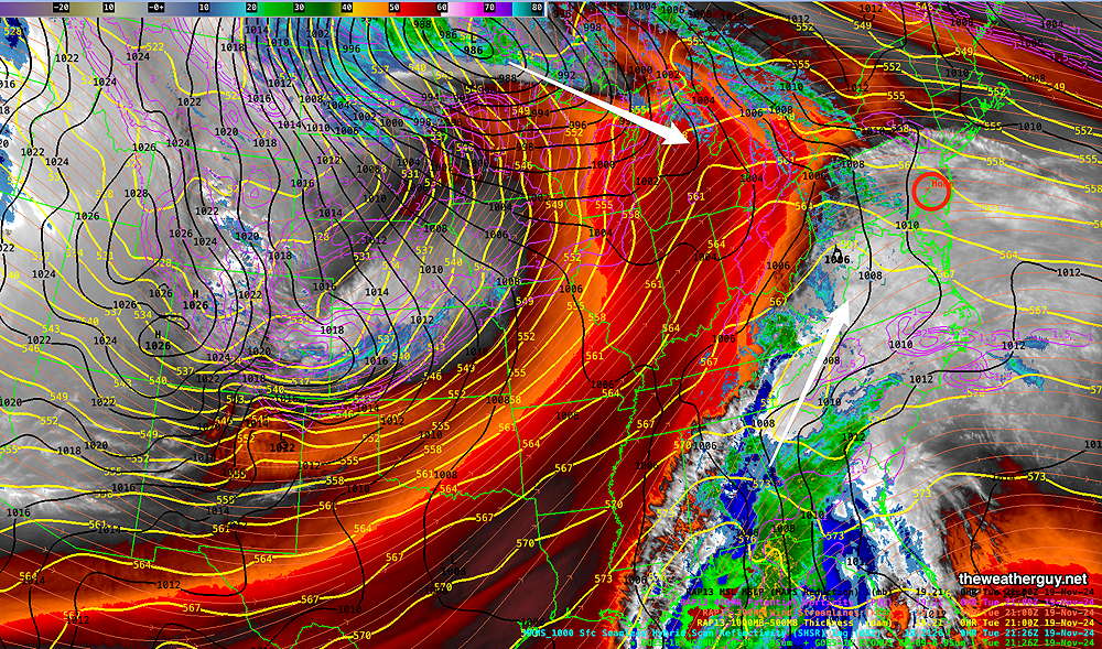
A cold front and deep low near the Great Lakes will spawn a secondary low off the coast Wednesday evening into Thursday. This will be helped by energy/moisture from a tropical system. Rain moves in during the early evening Wednesday and becomes heavier towards midnight. STRONG WINDS with the actual frontal passage about 3 AM Thursday.
Rain tapers off around noon Thursday here.
What’s interesting is the models are now showing the upper air low pressure system will link up with the developing secondary surface low and this secondary surface low will rotate around the upper low until they become vertically stacked, likely to occur Friday.
So rain Wednesday night will taper on Thursday, but more rain is expected Friday as this surface low undergoes precession around the upper low. Strong winds with gusts over 30 mph.
The models are still showing a range of 0.6″ to 1.2+” of rainfall with some of it coming Friday. Looks interesting. Stay tuned.
The weather forecast for the Philadelphia Marathon looks unchanged, perhaps a bit less windy.
Forecast Update
Posted Tuesday 11/19/24 @ 9:16 AM — Tuesday will have sunshine through high, thin cirrus cloudiness for much of the day. Clouds thicken about 5 PM, as a weak warm front approaches this evening.
Some models are cranking out 0.01″ to 0.03″ (very light, scattered) showers this evening which will move away with the warm front tonight.
For Wednesday, most of the day will be dry but cloudy. Rain moves in about 7-10 PM and becomes moderate to heavy especially areas north of the city.
While some models were trending towards lower rainfall amounts yesterday, the ECMWF has been consistent with close to 1+” of rain just north of the city and the model blend (NBM) shows at least 0.70″+ of much needed rainfall.
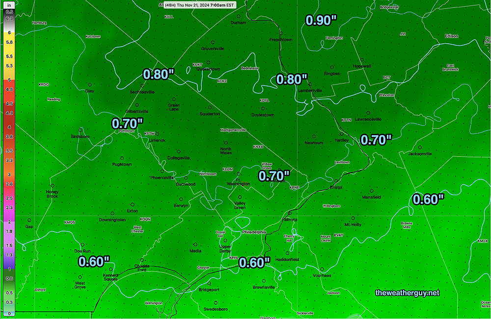
The experimental RRFS shows lesser amounts of rain near the city and has a different coverage—
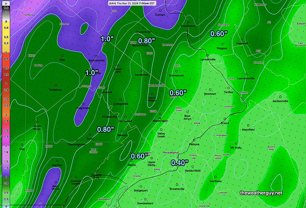
BTW, the AI models (ECMWF-AIFS and the GraphCast-GFS) continue to have 1″-1.3″ of rainfall in the immediate PHL area. Likely outliers, but we’ll see.
Philadelphia Marathon Forecast Update– A mix of sun then clouds. Temps in the morning in the mid 40s rising to the low 50s in the afternoon. Windy/gusty from the west.
Diminishing Precip?
Posted Monday 11/18/24 @ 4:29 PM — Some clouds move in during the afternoon Tuesday and some light showers are predicted northern, southern, and western areas late evening.
Wednesday will have increasing cloudiness, with some sun and bright spots at times mid-day. Rain moves in from the west about 6-9 PM.
It’s been looking like a slam dunk for some moderate to heavy rainfall late Wednesday into Thursday. Several models (GFS, NAM, Canadian RGEM) have been trending towards lower rainfall totals, especially in and west of Philadelphia.
What had been looking like a range of 0.6″-1.0″ is now more likely to be 0.35-0.7″ in the immediate PHL area. Areas north and east are forecast to receive more rain. (The latest NBM is staying with a 0.6″- 0.9″ rainfall, but its forecasts tend to lag trend-wise.)
This morning’s GFS model captures the trend—
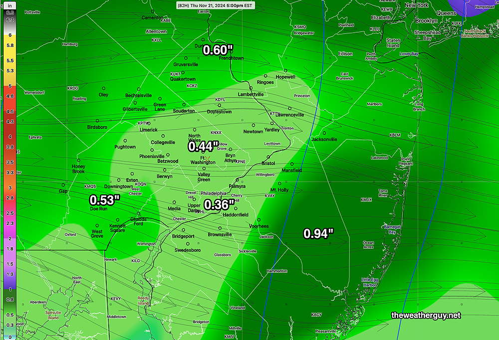
It should also be noted that the AI models are still predicting rainfall almost double what is forecast by the operational models with many areas receiving over 1″ of rain in and around the city due to more explosive development of low pressure. As I said yesterday, this storm will be a good assessment of the AI models.
I’m confident the forecast will change again, but the current trend with the operational models, unfortunately, is for lower precipitation amounts near the city.
Philadelphia Marathon Forecast
Posted Monday 11/18/24 @ 4:36 PM — Sunday Outlook—It’s looking dry, windy, with considerable cloudiness due to a warm front. Showers with this warm front currently forecast far north of the our area. Temps in the low to mid 40s in the morning rising to 50º by 1 PM.
Originally Posted Sun @ 6:19 PM — —A weak cold front will move through around daybreak Monday morning. Some models are showing a few widely scattered sprinkles in early morning hours; other models show weak radar echoes where rainfall never reaches the ground.
Monday should become sunny and windy.
Tuesday will be sunny in the morning with increasing cloudiness in the mid to late afternoon.
Wednesday will be mostly cloudy. An increasing number of models are showing some showers, especially south of the city, in the morning with more heavier rain moving during the early evening.
There’s a continuing signal for moderate to heavy rain as low pressure forms near us on late Wednesday into Thursday. While some models have the heaviest rain north of us, most are forecasting at least 0.6 to 1.0″ which would be the heaviest rainfall we’ve had here in months.
It looks like it might be quite stormy late Wednesday through Thursday as very windy conditions develop.
Here’s the latest ECMWF-AIFS and the Graphcast-GFS AI model forecasts for Thursday morning—
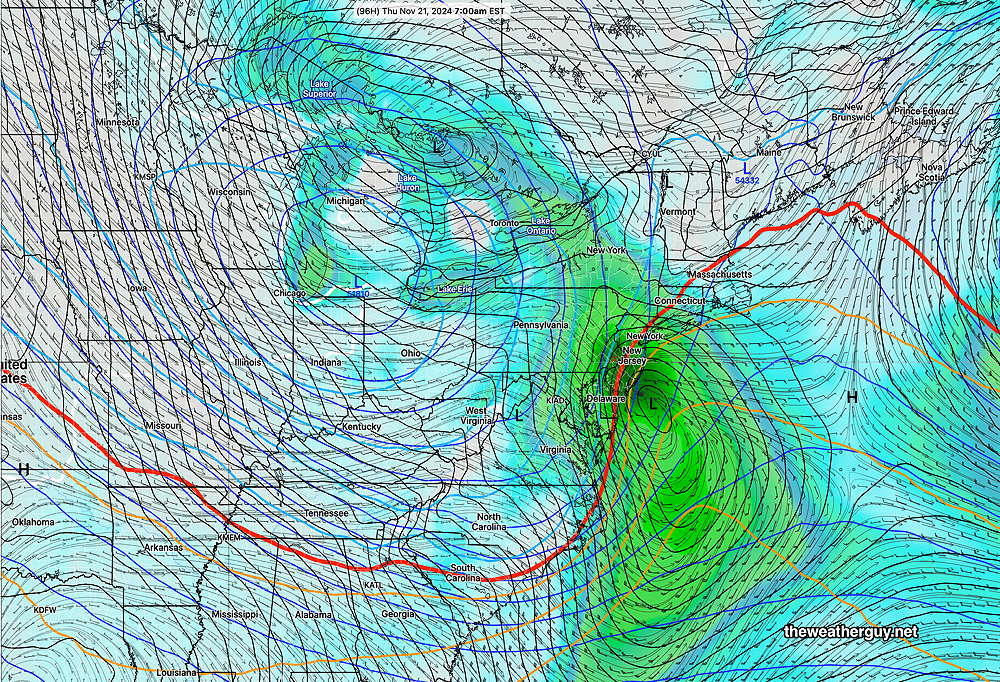
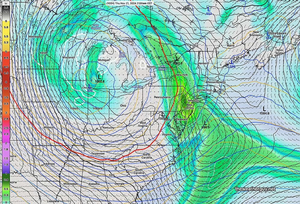
Friday looks to be unsettled with clouds and sun, windy and cold and possibly some light scattered showers. Snow flurries are possible far north and west of Allentown.
My regular visitors to this site probably have noticed that I’m increasingly using the AI models for this site. I’m really fascinated to see if they do as well (or better) than traditional numeric weather prediction models. This storm will be a good test, as they are predicting heavier rainfall for us than the traditional models.

Hi, Glenn.
Thanks for all you do–one of my favorite places to go to see what’s really going on weather-wise.
The Philadelphia Marathon is this coming Sunday, the 24th. To the extent you have time and willingness, weather advice from 7-11am that day would be much appreciated.
Hi Brian,
It’s looking dry next Sunday and somewhat breezy. Temps in the mid 40s. Somewhat cloudy as a warm front approaches from the south. Of course, this is forecast is 7 days in the future, but the AIFS, NBM and GFS have similar forecasts. I’ll see about putting some emphasis on future posts for Sunday.