#Philadelphia #weather #PAwx #Drought
Rainfall
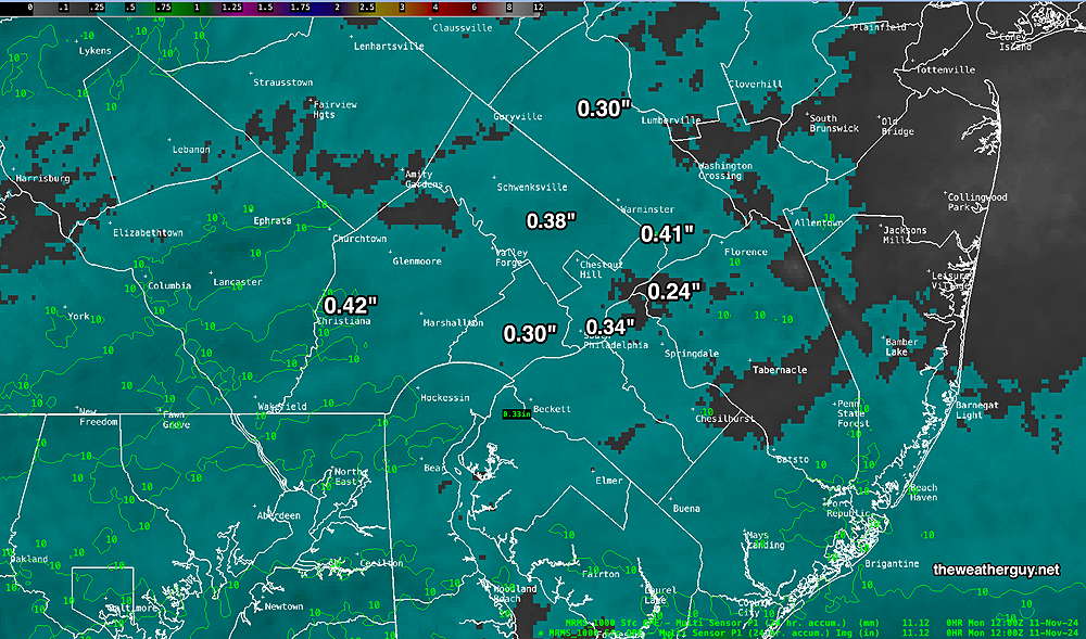
Posted Friday 11/15/24 @ 8:34 AM — Yesterday’s high resolution model forecast was pretty good in forecasting the very light precip areas to our west received.
Here’s the MRMS rainfall summary—
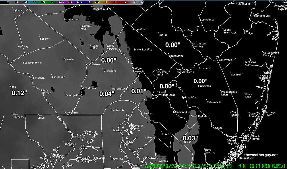
We could really use some rain, but it looks like we’ll need to wait until next Wednesday -Thursday (if we’re lucky) to receive any.
Thursday Precipitation Update
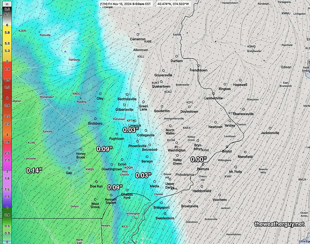
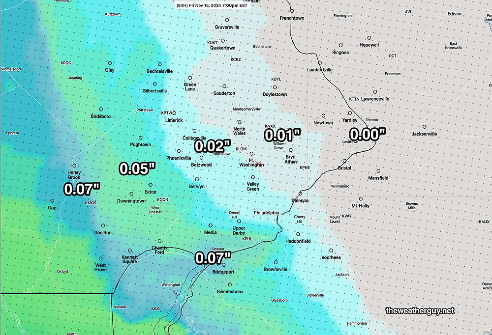
Posted Thursday 11/14/24 @ 3:00 PM — Several of the latest high resolution models (HRRR, RRFS) have moved the light precipitation this evening slightly eastward, perhaps giving more of the western suburbs of Philadelphia a bit of much-needed light rain.
Here’s the latest HRRR—
No Rain Today But Possible Pattern Change
Posted Thursday 11/14/24 @ 10:07 AM — All models, including those late to this forecast (ICON, HRDPS), have come together for a cloudy but dry forecast for the immediate Philadelphia area today and tonight.
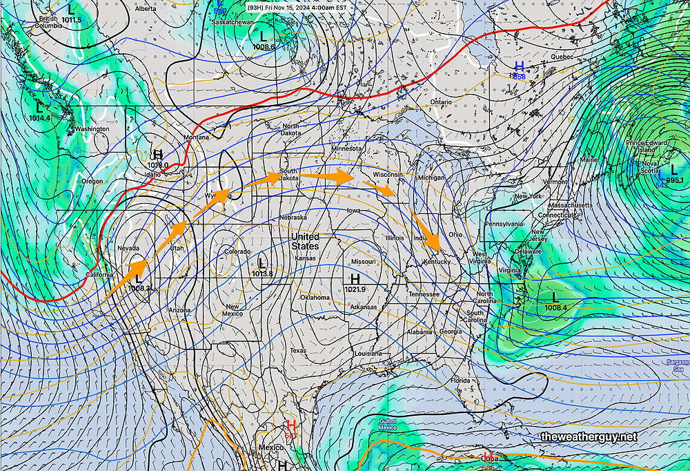
Another front moving in late Monday may also meet the same fate of a mostly dry frontal passage. This is all due to an upper anti-cyclonic flow over us that has persisted—
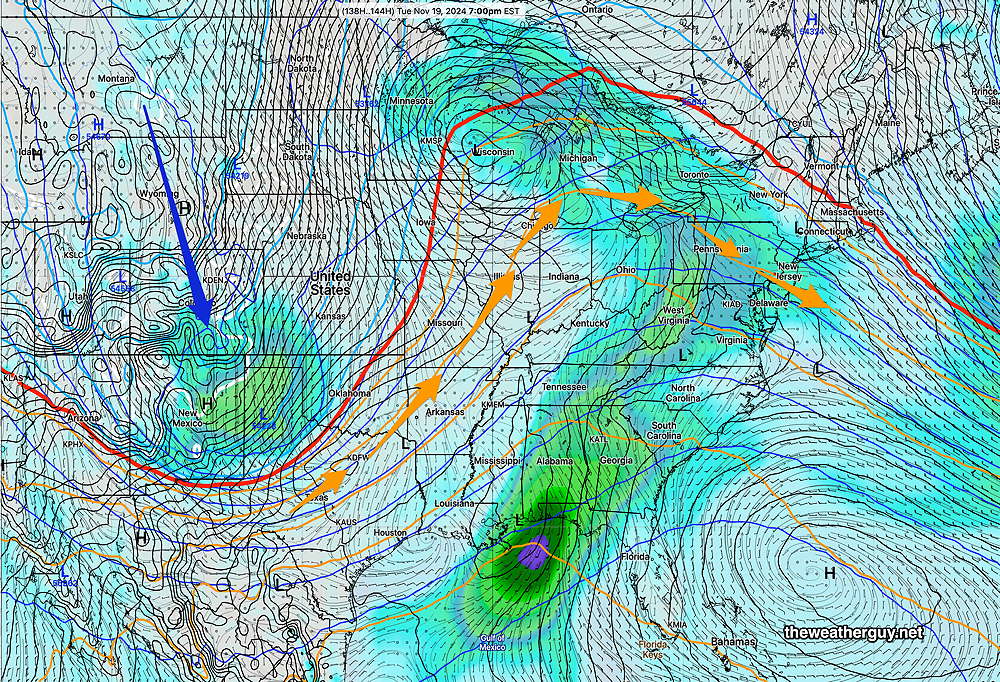
Note the plunge of colder air in the above graphic which should result in at least a temporary change in the position of the jet flow and set up a cyclonic flow over us next Thursday or Friday. Additionally, high pressure in the western Atlantic is setting up further southward. This system has been blocking rainfall in our area, but may finally lose its grip if it sets up further southward. Much of this change is simply seasonal, as colder air builds in the polar areas.
Unfortunately, I’m not sure that any new pattern setting up will be persistent, so any change to colder (and possibly stormier weather) may not last more than a week or two.
No Rain for Thursday Evening. Another Tropical System?
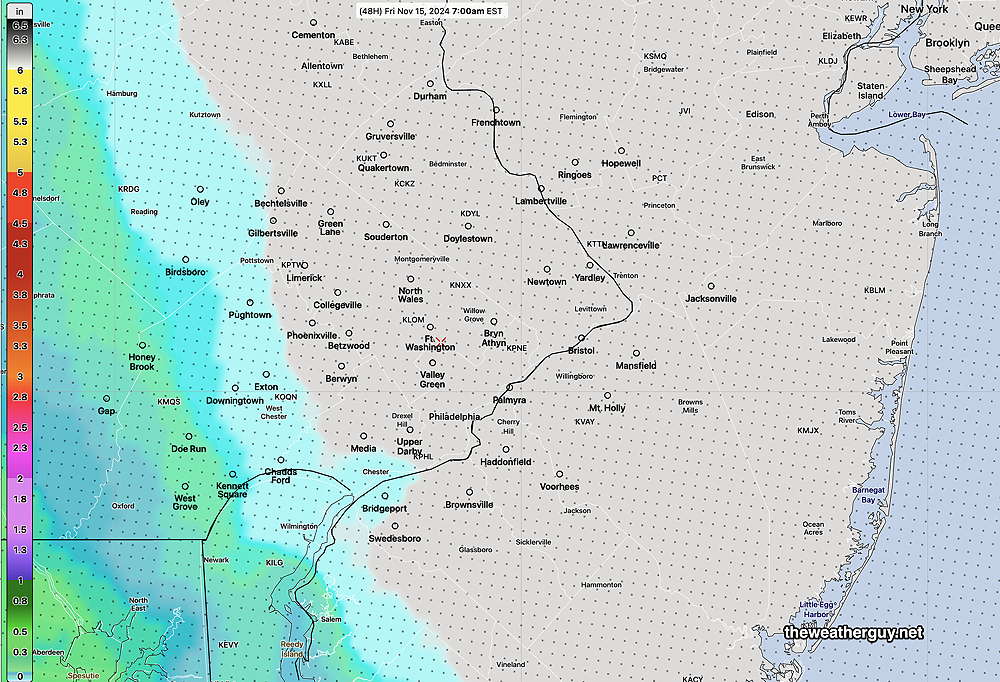
Posted Wednesday 11/13/24 @ 10:45 AM — Last night’s models have continued a trend set by the ECMWF, where any rain Thursday will stay west and south of our area.
Here’s the latest model blend (NBM)—
The National Hurricane Center is keeping its eye on the Caribbean for a likely hurricane to develop and hit the Yucatan, then likely dissipate with its moisture eventually brought up along the US southeast and east coast early next week.
Here’s the latest AIFS —

This is just one of many possible scenarios with this developing tropical system.
Any Rain Thursday?
Posted Tuesday 11/12/24 @ 10:03 AM — Low pressure is expected to develop later Thursday off of the North Carolina coast.
Depending on the model, the Philadelphia area will be in the periphery of the precipitation shield, with the latest ECMWF keeping us totally dry while the GFS, Canadian and NAM-Nest have us receiving anywhere from 0.05″ to 0.20″ of rain Thursday night.
If the ECMWF is correct, the Eagles game will be rain-free. Otherwise, light rain possible during the game. I’m leaning towards the very light rain forecast.
Here’s the latest model blend (NBM) which shows the periphery of the rain shield—
Our Drought Continues
Posted Monday 11/11/24 @ 4:04 PM — For the past several days, it looked like we might get some rain on Thursday. Over the past day, the chance of any significant rain on Thursday is now looking unlikely. Any rain here late Thursday will be light.
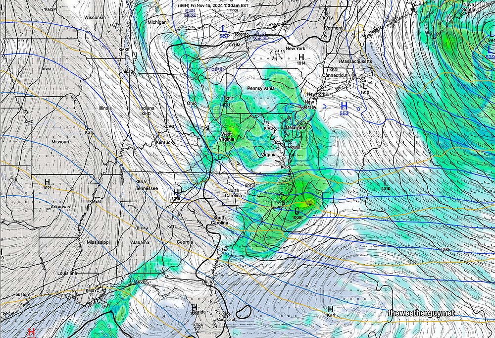
An expected low pressure system now looks to develop too far to our south and east—
With the exit of this low on Friday, a strong mid level ridge with warmer temperatures will move in for next weekend. And more dry weather.
Low End of the Forecast Range
Originally Posted Mon 9:40 AM — Last night’s rainfall was in the low end of the forecast range, closer to the Canadian models and somewhat disappointing compared to the HRRR, RRFS and GFS forecasts.
Here’s the MRMS precipitation totals from last night—
Following several additional days (today through much of Thursday) of nice weather, we’ll see another chance for rain late Thursday evening.
