#Phillywx #Philadelphia #weather #PAwx
Friday, The Weekend
Posted Thursday 11/30 @ 8:06 PM — A series of disturbances will approach our area ahead of cold front that eventually gets here on Monday.
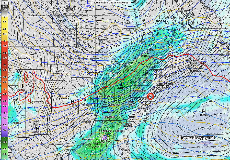
For Friday, some sun early through high clouds, then cloudy by noontime. Rain moves in about 2:30 PM to 5 PM from the west.
The rain departs by Saturday morning. A strong southwesterly flow of warm air will allow temperatures to reach 62º Saturday before clouds thicken ahead of the next disturbance Saturday evening. Most of the daytime Saturday will be rain-free.
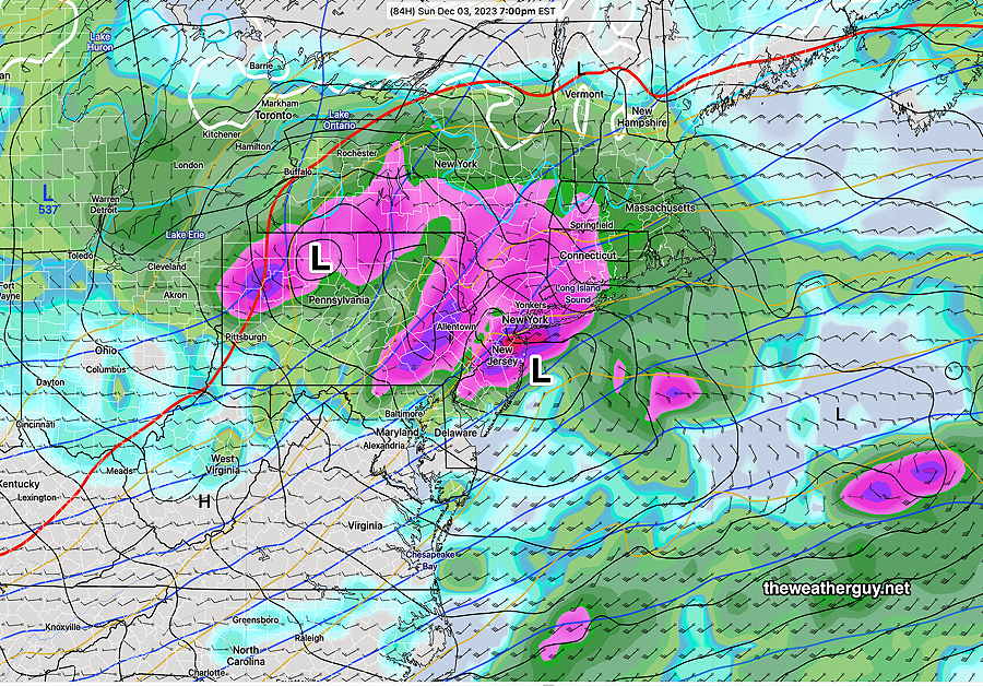
Rain develops later Saturday night into Sunday, tapering off late afternoon or evening but there’s uncertainty in the timing of these disturbances on Sunday and beyond.
The ECMWF is most aggressive with secondary low formation near us—
The GFS has a faster and less developed system at 7 PM on Sunday evening—
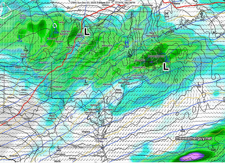
So there’s an interesting setup for the next several days with large swings in temperature and uncertainty in secondary low development.
In the Monday through Wednesday time frame, it will get cold with snow flurries likely at some point. Another big warm up for next weekend!
Thursday, Friday, The Weekend
Posted Wednesday, 11/29 @ 5:18 PM —
A gradual warm up is expected Thursday and Friday with high temperatures expected to reach 49-51º Thursday and Friday. Cloudiness is expected on Friday and showers are possible late mid afternoon ahead of the next system to affect our area.
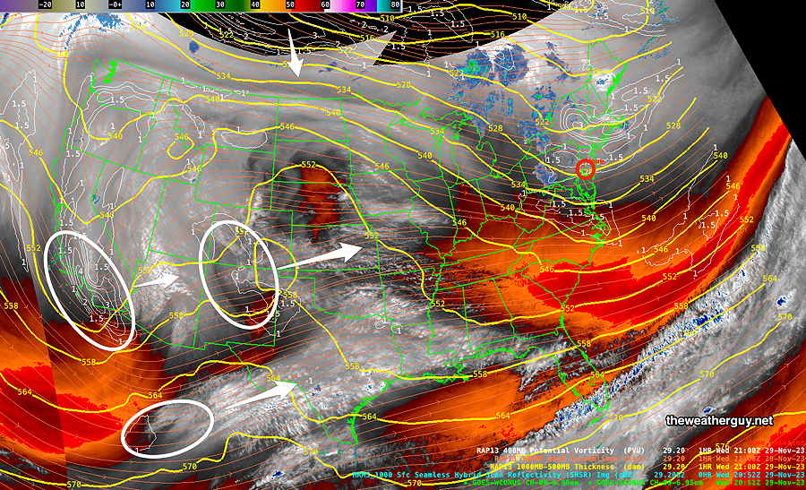
This afternoon’s water vapor image shows developing disturbances that will bring the light rain late Friday and additional rain likely on Saturday—
Speaking of next week’s possible storminess, I’ve been doing some additional thinking about the coming winter. I’m planning to put together a separate page for my winter outlook.
Snow Flurries are Here
Update Tue 11/28 @ 8:24 AM —
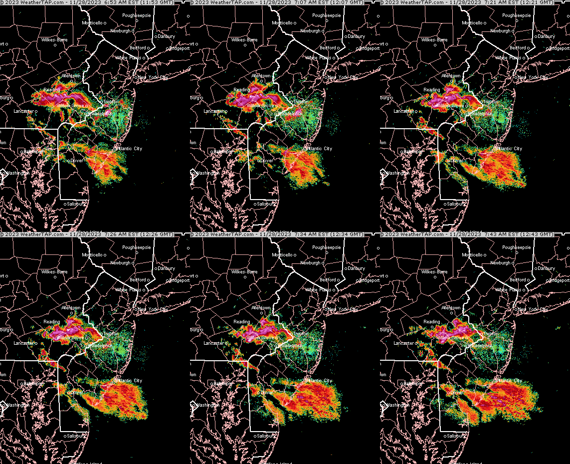
The light snow flurries should be ending shortly. Some additional flurries possible this afternoon, but the models have backed off of that somewhat.
First Snow Flurries of the Season
Update Mon 11/27 11:10 PM — Tonight’s models show some snow flurries during the morning hours in the northwest suburbs and again at times during the afternoon.
Update Mon 11/27 @ 9:21 PM — A very intense cold flow of air will bring instability cloudiness to our area on Tuesday along with snow flurries. Not everyone will see flurries, but a fairly significant band should set up. Total precipitation will be 0.01 to 0.02″ water equivalent. If there’s a coating anywhere, it will be on grassy surfaces and it shouldn’t be there long.
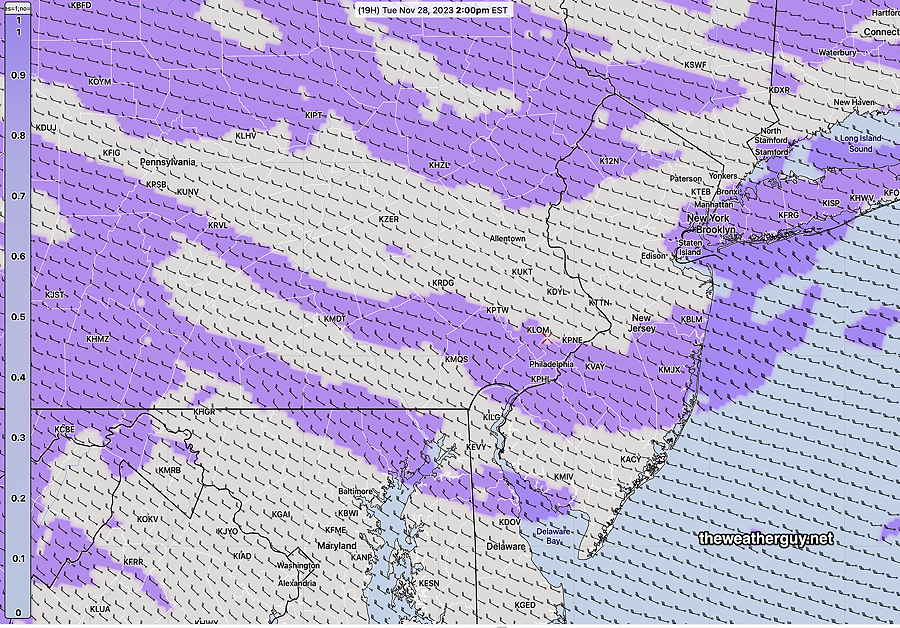
Wind gusts in the early afternoon > than 35 mph possible and high temperatures 36º Blue Bell, 38º Philadelphia.
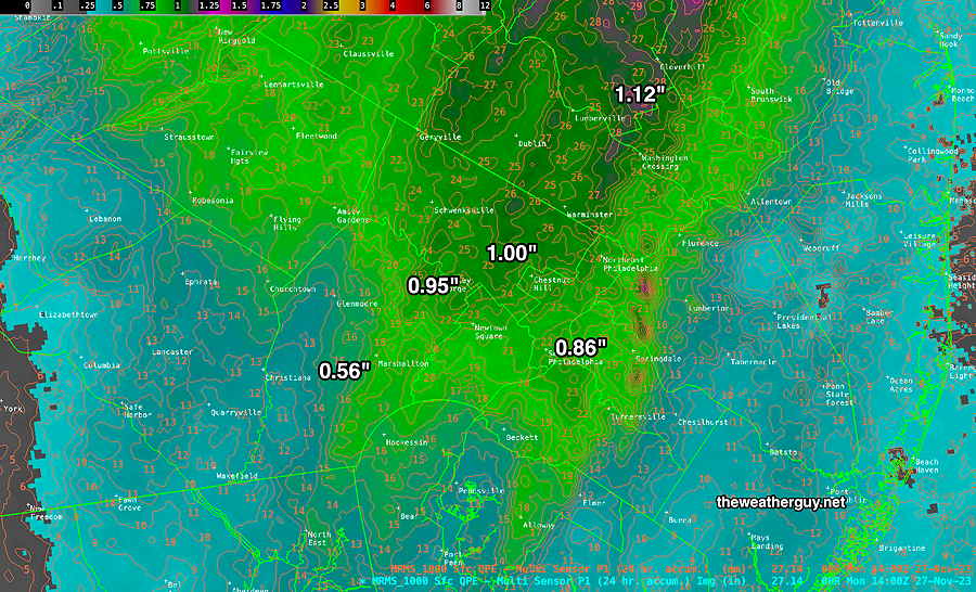
Update Mon 11/27 @ 9:26 AM — Sunday’s models finally got it right for the heavy rainfall we received—
Current Water Vapor image Monday morning—
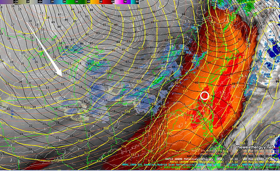
Monday will become windy and considerably colder after noontime. Typically, the high temperature is reached daily around 2-3 PM standard time. Today, our high temperature will be reached around 11 AM -12 PM and will drop from there. An abrupt increase in winds is expected as well.
Tuesday is looking quite cold and very windy.
Previously Posted Sun 9:56 PM —
Following this heavy rainstorm Sunday night (totally missed by most models 24 hours ago with the notable exception of the HRDPS -which I ignored), a cold front will move through a few hours before daybreak Monday.
We may see some periods of instability cloudiness on Monday and an increase in winds/gusts.
The cold air will move in during Monday afternoon and from Monday night through early Thursday, it will be quite cold here with highs in the upper 30s to 40 Tuesday and Wednesday.
Here’s the NAEFS forecast for Tuesday, showing high pressure over our area—
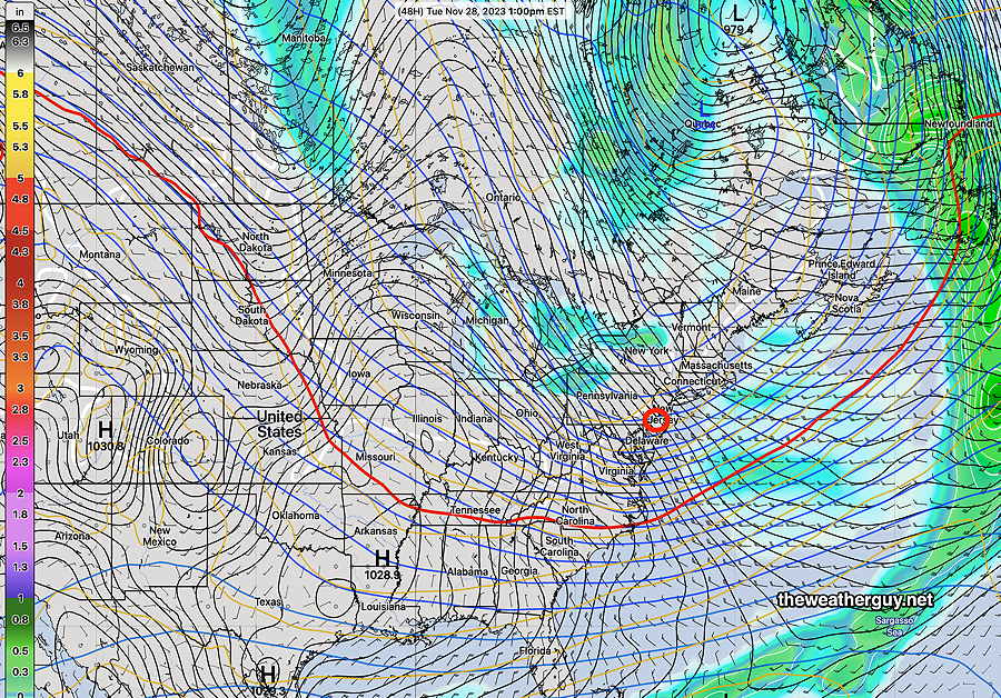
By Friday, the upper trough from Tuesday will have transformed into a ridge, indicating warmer air returning. Low pressure and another front will bring rain later Friday—
So a dry, cold week on tap. Rather windy at times as well. Rain returns later on Friday.
