#weather #paweather #wx #pawx #philadelphia #phillywx
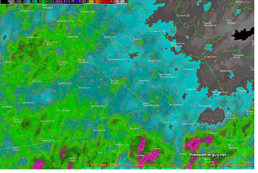
Friday Night’s Rainfall
Show More
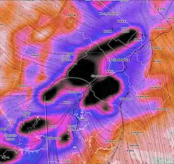
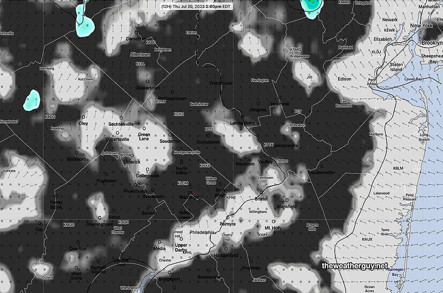
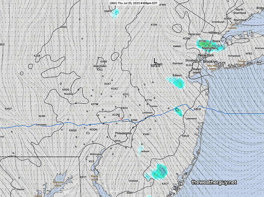
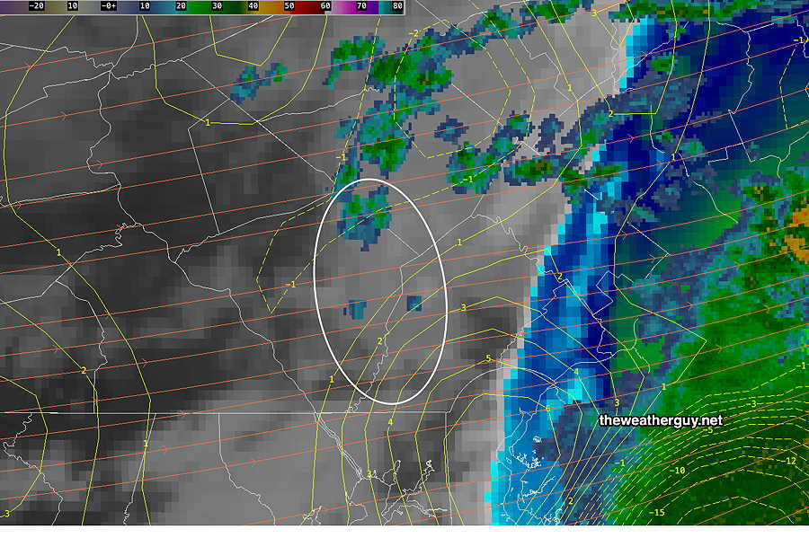
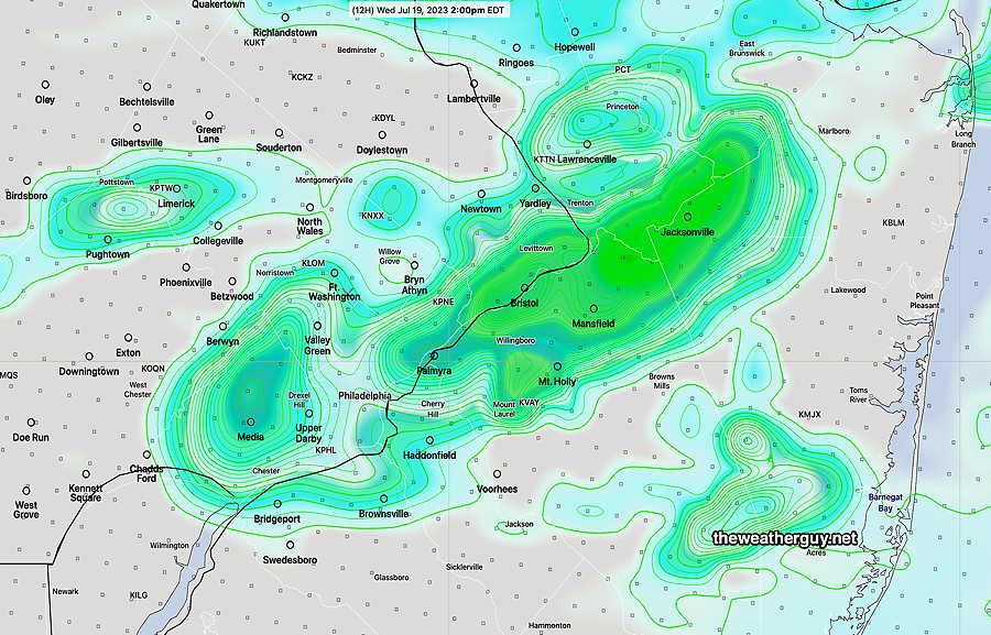
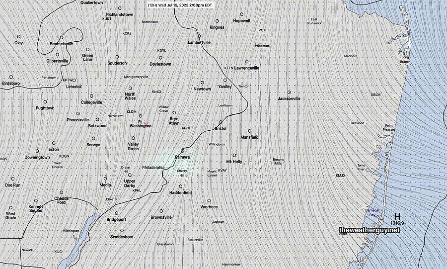
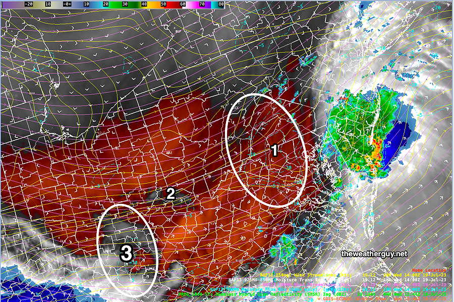
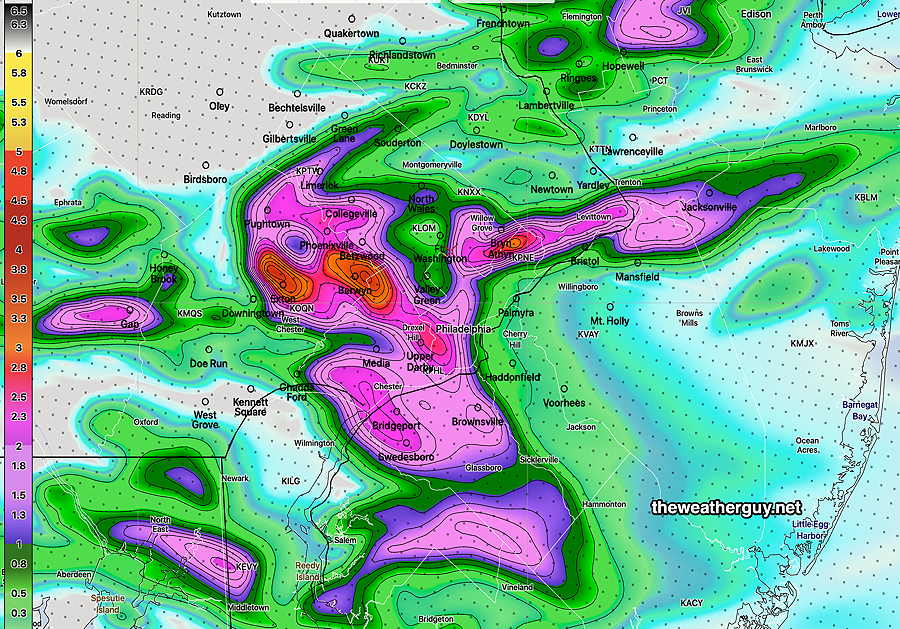
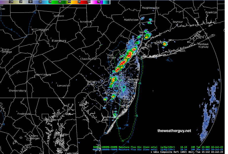
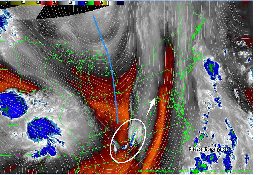
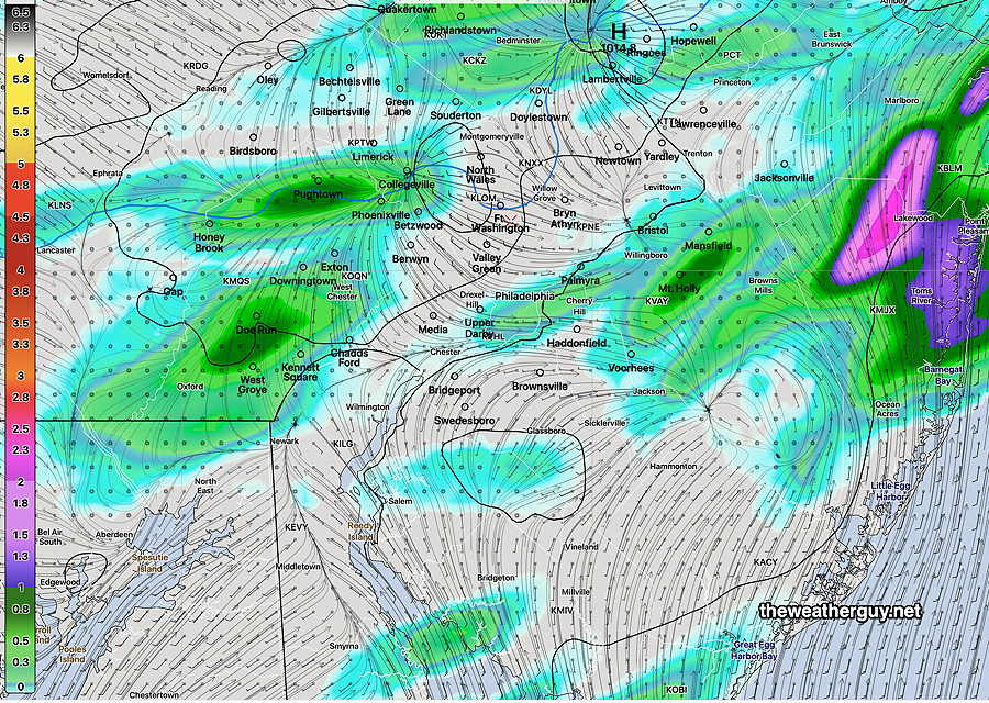
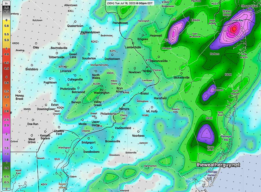
While it’s great that no severe weather was reported in our area, it suggests that yesterday’s models had over-stated the severe potential. The general timing was within range, somewhat faster than predicted, especially considering the mesoscale complex line of storms had been moving through central PA at near 30 mph. As mentioned in my 11:04PM update (below), a few of last night’s 00z had models backed off of the heavy rain. (Actually more than a few- the RAP, HRRR and NAM-NEST, but not the three versions of the HIRESW.) When dealing with the potential of severe weather, especially late model changes within 6 hours of a weather event, one never knows if any observed late changes in the model forecast are the result of true late changes in conditions or whether they simply reflect inadequate “model spin-up” time. Such is the state and art of the current numerical weather prediction. As for today, Friday, a mix of sun and clouds. Some scattered pop-up thundershowers expected from 2 PM to 8 PM as a secondary trough moves through. Update Thu 7/20 11:04 PM — While a few of tonight’s models have backed off from some of the heavy rain, the high resolution models show some impressively severe dynamics— HIRESW-FV3. Maximum vertical velocity Updated Thu 07/20 @ 7:46 PM — A front will move through the Philadelphia area between 3 AM and 8 AM. Strong, possibly severe thunderstorms are possible with this frontal passage. PWATs are in the 2 inch range, meaning heavy rain is possible in a short period of time. Helicity is elevated in NJ – tornadic activity possible. Thunderstorms with hail possible. Here’s the latest 22 z (6PM) HRRR forecast for 7 AM — Weak low pressure is expected to form along this front in the Delmarva area, possibly slowing its passage through our area. A secondary trough in the afternoon may bring some additional showers/thunderstorms to some areas. Severity Parameter Table As you can see from my Severity Index table, tonight’s storms have the potential of being severe in some areas with heavy rain. Updated Thu 07/20 @ 10:07 AM — Correction/Clarification: Based on the new morning models, the showers/thunderstorms tonight, now expected between 1 AM and 5 AM, will be the result of a warm front. Showers should end in the morning. The associated cold front will move through during later Friday afternoon, with additional scattered storms. More specifics this evening. Updated Thu 07/20 @ 8:56 AM — A cold front is approaching the region today and there’s some uncertainty with the timing of the rain associated with the front that’s expected later tonight. The GFS and RAP models have an earlier onset of the showers/thunderstorms: about midnight tonight. The HRRR is slower with the rain: It shows some showers overnight but has a large area of rain moving through mid Friday morning. Total rainfall about 0.75 inches. The HRDPS is similar to the RAP and GFS forecast: the rainfall starts about midnight to 2 AM. As for the daytime, many models are showing some large areas of cloudiness with breaks of some sun about 2 PM this afternoon. A few very isolated showers possible this afternoon; most areas dry. More details about the rain/thunderstorms later this evening to follow with an update this evening. Updated Wed 07/19 @ 8:47 PM —Tomorrow had been forecast to be rainy, but the latest HRDPS shows little in the way of rain or even pop up showers during the afternoon— The front expected to move through on Friday, now appears to come through before daybreak Friday with some showers/thunderstorms. Friday is looking better, but maybe some thunderstorms in the late afternoon. One model that hit the nail on the head today was the Canadian HRDPS model. Our own HRRR model did poorly today, as it did poorly this past Saturday with the overwhelming storms that developed in Bucks county. It should be noted that the HRDPS also did much better with this Saturday’s storms, but was an outlier of sorts. So why not use the HRDPS all the time? Well, it’s not always accurate either. Sometimes, it’s plain wrong too. The HRDPS forecast extends out only 48 hours. It’s a very complicated model to “post-process”. Because of its heavy post-processing time and because the model comes out about 3-4 hours after its designated run time (due to their own supercomputer speed limitations), the best I can do is see a model that’s already almost 5 or 6 hours old. Nonetheless, I’ve been impressed with some of its forecasts over the past year, especially regarding cold front passages. If someone can figure out when HRDPS is going to be correct or when the HRRR is going to be correct, we’d have a winning forecast approach. Updated Wed 07/19 @ 10:48 AM — It appears that some additional showers are developing just to our west this morning in an area that the RAP model showed as having high moisture convergence— The predominance of models from this morning show showers developing here by 2 PM, as forecast below in in HREF So my earlier attempt using satellite imagery that delayed showers until this evening just may be too primitive and incorrect. Updated Wed 07/19 @ 9:36 AM — An area of showers is moving away as I write this and the forecast question for today is when and where will the next impulse set off showers? The forecast you heard on radio/TV is “scattered showers throughout the day”, a tacit acknowledgement that these things can’t be pinned down. And they likely can’t be. (It doesn’t keep me from trying.) Indeed, the freak downpour that occurred near Washington Crossing, Bucks county on Saturday is a perfect example of the sometimes chaotic nature of weather. The ensemble models have several areas and time frames for additional showers today. Here’s the current (06z) HREF forecast for 2 PM— Here’s the current 06z HRDPS which shows almost no rain at 2 PM— I’m searching the water vapor image for signs of a next impulse— Updated Tue 07/18 @ 5:49 PM — The storms only developed in NJ today and nothing is expected this side of the Delaware River for the rest of the evening. Wednesday looks to be unexpectedly “interesting” weather-wise. The cold front that triggered Tuesday’s storms in NJ will return as a warm front during Wednesday. An area of strong moisture convergence, instability and upward vertical motion will set up near the Philadelphia area. Showers and thunderstorms may develop as early as 9 AM and will blossom over our area early afternoon. Rain and thunderstorms may linger into the evening hours. Heavy rain is possible with these storms in some areas. Here’s the latest HRRR forecast for the rain Wednesday— Updated Tue 07/18 @ 11:23 AM — This morning’s NAM-NEST confines all the activity to New Jersey, even later this afternoon. So maybe nothing for the immediate PHL area. Updated Tue 07/18 @ 8:34 AM — The upper trough and the disturbance that is expected to cause thunderstorms in our area this afternoon are clearly visible on this morning’s water vapor image— The trends from last night still remain— the upper air support diminishes as the disturbance approaches. Most of the heavier activity is expected in NJ. Some dry air filters in at some levels and the PWAT is reduced. Here’s the HRDPS depiction of the rain coverage— The HRDPS still has some storms as early as 2-3 PM, now in western suburbs. Groups of storms will be disorganized, not necessarily a line of storms. Some areas may see nothing at all. Some scattered activity lasting to about 8 PM in our immediate PHL area. Some storms that do form may be strong to severe. CAPE values still moderately high and instability values are highly elevated. Update Mon 7/17 9:50 PM — Just a quick update. Tonight’s early models are forecasting a weaker frontal passage and dry air moving in Tuesday afternoon. This would significantly decrease the chance of thunderstorms Tuesday. Check back tomorrow morning . Updated Mon 07/17 @ 8:48 PM — First let me say that the HRRR smoke model is forecasting for tonight to have the most smoke pollution in this area and things improve Tuesday. A cold front moves through sometime Tuesday afternoon or or early Tuesday evening. There are large differences in the timing of the front, with the HRDPS having early to mid afternoon storms here, moving into NJ later in the afternoon. There are also giant differences in forecast PWAT, with the HRDPS having values near 2.2″ while the HRRR is in the 1.6 to 1.9″ range. The NAM and HRRR have most of the activity late in the afternoon and early evening. Most models seem to have the greatest activity in NJ. There isn’t much storm activity forecast for the western suburbs of Philadelphia, so at the current time it appears that the areas from Philadelphia and especially east into NJ will be the most impacted, with NJ possibly receiving the heaviest rainfall. The latest HREF model captures this emphasis of having most of the activity east into NJ— There will be plenty of CAPE and somewhat elevated vertical shear Tuesday. Storms could be strong to severe. If the PWAT forecast by the HRDPS is correct, some of the storms could again produce local flooding. We’ll have a better handle on this tomorrow morning. Forecast Review
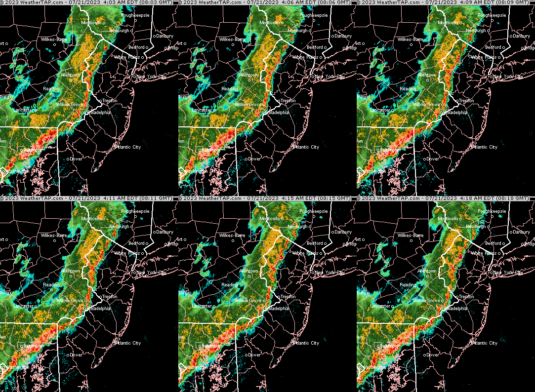
Update
Early Friday Morning Storms
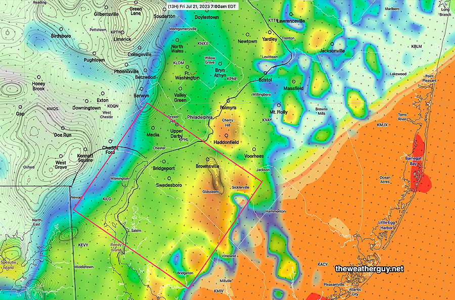
HRRR
Severity
ParameterSept 1 , 2021
Tornado Outbreak
(example of highly severe)Recent
April 1st 2023 Tornadoes
(Example of severe)07-20-23
Today’s
22z HRRR ForecastToday’s
ImpactNotes CAPE
Joules/kg 3500-4200
2100 1500-2300 ⚑ Mostly south and east of PHL Helicity
m^2/s^2 1350 655 360 ⚐ ⚐ Southern NJ Vertical Shear
1/sec40-46 40-45 29 ⚑ Precipitable Water 2.7″ 0.83” 2.0″ ⚑ Lifted Index
º Kminus 6º minus 9.3º minus 8.4º ⚑⚑ HRRR Hail
inches1.9 1.4 1.7 ⚑⚑ Peak Wind Gusts
mph 40-50 40-50 35 ⚐ Storm Motion Shear Vector
AlignmentAligned – ~ 90º Almost aligned Slightly aligned ⚐ 250 mb
Jet Stream Wind
mph63 135 65 ⚐ Showalter Index (from HRDPS) -4.4 ⚑⚑
↓ indicates works against Severity ⇩ Significant, but less impact
Thursday Outlook Update
Thursday Outlook Update
Thursday-Friday Outlook
Updated Wednesday Forecast
Wednesday Outlook
Tuesday Forecast Update
Tuesday Forecast Update
Tuesday Thunderstorms
Outlook and Monday
Previously Posted Mon 10:09 AM —
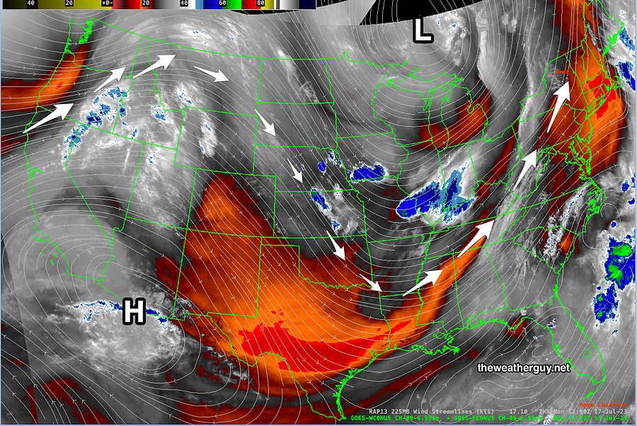
A persistent pattern of an upper low in Canada and a high pressure dome in the Southwest US will continue this week with some flattening of the upper trough in the center of the country. Disturbances continue to flow over and around the heat dome and around the upper low.
Here’s what the upper levels look like today —
For today, Monday, high pressure will bring mostly sunny skies and hot temperatures. Highs 90-91º Dew points in the tolerable mid 60s.
As the dip in the jet flow moves east, a cold front will move through on Tuesday afternoon. Another disturbance in the flow will spawn low pressure here on Thursday with more showers/storms possible.

“The predominance of models from this morning show showers developing here by 2 PM, as forecast below in in HREF So my earlier attempt using satellite imagery that delayed showers until this evening just may be too primitive and incorrect.”
Or it may be totally correct. I live just west of the city and it hasn’t rained at all today (7/19) as of 6:00 PM (although it did rain overnight last night)
Hi Peter, I was planning to comment in a forecast review later. I’m glad you noticed that my ‘primitive’ forecast was correct, it was incredibly hard to look past several models that forecast [a lot of] rain at 2 PM. I was particularly focused on the minutia of today’s forecast, because I wanted to get a bike ride in this afternoon. I ended up not biking and regretting it. As we saw, there was no rain.
This is a test