#weather #paweather #wx #pawx #philadelphia #phillywx
Friday Forecast Update
Updated Fri 07/14 @ 9:15 AM — There was a line of very fast moving storms that developed about 5 AM in Philadelphia and moved northeastward, Here’s the MRMS record of the precip.—
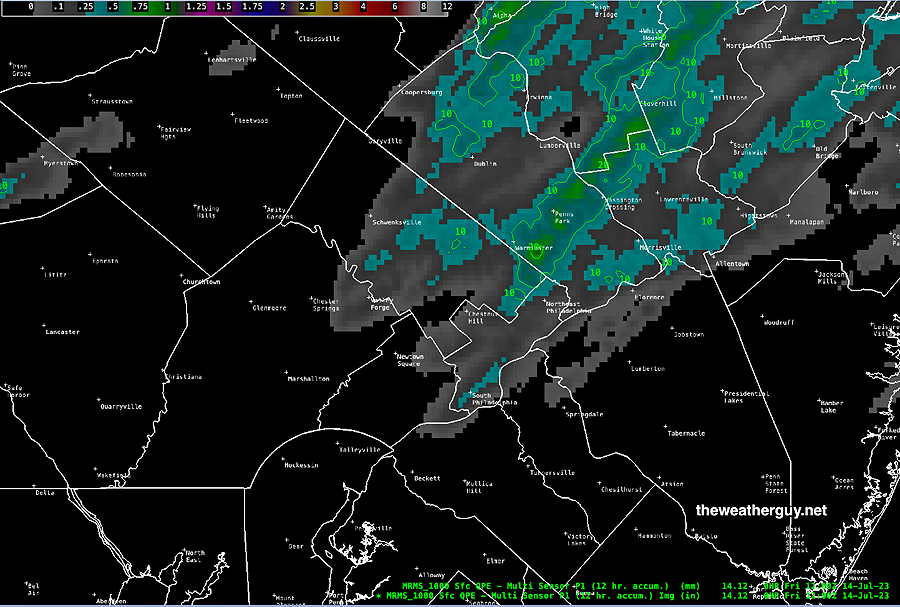
The big question for today is — what sort of thunderstorm development will occur and when?
Show More
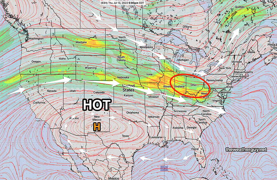
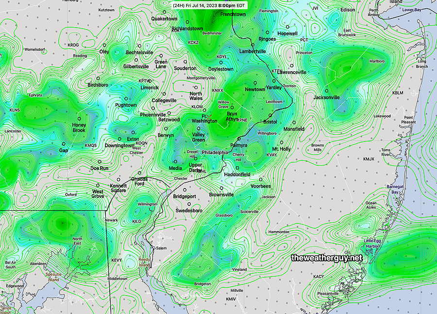
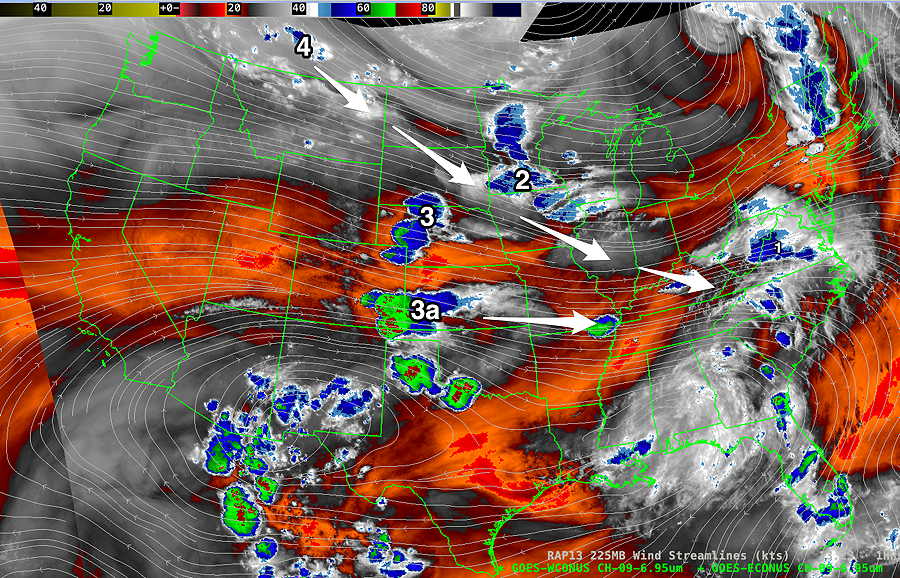
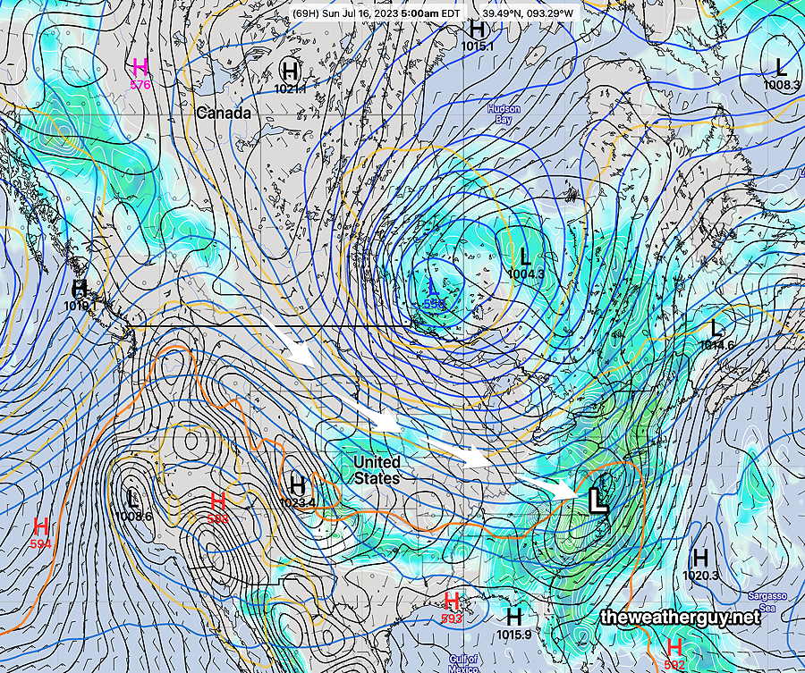
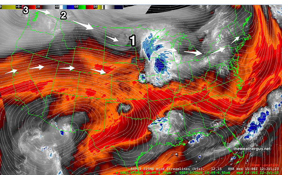
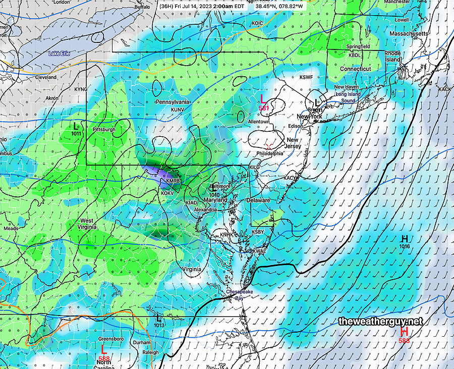
The 06z HRR, the 06z NAM-NEST and the 00z ECMWF did NOT forecast these storms earlier this morning, so I’m going take them out of the forecast consideration. Last night’s HIRESW and Canadian HRDPS did, so I’m going to lean on their forecasts for today. This translates into a mix of sun and clouds for the remainder of the morning. Between 1 and 3 PM, thunderstorms break out northwest of the city— For later in the day today, I’ll use the HREF which is similar to the HRDPS. This shows showers/thundershowers moving into Philadelphia by 5-8 PM— For Saturday, the HRDPS has a much drier forecast than the HREF. So check back later this afternoon/evening for my regular Weekend Weather forecast. Updated Thu 7/13 10:43 PM — Tonight’s latest models suggest a change in Friday’s forecast. Following some showers early Friday morning, sunshine expected by late morning through much of the afternoon. Showers and thundershowers move in from the west later afternoon and may not reach Philadelphia until mid to late evening. Updated Thu 07/13 @ 8:04 PM — Several disturbances rotating around an upper low near Hudson Bay Canada are lining up to affect our weather over the next few days. Current satellite water vapor shows several disturbances— The NAEFS model shows these disturbance will move together for a rainy day on Sunday— For Friday: Disturbance #1 will bring some showers to our area on Friday. A few showers in the very early morning, The showers will be scattered, but increased chances during the afternoon and evening. Most of the activity to our south and north, but some showers/thundershowers expected in the city and immediate suburbs. Saturday: Following some showers before daybreak, high and mid level cloudiness with possibly a break in the showers. especially for the city and immediate western suburbs. Showers and thunderstorms develop in NJ during the afternoon and spread into the city by evening. Sunday: Cloudy with showers and thunderstorms. Timing these upper air disturbances is challeng and the forecast details should clarify over the next day or so. Updated Wed 07/12 @ 8:34 PM — We’ll have another sunny and increasingly hot day on Thursday and early on Friday. Upper disturbances rotating around an upper low over Hudson Bay and additional energy moving over the ridge of hot weather in the south will bring an increasing chance of showers and thunderstorms Friday afternoon, Friday night and Saturday. The first of several disturbance is visible on this afternoon’s satellite water vapor image; most of its showers will stay to our north and west on Thursday— The GFS keeps the showers out of Philadelphia on Thursday— Previously Posted Mon 10:14 AM — Rainfall totals for Sunday have been posted here. A dome of extremely hot air over the Southwest and South will remain stationary while impulses pass around its northern edge into our area later in the week. For today, Monday, the latest HRRR has a few showers possible about 9-10 PM this evening, mostly north of the city. 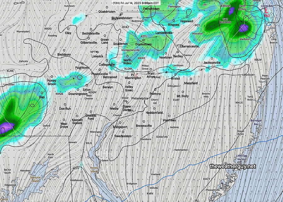
Friday Forecast Update
Friday and Weekend Weather Outlook
Thursday-Friday Forecast
Overview
