
#Philadelphia #weather #PAwx
URMA vs RTMA Temperatures
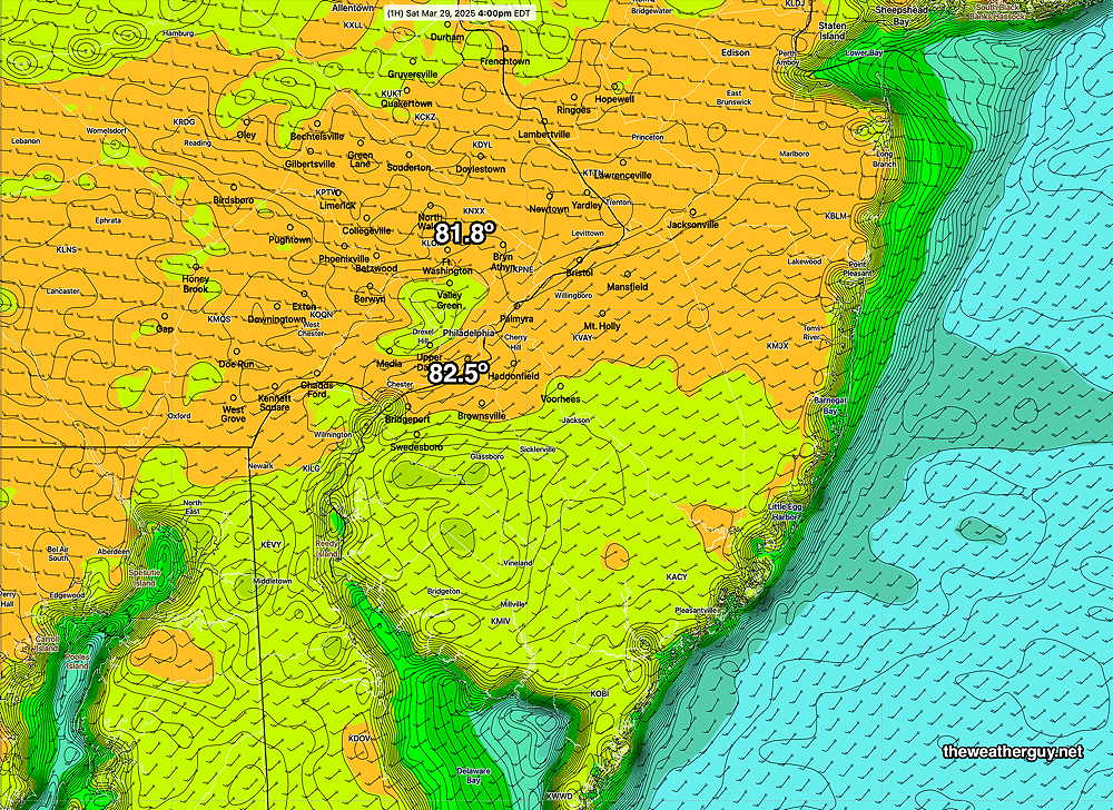
Posted Sunday 03/30/25 @ 9:58 AM — The high temperatures graphic I posted yesterday was based on the RTMA, updated every 15 minutes. Usually, there aren’t huge differences in the RTMA and what’s considered the “true final word” on actual conditions, the URMA. The true “final word”, the URMA, is available 6 hours later.
Here’s the URMA for 3 PM yesterday, and it shows the ACTUAL recorded [near high] temperatures. Yesterday, there were large differences in the “official temperature” recorded at the airport (KPHL) appearing in the URMA and the provisional temperatures appearing in the RTMA—
Sunday Forecast Update
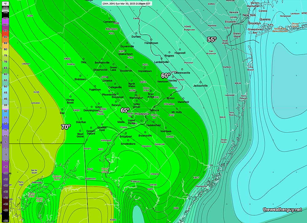
Posted Saturday 03/29/25 @ 8:53 PM — The warm front that moved through last night will return as a back door cold front. An easterly wind flow will result in high temperatures almost 20 degrees colder on Sunday compared to Saturday (highs in the low to mid 60s on Sunday).
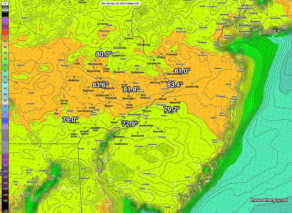
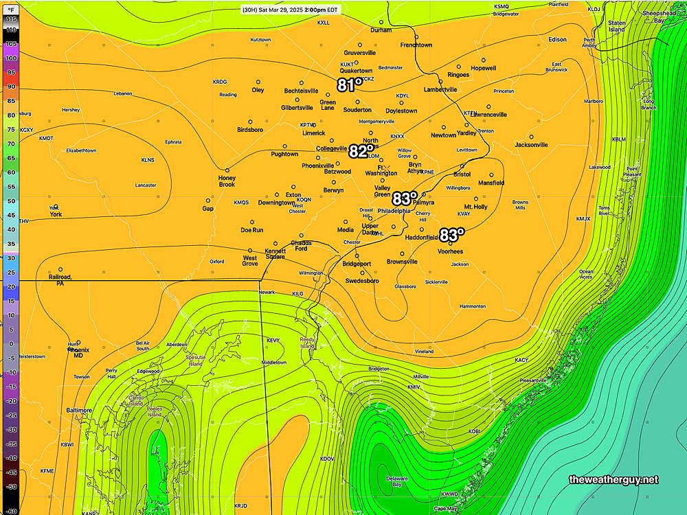
Today’s temperatures did reach the 80s. Blue Bell reached 81.9º at Wings Field. Here’s the RTMA temperatures at 4 PM—
As described above Sunday will be much cooler. Temperatures will have a sharp gradient—
There’s also wide range in the forecast cloud cover. The GFS forecasts significant cloudiness for Sunday.
The NAM-NEST forecasts clouds in the early morning, breaking for sunshine. The ECMWF-AI is similar to the optimistic NAM-NEST regarding cloudiness.
Originally Posted Fri @ 5:00 PM — —This weekend’s weather will be tricky to forecast accurately. There have already been some surprises in the short term (e.g. a line of showers in Chester County early this afternoon, not forecast by any model.) Warm fronts this time of year are notorious for difficult predictions. Let’s take a shot at it.
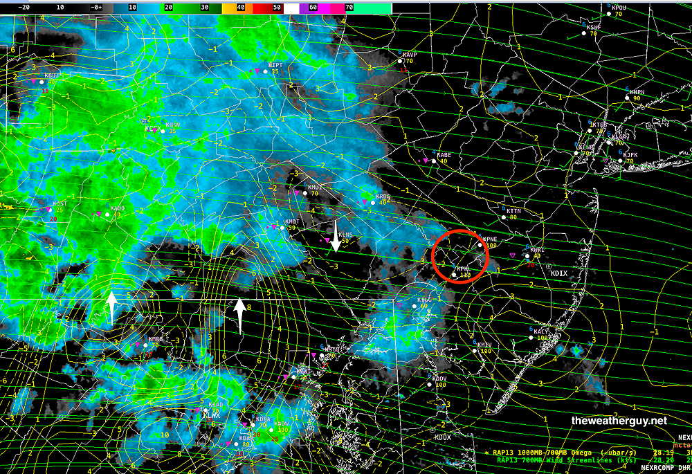
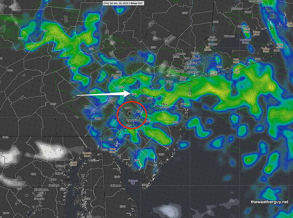
A warm front will move north tonight. Ahead of the front, some significant showers have developed to our far west. Current RAP model data shows areas of enhancement (positive Omega) and an area of negative Omega just the west of Philadelphia —
Earlier today most of the models had none of this rain reaching us. The latest HRRR does have some showers moving through this evening with the warm front. Here’s the HRRR forecast for 1 AM tonight—
Once the rain moves through, skies clear slowly on Saturday and temperatures rise to summer-like temperatures. Here’s the latest ECMWF-AI Temperature forecast for 2 PM. Actual highs may be greater, since high temperatures are reached at 3:30 PM or so. (The ECMWF-AI only does forecasts every 6 hours; 2 PM is the nearest forecast time.)
Skies should be a mix of clouds and sun on Saturday.
Sunday should be more cloudy, but still with breaks of sun and sun through mid level clouds. An easterly wind flow will bring temperatures down the the low 70s but there’s a high uncertainty with a standard deviation of ± 3º . As for rain, most models have the rain holding off until the evening hours, but this is where it gets tricky. Showers moving in sooner is definitely a possibility.
Check back for updates tomorrow.