[su_note note_color=”#defcdc”]The mystery of why the models are showing rain instead of snow has been solved. The models are forecasting a layer of warm air in the lowest 1500 feet of the atmosphere.[/su_note]
The Friday storm discussed earlier this week still remains a forecast challenge. Let me start by saying that ALL models currently forecast rain, not snow, for our area because near surface temperatures are expected to be well above freezing.
That said, there are many model parameters that historically predict snow for us and many features that still need to watched.
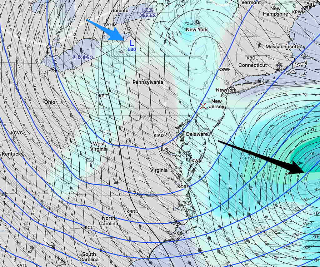
Basically a low pressure system was expected to come together and phase with an upper low resulting in an intense coastal storm. That scenario has faded, as phasing is expected to occur later, out in the Atlantic.
Here’s the current GEFS (Statistical Ensemble) mean forecast for Friday at 12 PM:

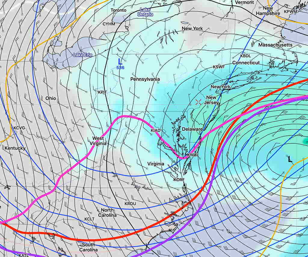
Below is the current SREF (Short Range Ensemble) forecast, showing a somewhat similar position of the surface low, but with this forecast, I have drawn in the snow-critical temperature lines. Notice that we are on the north side of these critical temperatures, usually meaning snow for us.

I’m sure the models ‘know what they’re doing’ regarding snow forecasting, but with this complex upper-low/surface low combination, it will be interesting to see what actually happens.
What I expect is for some snow to mix in with the rain especially later in the day, but no accumulation. Let’s see what happens.
