
The latest model data has just come in. NAM QPF values are 1.89 inches water and GFS 1.20 inches water (1.82 in Chester county!).
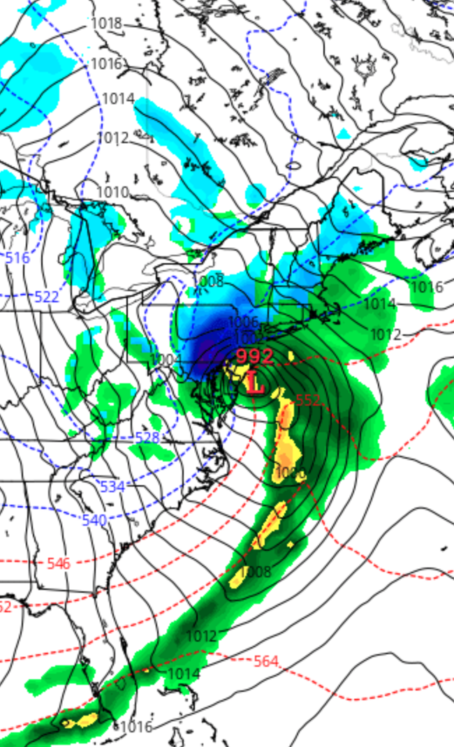
Current NAM and GFS thermal profiles show temperatures at critical levels of the atmosphere compatible with snow, with some possibility of mixed precip in PHL at some points during start of the storm. As was the case with the last storm, they keep the surface temperatures above freezing, in the 33-37 degree range.
I think the warm surface temperature prediction is incorrect. As was the case with the last storm, dynamic cooling should bring it down to 33 or 32 once the precipitation cranks up, allowing for accumulation.
Accumulation potential for the immediate PHL area (which doesn’t take into account melting due to March sun factors) is 12-16 inches, potentially more in immediate western suburbs.
Timing: Some wet snow falls during the evening and night time Tuesday and before daybreak on Wednesday. Depending upon temperatures, there will be some accumulation. Snowfall becomes heavier during Wednesday morning and peaks during the afternoon on Wednesday, ending early Wednesday night.
I need to let you know that the model preconfigured snow accumulation algorithms currently show rain more likely than snow for our area. I think this wrong, as the preconfigured algorithms often are. I’m basing my forecast on predicted QPF and thermal profiles from the NAM FOUS data which has served me well in the past. So changes are possible with the forecast. I, for one, will be getting the snow blower ready tomorrow.
Either someone in the burbs is reading your blog or everyone is nervous after the last mess. Snow emergency for Towamencin already declared for 3/6 through 3/8.
The temperatures do look similar to last Friday. It’s still always strange to have snow predicted with temps looking above freezing. Maybe 2 years in a row with the biggest snow fall in March.
I think the NWS this afternoon has just jumped on the bandwagon with this snowstorm. Latest data is impressive. Actually, the upper air temperatures for this storm is much colder than last Friday’s