#Philadelphia #weather #PAwx
Friday Forecast Update
Posted Friday 05/02/25 @ 8:46 AM — A clean-cut forecast for the next three days will be difficult. There’s significant spread in the model guidance for today. The ECMWF-AI model has probably done the best overall with last night’s lack of rain and I’m going to lean towards it.
That said, the ECMWF-AI has low temporal and spatial resolution (forecasts every 6 hour and a grid size of about 17-21 square miles; in comparison, the RRFS is hourly and and a grid size of a little more than 1.8 miles.) So we have a choice of better accuracy with low resolution or poor accuracy or high resolution.
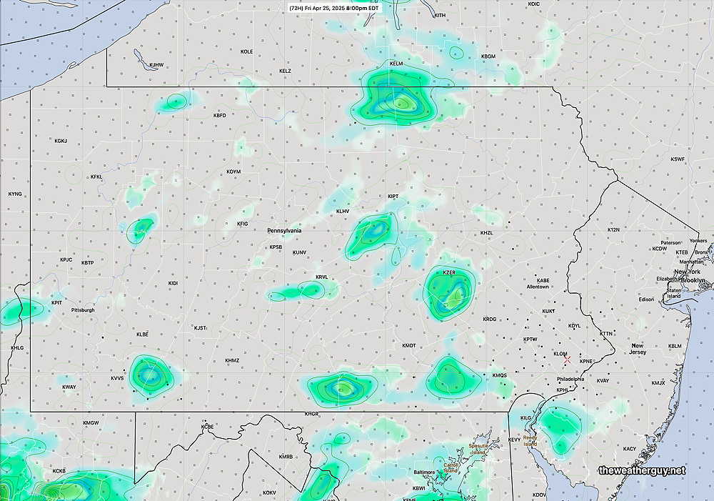
A mix of sun and clouds today (Friday) with a slightly increasing chance of very widely scattered showers (and even thundershowers) later this afternoon and tonight. Most likely locations are north and west of the city. Confidence is below average.
To capture the range of forecast for today, here’s the HRRR and HRDPS, two high resolution models—


As far as the Sunday Philadelphia Broad Street Run, there are signs that the heavier rain will occur Saturday night and before daybreak Sunday. There may be a break in the rain for much of the morning hours.
Forecast Update
Posted Thursday 05/01/25 @ 7:39 PM — The showers forecast by the GFS and RRFS are missing in action. (As mentioned earlier today, the ECMWF and the ECMWF-AI kept the rain to our north and west this evening.) With the latest HRRR and NAM-NEST also keeping us fairly rain-free this evening, a forecast of showers this evening seems increasingly unlikely. Yet a warm front sometimes sneaks some showers in later at night, so we’ll have to see.

Friday looks to be sunny through high clouds again. Some widely scattered showers are forecast for the afternoon. The closed low pattern bringing rain will begin during the day Saturday.
Rainy Pattern Looking Increasingly Likely
Posted Thursday 05/01/25 @ 8:34 AM — The GFS has joined the other global models forecasting a cut-off upper level low to develop in the Mississippi/Ohio Valley over the weekend. Before that time, the disturbance shown in yesterday’s water vapor image will move up to our area and bring some much needed rain as early as this [Thursday] evening, ahead of a warm front.
Here’s the latest GFS forecast for 7 PM —

It should be noted that the latest ECMWF-AI model has much less rain for us this evening than the latest GFS. The latest experimental high resolution RRFS supports the GFS—

Following the warm front, Friday should become sunny through a layer of high cirrus clouds. It will be warm and humid. Some showers and thunderstorms break out Friday evening.
For Saturday, the GFS has a mix of clouds and sunshine with thunderstorms later in the afternoon/evening. The ECMWF-AI is forecasting showers even during the daytime hours on Saturday.
Blocked Pattern and Rainy Period Possibly Developing
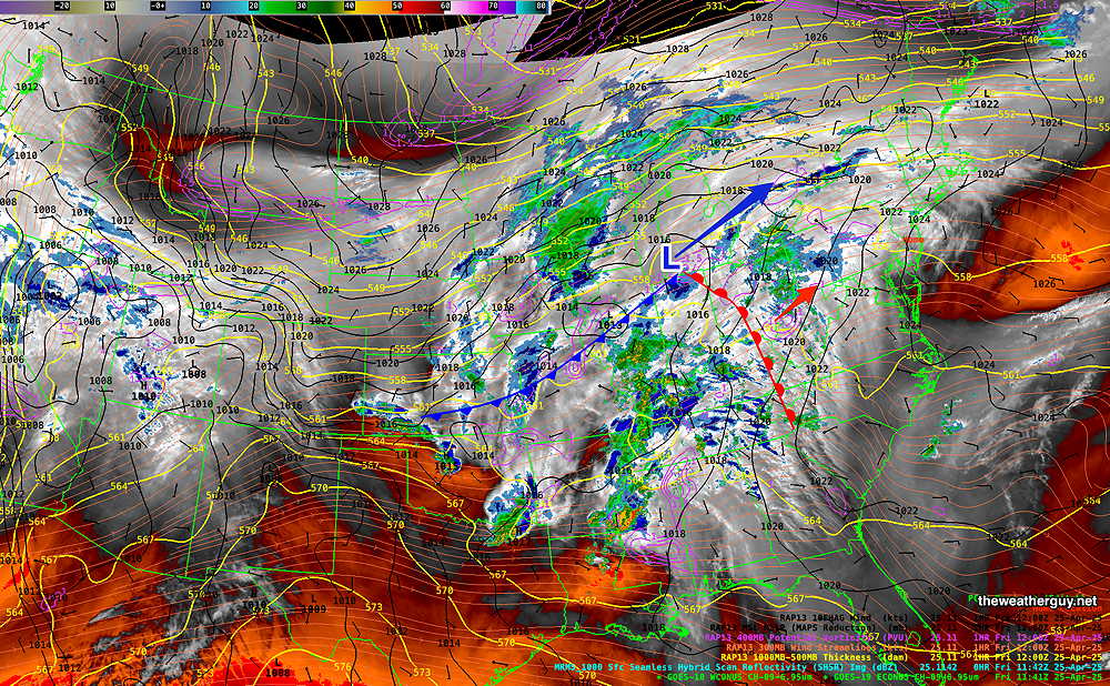
Posted Wednesday 04/30/25 @ 5:17 PM — A complex transition to a possible blocked pattern giving us much needed rain is beginning to take shape for this weekend, but with significant uncertainty. The caption below explains the current situation.

As described in the above caption, there is a wide spread of uncertainty with this position of this upper closed low, but I’m leaning towards the Canadian/ECMWF/ICON and ECMWF-AI model forecasts. Here’s the latest ECMWF-AI forecast—

As described in the water vapor image caption, the large area of rain currently in the Midwest will pass to our north and west through Friday, with little rain here at least through Friday.
We’ll see if the GFS joins the other models with the position of the closed upper low resulting in a rainy several days from the weekend and beyond.
Posted Tuesday 04/29/25 @ 6:22 PM — Current radar and water vapor shows the expected line of storms. (almost appears as a “bow echo”, indicating fast, strong storms.

Today’s models still have the showers/thunderstorms falling apart as they approach Philadelphia, due to lack of upper air support, as outlined below.
Posted Tuesday 04/29/25 @ 8:32 AM — An approaching cold front this evening may threaten rain. “Threaten” will likely be the extent of it.

Today should be a perfect example of why I rarely use the term “tracking” when it comes to weather and areas of rainfall in particular. Let me explain—
This evening, about 8 PM, if you were to look at the radar image for Pennsylvania, you will likely see a giant area of heavy rain just to our west, moving eastward. You might think, “Gee, I’ve been watching (“tracking”) this and it looks like it’s going to move right through Philadelphia”.
You’d be wrong. Weather is much more dynamic and three dimensional than what appears to be “trackable” on radar. Here’s why:
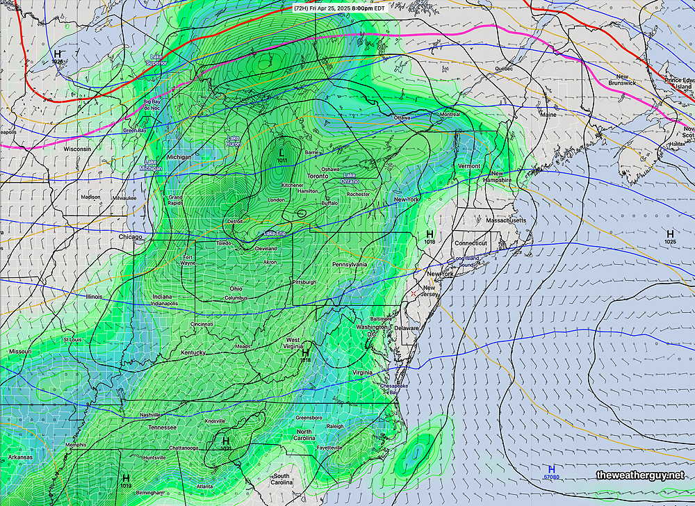
At the surface, a cold front and preceding trough will be approaching—

In the upper atmosphere, though, the wind flow is “anticyclonic”, there is a strong upper ridge axis that can thought of as physically blocking the rainfall and the position of the jet streak will be such that we are not in area of upward vertical motion (what’s called the” right entrance region”—

The rain should diminish and fall apart. If you were “tracking” this area of rainfall as it moves eastward without the knowledge of the upper atmosphere, your forecast of the heavy rain moving into Philadelphia would be wrong!
The TV people sometimes say “that area of rain will fall apart as it approaches us”. They don’t explain why, but this is why.
Of concern— this feature last summer resulted in many missed rainfall events and our drought.
Previously Posted Mon @ 8:39 AM — —This week’s weather looks quite nice, especially today- Monday. Light winds, low humidity and ideal temperatures in the mid 70s. (76º Philadelphia , 74º (Blue Bell.)
Tuesday also looks quite nice- sunshine through high cirrus clouds, but it will become quite WINDY ahead of a disturbance Tuesday night that will bring showers to western suburbs, with maybe a sprinkle near Philadelphia. (The trend of showers remaining west continues!)
Highs near 81º.

Clearing by Wednesday morning with highs in the low 80s!
The disturbance that passed us to our northwest early Wednesday will bring a cooler easterly flow on Thursday.
Another system approaching late Thursday will bring rain on Friday, possibly lasting into the afternoon/evening on Saturday.
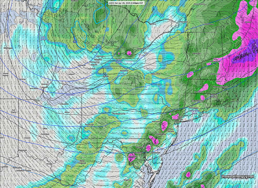
Current AI forecast for 8 PM Saturday—


