Update Thursday 8 AM: The GFS cranks out only 0.03 inches water between 11 AM and 1 PM. Both the NAM-based HRRR and the GFS-based LAMPS also show a chance of light showers mid-day.
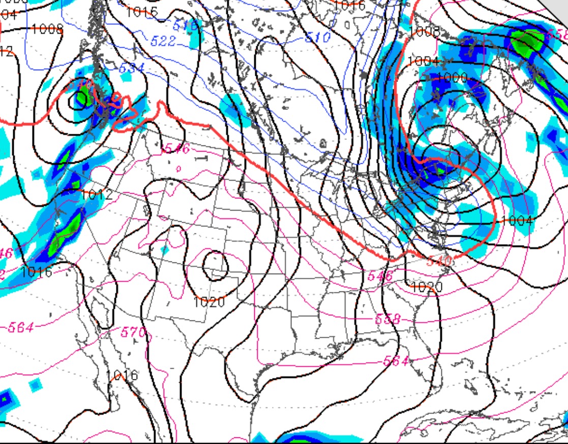
There’s uncertainty about whether we’ll have showers on Thanksgiving day. (Previously, it appeared that the day would be dry.)
The latest HRRR model has showers moving through midday. The GFS LAMPS has showers possible in the afternoon while the MOS forecasts and NAM and GFS have it still essentially dry.
So I’m going with the HRRR – some light showers midday. I’ll update if things change or clarify.
High pressure that has moved in Tuesday and the early Wednesday will move offshore as a weakening low pressure system and associated weak cold front approaches late Wednesday. Clouds will increase Wednesday afternoon, but the lack of upper air support will cause the low to weaken. Expect little precipitation.
A light shower is expected Wednesday night and possibly some light spits early Thursday morning, Thanksgiving Day.
Later Thursday morning into afternoon, it will be mostly cloudy, but some clearing possible late afternoon. High temps near a seasonable average of 51-53.
Outlook for the weekend- A new dip in the jet stream will cause low pressure to develop and intensify Friday evening and night with some very light showers. The low departs Saturday morning, with the Saturday being partly sunny/cloudy and a bit colder and breezy.
The sharp cold front is expected to move through Philly between 5-7 PM today (Saturday). Before that time, expect high temps in the low to mid 60s. After the frontal passage, winds will rapidly pick up from the northwest and continue through the night. Temperatures will drop rapidly after the cold front moves through.
For the Philly Marathon on Sunday, expect partly to mostly cloudy skies and windy. Sustained winds near 18 mph mid-day with higher gusts. High temperatures about 44. There’s a chance of a quick, light snow flurry during the afternoon.