Sunday Update and Comment

As has been the case over the past few weeks, my forecast for sky cover (cloudiness) hasn’t been too spot-on.   Yesterday was a good example, where the GFS had cloudiness for much of the afternoon, but we had beautiful sunshine.   (I use humidity fields at certain levels to predict cloudiness;  something hasn’t been working lately.)

I’ll take another stab at it today.   Low level cloudiness (stratocumulus and nimbostratus) lifts by afternoon, but mid-level cloudiness (altocumulus and altostratus)  will be with us for the rest of the day.  As far as sensible weather, it should just be cloudy.   The GFS also shows an ongoing chance of light drizzle through late afternoon.   High temp about 63.

The warm front moves through this evening, and winds shift to the southwest.

Philly Weekend Weather Forecast – Sunny, then overcast.

A weak cold front moved through Friday afternoon and a northerly flow of more seasonable (cooler)  air moves in Friday evening under weak high pressure.

Saturday starts sunny and and seasonably cool, however, mid-level clouds move in during the early to mid afternoon as the high drifts off and the frontal boundary slowly moves back as a warm front.  High 62.

There will be the chance of light showers Saturday night with the approaching warm front and the showers may last into Sunday morning.

Sunday will be cloudy for much of the day, with the chance of light showers or sprinkles, especially in the morning and possibly early afternoon.   High will be 67.

Depending upon the movement of the warm front, we may have some breaks in the overcast late afternoon, however, the warm front is not expected to move past us until Sunday evening, so that’s an optimistic read right now.

Monday will be very warm with temperatures back into the 70s before another cold front moves through with showers later Monday afternoon.

Philly Weekend Weather Forecast

A southerly flow around high pressure will maintain mostly sunny conditions for early Saturday with a high temperature near 70, However, some middle level clouds begin moving in during the afternoon as low pressure and a frontal system  approaches from the west.  It will be cloudy by late afternoon.

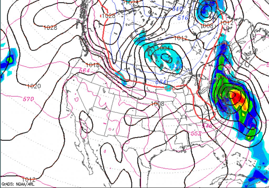
This system is expected to entrain some moisture from a tropical system in the Gulf resulting in heavy rain during the afternoon and evening on Sunday.  It will windy.  High temperature near 65 on Sunday.

GFS Sunday afternoon prediction

There are differences between the NAM and GFS models regarding the timing of the heavier rain, with the NAM having the heaviest rain in the evening

Weather… and Other Things 'Up in the Air'