WEEKEND WEATHER OUTLOOK

[su_box title=”Weather Outlook Update Tues PM ” box_color=”#defcdc” title_color=”#000000″]I posted this weekend outlook Tues morning and things have already changed regarding timing. The front that moves through Friday may linger just to our south to allow some instability showers on Saturday afternoon.

The large low pressure system forecast to bring rain for Sunday may move in later in the day, keeping Sunday dry for much of the day. [/su_box]

It’s April, and that’s where we get the expression, “April showers brings May flowers.”

This coming weekend, or at least Saturday, appears to be sandwiched between two low pressure systems— one Friday afternoon/night and another stronger low pressure system on Sunday.

Timing can change this far out in the forecast period, but the models have been fairly consistent with these two systems.

It appears that Saturday will be mostly sunny and warm.  High temperature possibilities show 70s for Saturday, but the statistical spread in the EKDMOS (Ensemble Kernal Density Model Output Statistics)  is quite large, indicating uncertainty in the forecast.

EKDMOS for this week’s temperatures

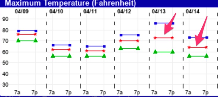
For Sunday, it appears we’ll be having rain.  Notice the lower spread in the temperatures suggests greater certainty in the temp forecast and weather for Sunday’s weather.

As usual, I’ll update Friday evening.

WEEKEND WEATHER FORECAST

[su_box title=”Saturday AM Update ” box_color=”#defcdc” title_color=”#000000″]Low level moisture that was forecast in the form of fog and low clouds has remained this Saturday morning. We should see a gradual brightening of skies through the morning and the afternoon. It’s a tough call if the grey skies will totally dissipate today, but the model cloud algorithms say it will.

Sunday looks to become cloudy in the afternoon.[/su_box]

Low pressure will slowly depart overnight. Showers should end before daybreak Saturday.

The models, particularly the GFS, maintains significant low level moisture for the morning and at times during the afternoon on Saturday.  So, while the model cloud algorithms have the clouds dissipating slowly in the morning, it’s possible we may see lingering low level clouds into the afternoon. High temperatures between 65 and 67, depending upon the cloud cover. Winds will be light from the W-NW

Sunday will start sunny and it will be milder.  Clouds move in during the afternoon. High 68.  Winds light, but become southerly and increasingly gusty in the later afternoon.

WEEKEND WEATHER FORECAST

[su_box title=”Sunday Update ” box_color=”#defcdc” title_color=”#000000″]The forecast posted below on Friday evening remains on target. Rain will taper off and end between 2-4 PM from west to east. The cold front has already moved through about 11 AM this morning.

NBM Wind forecast- Grid Point Citizens Bank Park

Temperatures for the Phillies game tonight will start near 50º and fall to near 40º by the end of the game. Winds NW 15 mph with gusts over 30. [/su_box]

[su_box title=”Saturday Morning Update ” box_color=”#defcdc” title_color=”#000000″]Forecast remains on track. High and middle clouds through the day. Winds become a bit gusty in the afternoon.

The daily high temperatures are expected to be reached about 3:45 PM on Saturday- HRRR Forecast

[/su_box]

from Friday evening…

A diffuse warm front that gave us the [unpredicted] light showers today will slowly move north by Saturday afternoon. (The models didn’t pick up on this until just a few hours before the showers started.)

[su_note note_color=”#d9f2da”]Update -Tonight’s NAM shows high temperatures 73-77 degrees for Saturday. [/su_note]

For Saturday- A southeasterly flow of warm air will bring unseasonably warm temperatures, along with enough mid and high level moisture aloft to create high and mid-level cloudiness.  High temperatures are forecast in the 70-73º F range for the Philadelphia area, despite this cloud cover layer which may at times be significant during the day.  Winds light from the southeast in the morning, shifting to the south and increasing somewhat after the warm front passes in the early afternoon.

Winds with gust increase in the afternoon, southeast—> south

[A cold front approaches later on Saturday night into Sunday morning.  The cold front is expected to bring showers to our area between 9 AM and 3 PM on Sunday as it moves through.   It will be cloudy for much of the day, possibly clearing late in the afternoon. There is some uncertainty about the timing of the showers ending, as low pressure developing along the front may cause the light showers to linger.  Total rainfall is currently expected to be less than 0.20 inches water.

High temperatures will be early in the day Sunday, before the frontal passage and will fall through the 50s during the afternoon, reaching the 40s by evening and near freezing by Monday morning.

Weather… and Other Things 'Up in the Air'