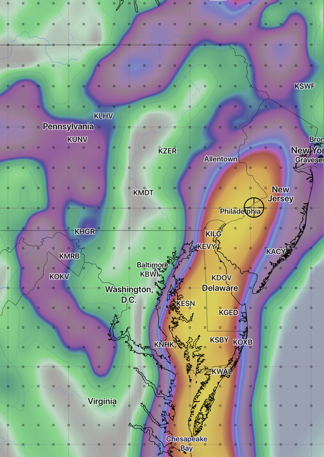
[su_box title=”Weather Update Fri AM” box_color=”#defcdc” title_color=”#000000″]Last night’s GFS maintains a QPF of 2 inches of rain over the Philadelphia area, occurring after midnight tonight. Rain tapers and ends Saturday morning with a mostly dry Saturday and some sun and clouds.
GFS 6 hour accumulated rain depicted at 3 AM Saturday morning.
Large uncertainties with the heavy rain placement remain due to the closed upper low pattern. All models have it dry for Saturday afternoon. [/su_box]
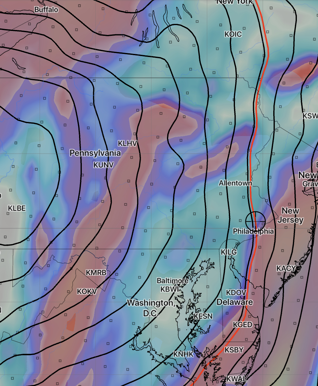
Tonight’s NAM is a perfect example of how a closed upper low plays havoc with the model’s ability to accurately predict placement of precipitation.
Tonight’s NAM has the main precipitation shield rotating to the east of Philadephia. Instead of 1-2 inches of rain here, it’s showing a QPF of less than 0.30 inches. (This afternoon’s GFS had the heavy rain rotating through to our west.)
NAM forecast for 8 am Saturday ( 6 hour accumulated QPF)
Expect additional changes in the forecast. (Saturday late morning and afternoon still look good.)
[su_box title=”Weather Update Thurs PM” box_color=”#defcdc” title_color=”#000000″]The forecast below still looks good for Saturday and Sunday. Some sun Saturday afternoon is looking like a strong possibility.[/su_box]
An upper closed low pressure system and a surface low will affect our weather over this weekend.
The weather produced by an upper closed low is notoriously difficult to predict – the exact position and movement of the system can be challenging to forecast and the placement of the rain produced by the low is often forecast inaccurately by the models.
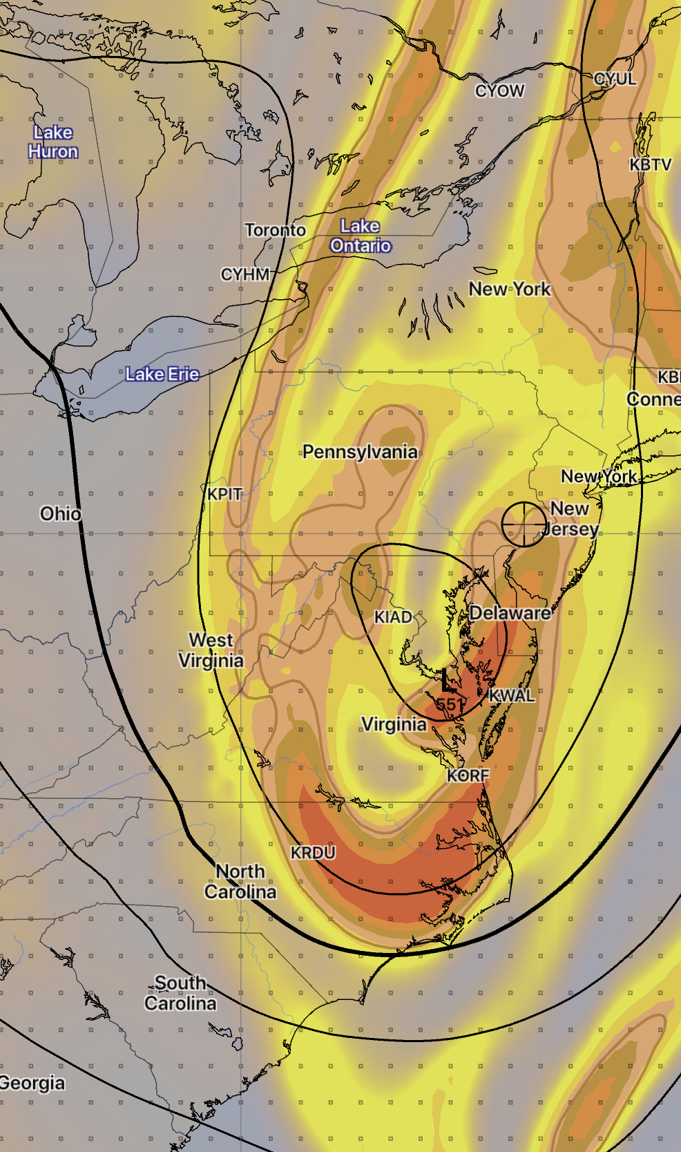
GFS forecast- Sunday noon shows closed low at 18,000 ft ( shading is vorticity)
The GFS is predicting close to two inches of rain Friday evening through Saturday morning.
That said, here’s the current outlook- rain expected Friday night should end by late morning Saturday. There may be partial clearing Saturday afternoon. Possibly some sun. It will be windy.
Sunday may start dry with a mix of clouds and sun, but thermal instability from the upper low may cause clouds and widely scattered showers to develop Sunday afternoon.
This weather outlook is a lower than average confidence forecast. I’ll update Friday evening.
The latest NAM model data has become available. Light scattered showers are forecast for Sunday, especially for the late morning and early afternoon hours. QPF values are low for these early showers (0.05 inches)
It will be cloudy and increasingly windy. There may be some brightening skies briefly late afternoon. High 70-72 reached later in the afternoon.
Winds increase at night. A strong cold front moves through after midnight. Heavy rain, thunderstorms and very strong winds will accompany this front.