[su_note note_color=”#bceaed”]We had the clouds and light snow flurries. High temps were much lower than forecast, closer to 32º.[/su_note]
Quick Update: Don’t let the early sunshine this morning fool you. The models are all-onboard for upper air disturbances to move through late morning into the afternoon; expect clouds by late morning and very light, scattered snow flurries mid-afternoon. High temps look closer to 37º.
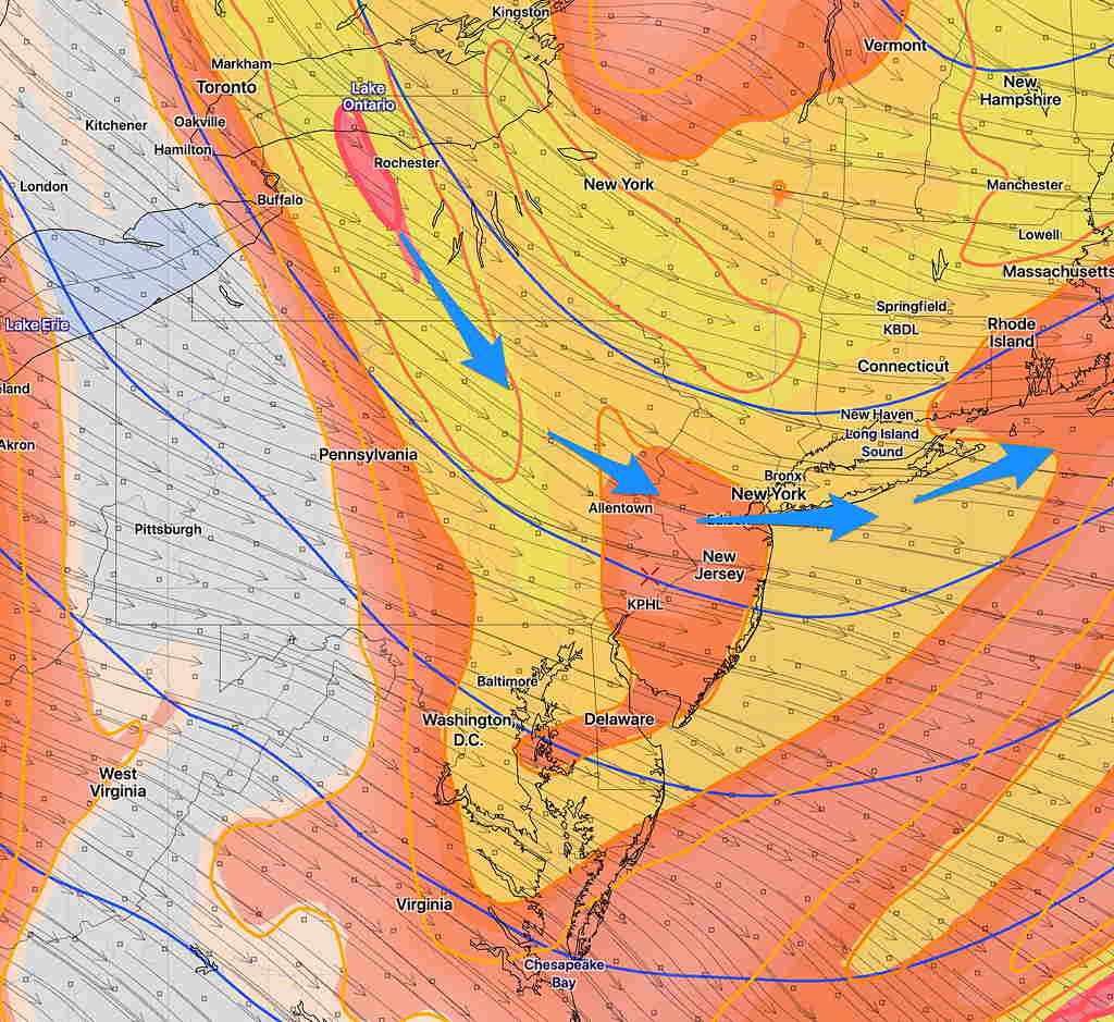
The graphic below is from this morning’s RAP (Rapid Refresh Model) showing upper air disturbances expected to move through beginning late morning (10-12 PM and through the afternoon.) Expect an increase in low level cloudiness.
Rapid Refresh Model forecast for 12 Noon- orange-yellow color shading is “absolute vorticity”
The cold and windy conditions will continue through Saturday. We had some scattered snow flurries today, not mentioned by last night’s TV forecasts but very much predicted by the high resolution models last night and this morning.
Saturday will be similar to Friday, weather-wise. A cold cyclonic flow aloft from an upper trough (shown in yesterday’s graphic) will bring significant cloudiness and perhaps some more snow flurries during the day. Still somewhat windy, with high temps a chilly 36º-39º.
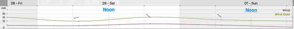
NBM Wind and Wind Gust forecast Sat and Sun. Click for larger image.
Sunday, the upper trough departs to our east and winds turn to the southwest later in the afternoon. Sunny. Less windy, highs 43º to 45º