
The strong cold front that moved through early Friday morning has brought much colder weather to our area.
The deep low pressure system to our northeast will affect our weather on Friday and the upper air trough and upper cyclonic flow will bring cold, windy conditions for Saturday, moderating Sunday.
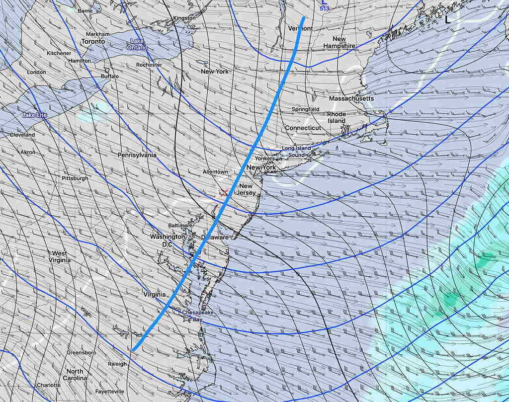
With several areas of vorticity and unstable cyclonic flow, it’s looking like we’ll have a mix of sun and periods of low level cloudiness on Saturday. High 41º (EDKMOS) seems too high. The NBM has a high of 36º (It’s likely to fall somewhere in the middle).
The GFS has it windy both days:
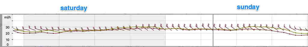
The NBM blend has winds lower than this.
For Sunday, the upper trough moves to our east. It will be mostly sunny and but still somewhat windy. High 45 (EKDMOS) or 44 (NBM).
For snow lovers, there’s still nothing in the extended model forecasts. Warmer weather again next week.