High pressure builds in for early Sunday. Sunny skies in the morning after a cold start.
Sunday afternoon, low pressure begins to approaches from the southwest as a weak cold front sinks south. Clouds move in between 2 and 4 PM Sunday afternoon.
High temp 60.8° sd 1.4°
Some light showers possible Sunday evening.
For Monday…
Right now, the GFS keeps the low pressure scooting out to our south with only very light showers Sunday evening and Monday in Philadelphia. (South Jersey and Delaware will have some rain Monday.) Other models have a bit more rain for Monday here in Philadelphia. Will have to wait and see.
[su_note note_color=”#bceaed”]Some new information will be included in these forecasts going forward—
Forecast max temperatures will be based on the National Blend of Models (NBM) and will now include the “standard deviation” (“sd”) in ºF to show the amount of forecast uncertainty and model spread.
The specific run of the NBM used will include the latest EKDMOS forecast. Perhaps the best of all worlds! [/su_note]
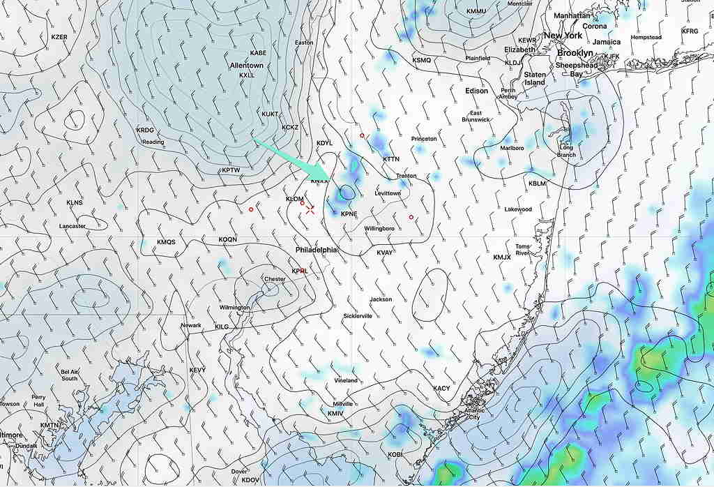
Last night’s models continue with forecast that light sprinkles and considerable cloudiness will linger through 12-2 PM and considerable low level cloudiness may linger until 3-5 PM. Clearing northwest in the Allentown area earlier—
NAM NEST Forecast for 2 PM showing lingering showers and clearing near Allentown and areas north and west.
High temp 51.6º standard deviation (sd) 1.7º for Blue Bell
Low pressure and a weak cold front moves through before daybreak Saturday.
Tonight’s model trend is for the showers and clouds to linger as the upper air trough moves through.
The clouds and precipitation will linger post frontal passage and showers are still possible through 11AM. Clouds will gradually dissipate about 2-4PM. It will be windy. High 52.
High pressure will move in on Sunday. Sunny skies with high temperature about 62.