The weak cold front that moved through on Friday will move north as a warm front later Saturday into Sunday. Showers expected with the warm front Saturday night. My regular readers know that a tropical system or hurricane near the continental US often plays havoc with the model forecast specifics.
Saturday—
Significant and increasing high level cloudiness (cirrus). Lower level clouds increase during the late afternoon and early evening.
High temp 87.0º sd 2.0º
Dew points mid 60s.
Winds calm to very light from the SE at 0-6 mph
The warm front moves north, but unstable and humid air may result in thunderstorms Sunday afternoon, especially west of Philadelphia.
Sunday—
Cloudy in the morning, sun breaks out during the late morning or early afternoon.
Showers linger early in the morning.
Thunderstorms and showers possible later Sunday afternoon.
High temp 91.3º sd 2.6º (larger than average spread)
Very humid! Dew points near 75º
Winds increasing 10-15 mph from the S and SW. Becoming gusty in the afternoon.
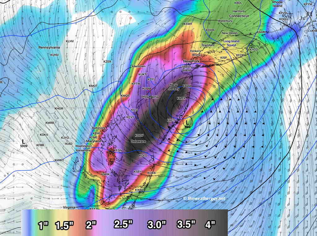
GFS (pre-release version 16) forecast Hurricane Isaias on Tuesday morning at 8 AM, currently the closest forecast approach to our area —
GFS v16 forecast for Tuesday 8 AM (Click on image for a larger view.)
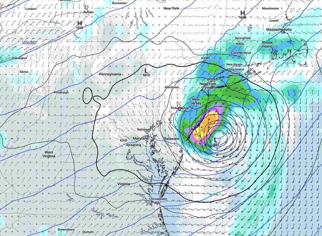
The model blend (NBM) shows much more rain to the west on Tuesday—
NBM 1 hour rain forecast for Tuesday at 8 AM (Click on image for a larger view.)
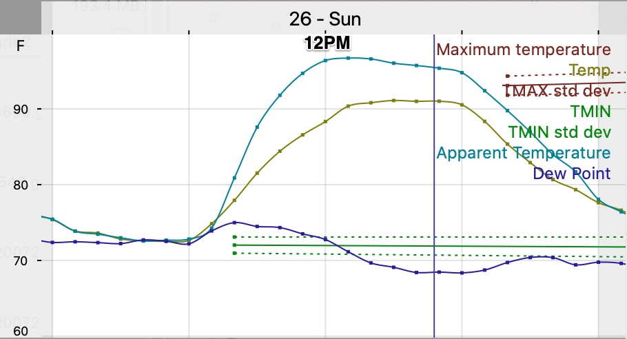
Sat 10:36 PM Update — The relative humidity as expressed as the dew point looks slightly more tolerable on Sunday afternoon than previously forecast. Still a high of 93 (Blue Bell)—
Model Blend temperature and dew point forecast for Sunday
A weak frontal boundary will move to our south this evening, ending the showery weather. Somewhat drier air will move in for Saturday with a mix of clouds and sun. It will still be humid.
The boundary will be just to our south and their are signs that it will move back as a weak warm front later Saturday afternoon. An increase in clouds and spotty showers are possible Saturday afternoon from 3 PM to 7 PM. (Tonight’s models just becoming available downplay the chance of showers.)
It will be very warm and humid on Saturday, but the real heat and humidity returns again on Sunday.
Saturday —
A mix of sun and clouds. An increase in clouds with spotty showers possible after 3 PM.
high temp 89.0° sd 1.9°. Dew points just below 70°