1:00 PM Update- Storms approach 3-4 PM according to the latest HRRR
A quick post- models are on-board with thunderstorms today in the immediate PHL area, from 3-6 PM, moving northwest to southeast. Several models show closer to 4 PM. Severe storm parameters are in the moderate range. Some quick heavy rain possible, gusty winds.
Most models have the remnant moisture of Hurricane Laura moving into our area on Saturday. It currently appears that the storm’s energy and moisture will become incorporated into a non-tropical low pressure system moving through to our north. A cold front moves through Saturday evening.
At this stage of things, there’s little agreement where the maximum dynamics, moisture and precipitation will fall.
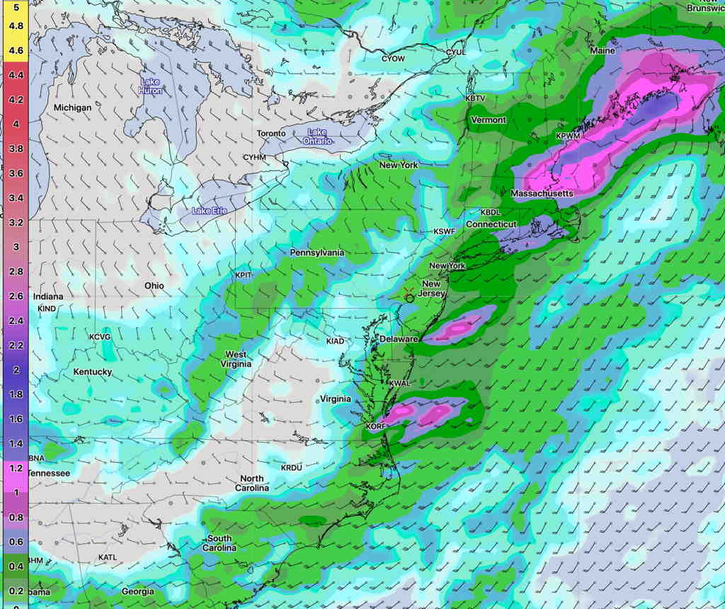
The GFS model, along with the statistical ensemble version, the GEFS, have the maximum precipitation falling in New England—
GFS precip forecast 8 PM Saturday (Click on image for a larger view.)
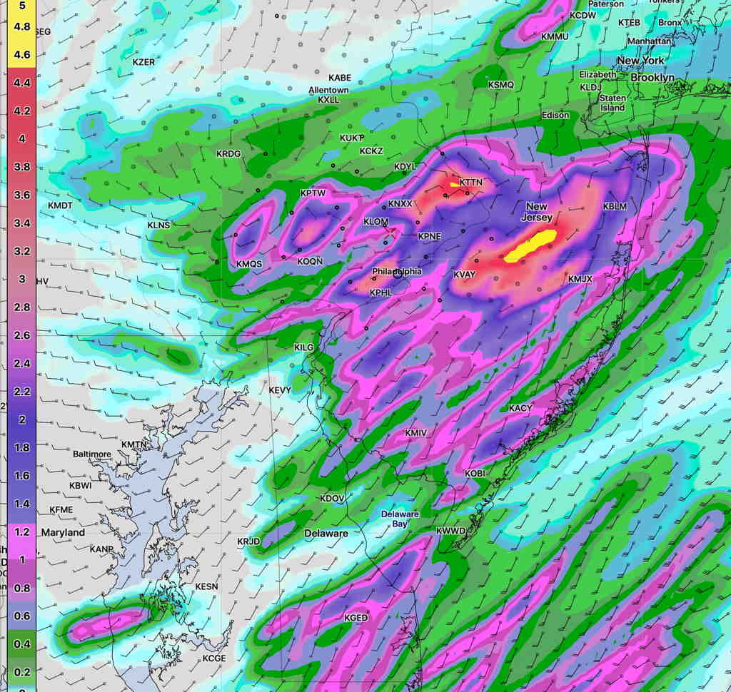
The NAM-NEST has a very different scenario, with much higher amounts falling closer to home—
NAM-NEST precip forecast 8 PM Saturday(Click on image for a larger view.)
Most models agree that rain starts Saturday morning and becomes heavier during the afternoon. It’s likely that the NAM-NEST is over-forecasting the rain here and we’ll likely get only 0.5 to 1.5 inches of rain.
Thu 02:53 PM Update — Thunderstorms look much less likely this afternoon and tonight. It also appears that we won’t hit the highly advertised 94º high temp today.
My previous post postulated that it’s tougher to accurately forecast the weather with a tropical system in the picture. That’s not going to stop me from trying.
Tonight’s models are just becoming available. A warm front moves through overnight and dew points rise almost 10° by 8 AM.
Tonight’s models show some scattered/isolated thunderstorms developing between 5 AM and 7AM Thursday morning with the warm frontal passage. The ‘severe weather parameters’ are fairly elevated at that time, so while these storms will be isolated, they may pack a punch.
Some models are showing more thunderstorm activity late Thursday afternoon and evening.
Unfortunately, I’m unable to access the HIRESW model this evening.