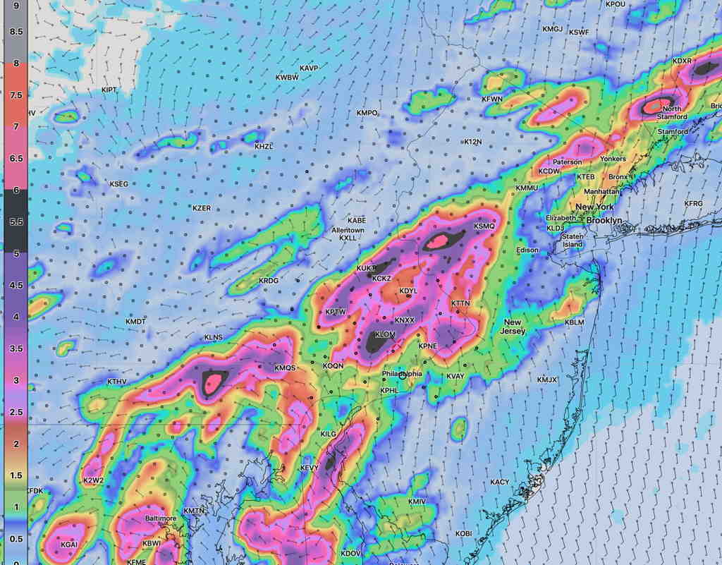
A front slowly moving through Thursday will cause heavy rain to fall in the Philadelphia area. The latest NBM cranks out several inches of rain for our area, about 2.5 -4+ inches, with even some higher localized amounts! The heaviest rain north of the city.
Model Blend 5 PM accumulated Rain—
NBM accumulated rain 5 PM Thursday (Click on image for a larger view.)
I’m going to be without weather model access for a few days, so there won’t be the usual sort of updates for this weather event tomorrow, nor will there be my regular weekend weather forecast.
Forecast Review — Last night’s models, which had been more conservative with the forecast severe parameters, were more on target with their thunderstorm forecast than this morning’s models. We had several hours of clouds this afternoon which reduced the available energy when the storms arrived. It’s not the first time I’ve seen the 24 hour forecast be more accurate than the “latest models”.
With thunderstorms, sometimes you’ve got wait for the latest models.