The weather has been mild and quiet recently. However, changes are expected over the next week as a highly amplified pattern develops. The trend is a change to much colder weather next week.
Tomorrow, Monday, will be a rainy, windy day. Jet energy from both the northern jet and southern jet will phase and result in deep low pressure development over the Great Lakes. Some of that energy will move down to cause GUSTY WINDS (up to 40 mph) for us on Monday—
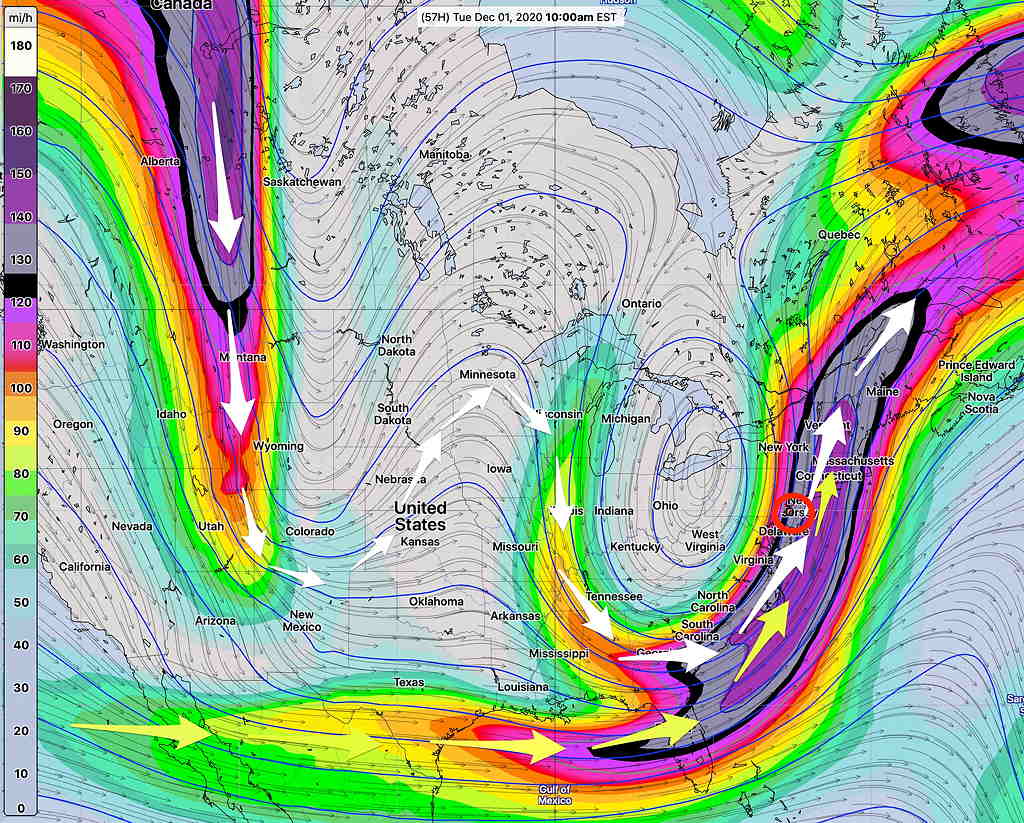
It will still be mild on Monday, but colder air moves in later Monday and Monday night.
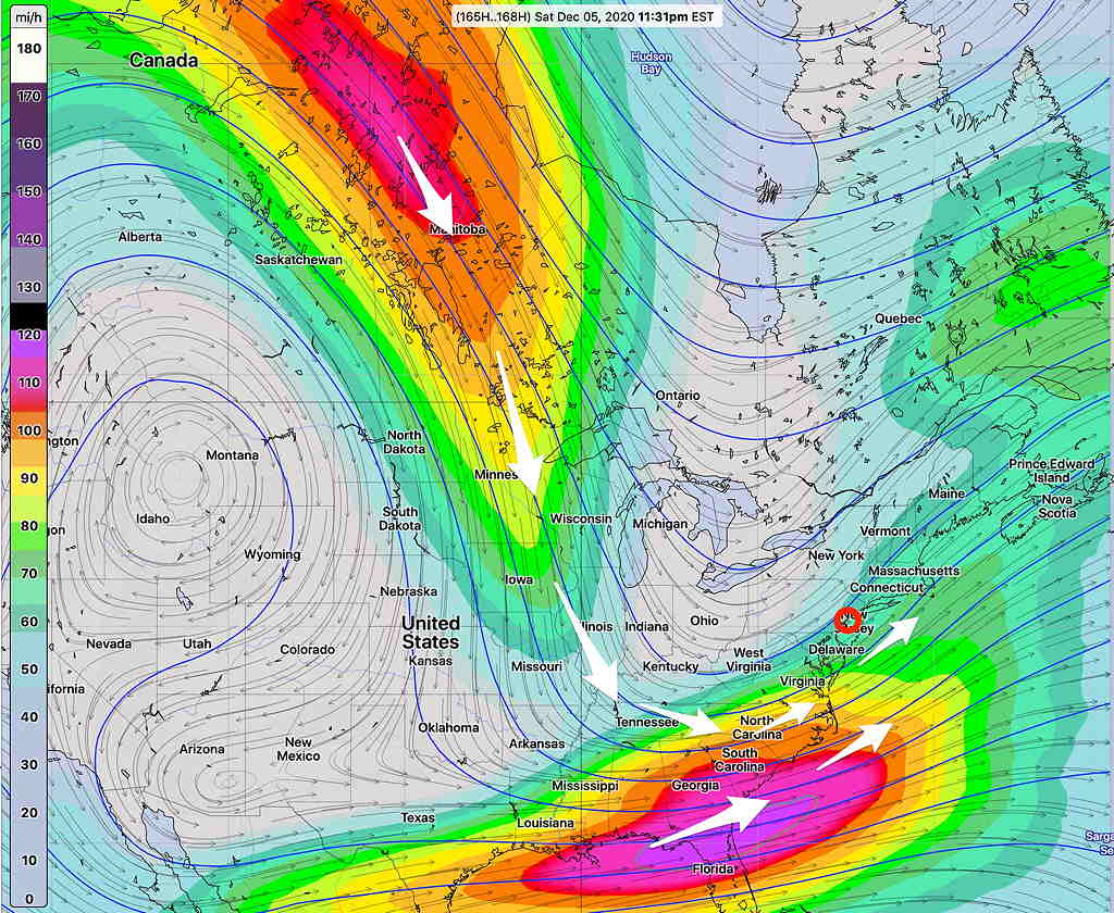
Notice that the jet flow makes a loop over high pressure in the Mid-West and another high energy impulse is waiting in the wings for later in the week.
There’s much uncertainty about timing of this next impulse with how these things are going play out later in the week, but some models are showing snow for central and western Pennsylvania.
For us, it will be rainy, windy and cold Friday and unsettled and cold next weekend. NO SNOW for us at this time. Stay tuned.