WEEKEND WEATHER FORECAST

Update Sat 7:15 PM— Today’s cloud forecast was spot-on. Sunday’s forecast below looks good as well with plenty of sunshine, occasional clouds. Some clouds move in later in the afternoon.

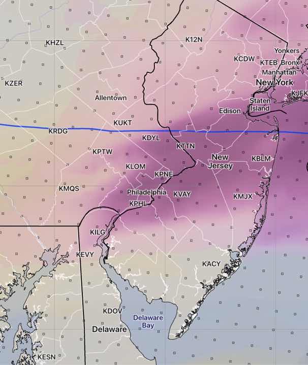
Word has gotten out about snow for Wednesday. Since that time period is over 90 hours in the future, the higher resolution models don’t extend into that forecast range, making snow accumulation forecasts quite unreliable. It was refreshing to hear the Channel 10 meteorologist refuse to make a snow accumulation forecast until Monday.

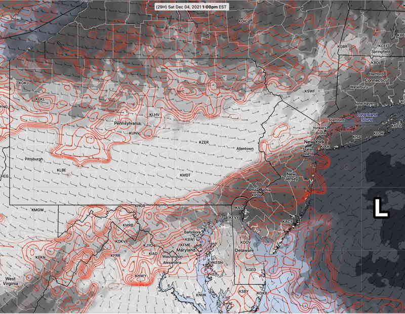
Nonetheless I’m sure people are curious about the snow accumulations being forecast by the longer range models. Snow is forecast to start before daybreak Wednesday, change to rain, and then change back to snow Wednesday night. Basically, snow accumulations are in the 0.5-2 inch range from just outside the city, with higher amounts possible towards Allentown and northwest NJ.

Curiously, most models have snow accumulations in our immediate area where surface temperatures are forecast to be over 32º. Again, too soon to make any ‘predictions’. Stay tuned.


Update Sat 7:30 AM— Last night’s models continue with the forecast of an area of cloud development Saturday directly over the Philadelphia area. The NAM NEST and the new CMC GEM models have brief clearing late morning before clouds redevelop as shown below—

HREF Ensemble mid-level cloud forecast for 1 PM Saturday looks similar to the NBM posted last night. The NAM-NEST and CMC GEM area similar, but have the area of cloudiness somewhat further south. Areas in Chester county and upper Montgomery county are forecast to be more sunny. (Click on image for larger view.)

Initial Post Discussion—[post_published]

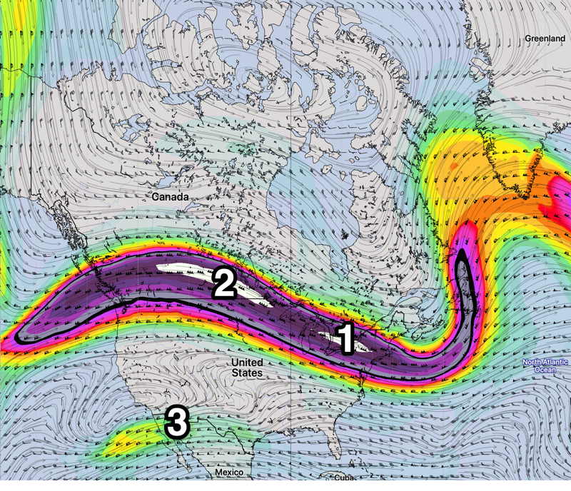
As described earlier this week, a flat jet flow has prevented active weather from developing this past week and this upper air flow will continue into this weekend. Much of the low pressure development is in Canada. Things look to change next week.

A frontal boundary stalled to our south will allow for weak low pressure to develop Friday night.

Saturday

A few sprinkles may develop and end before daybreak Saturday.

The low will move off to our south and east, but moisture will remain in the form of mid-level cloudiness through much of Saturday.

NBM Cloud forecast for Saturday 1 PM (Click on image for a larger view.)

Not all models are on-board with this cloudiness Saturday (several models have over-forecast clouds recently) and this cloud forecast is lower confidence than usual. High temp 49.6º ± 1.4º (NBM) Blue Bell. (Seasonal average high is 46º-48º)

High pressure builds in and Sunday will be mostly sunny, but with some occasional clouds in the afternoon, especially west of the city.

High temp 46.9º ± 1.7º (NBM) Blue Bell.

THIS WEEK’S WEATHER

Update Thu @ 5:11 PM — A slight change to the weekend forecast, as today’s models are forecasting a weak low pressure system to develop south and east of us early Saturday, along the stalled cold front that has moved through today, Thursday.

This looks to bring some light sprinkles around daybreak Saturday mostly near Allentown, then periods of cloudiness with periods of sunshine. The morning looks to be cloudier than the afternoon.

Sunday starts sunny, but increasing cloudiness is forecast by the GFS and NBM in the afternoon. Average seasonal high temperatures are in the 47º-48º range for the weekend. We’ll be close to that.

Interestingly, the Canadian Meteorological Center (CMC) just completed and released major updates to their models this week. The CMC GEM model has forecast much more sun for Sunday, but the new statistical CMC GEPS has a similar forecast to the GFS of increasing clouds Sunday afternoon. We’ll see.

My regular weekend weather forecast will be out tomorrow.


Update Wed @ 8:00 PM — A warm front moves through tonight (Wed) with some showers into early Thursday.

The uneventful pattern continues through the weekend as a cold front moves through Thursday night and stalls near us, allowing disturbances in the jet flow to bring clouds.

Disturbances (1) and (2) in the upper flow will bring moisture and vorticity both Friday and again Sunday with increased cloudiness. Saturday looks to be the best day with periods of sunshine.

GEFS Friday 300 mb wind (jet-stream level) forecast. Generally flat flow continues over us with some embedded disturbances (1) and (2). Southern jet flow (3) is beginning to show some signs of life.

The pattern changes (at least for a few days) late Sunday as additional jet stream energy carves a higher amplitude trough over us. What remains unchanged is the upper low near Hudson Bay. It just hasn’t move much—

GEFS jet level wind forecast Sunday. Existing jet flow moves a bit north while an impulse (2) will cause a dip in the jet for Monday-Wednesday. Upper level low (L) has been stuck in this general position for several weeks. We won’t see a major pattern change until this moves.

Initial Post Discussion—[post_published]

An uneventful weather pattern has evolved for this week, as a flat jet flow will not lend itself to any great storm development. A warm front followed by a cold front will affect our weather later in the week.

GEFS 300 mb wind flow for Friday. Flat jet stream flow (1) will not lend itself to storm development. Some southern jet stream moisture (2) may work its way into our region by Sunday.

  • Some cloudiness on Tuesday.
  • A warm front moves through slowly on Wednesday with clouds.
  • Milder air on Thursday will be pushed out by a cold front late Thursday into Friday.
  • Windy late Thursday and on Friday.
  • Saturday looks to be cold and dry as does much of Sunday.
  • Moisture from the Gulf (2) may work its way towards us late Sunday.

Weather… and Other Things 'Up in the Air'