…
So, this all started a few days ago when the soon-to-be released GFS model version 16.0 had predicted some light non-accumulating snow for Monday when the other models were predicting all rain.
Since that time several (but not all) models have jumped on the light snow band wagon. There’s still much uncertainty about the temperature profiles on Monday. Many models show a change over to snow, but not all show accumulating snow in the immediate Philadelphia area Monday.
At this point in time, it’s best to move over to the new National Blend of Models (NBM) which runs hourly and statistically blends about 20 different models (including the much-touted European Model) with a complex statistical weighting based on each model’s accuracy over the immediate previous six hours.
One of the features of the newly release NBM version 4.0 is the statistical handling of many parameters, including snowfall.
The most recent NBM model shows rather unimpressive snow totals for most of us on Monday. (Again, it’s a blend of models. Current models aren’t all on-board with snow accumulation.)
So let’s try something new—snow prediction via statistical percentiles.
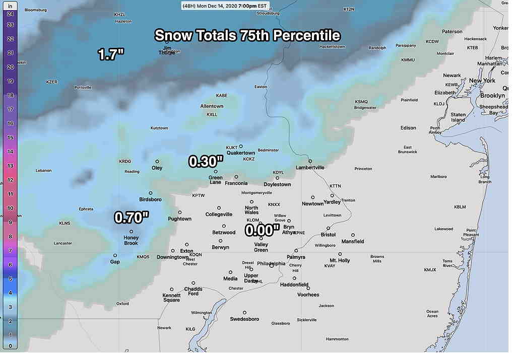
Here’s the total snowfall predicted in the 75th percentile (75% show this amount or less)—
Here’s the total snowfall predicted in the 90th percentile (90% show this amount or less)—
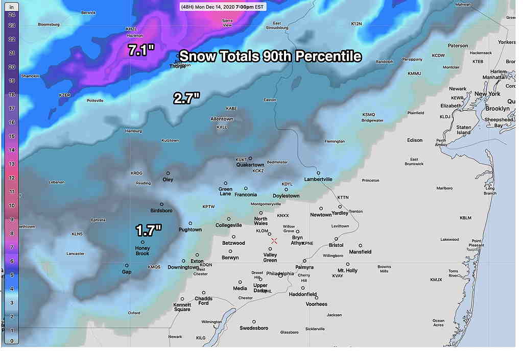
As you can see, most of the immediate PHL area won’t see any accumulation on Monday, although precipitation will fall as rain changing to snow.
In contrast, let’s look at the very latest high resolution NAM-NEST model forecast—
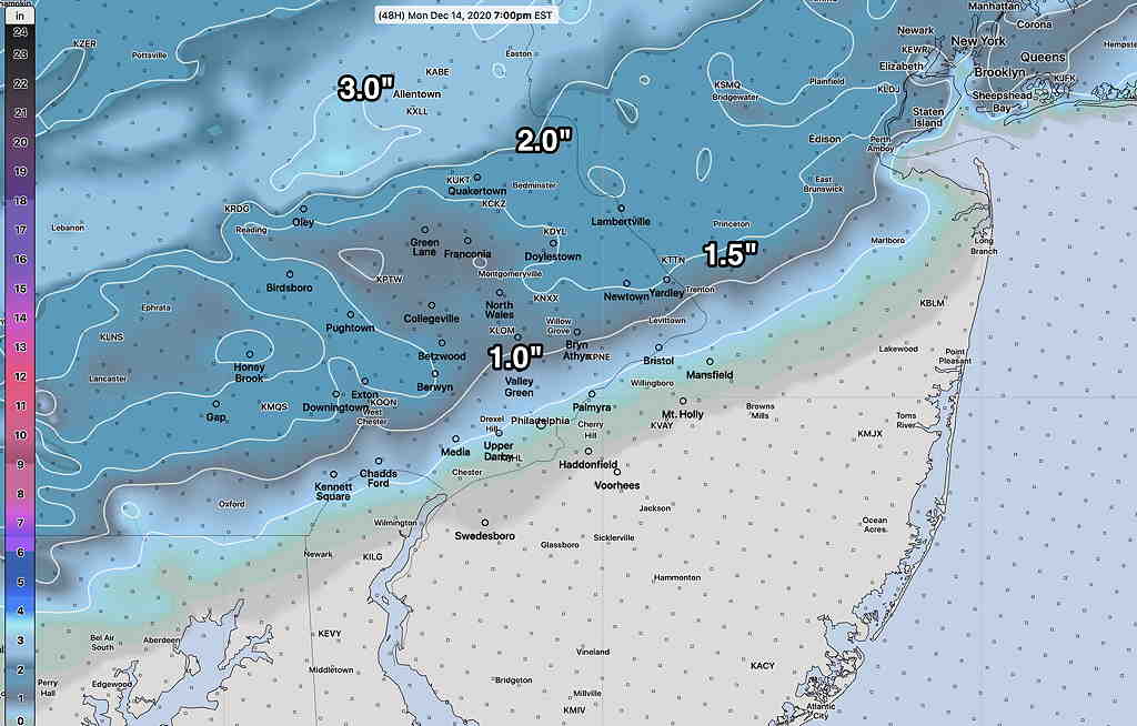
I would go with the NBM model, somewhere between the 75th and 90th percentile amounts above.
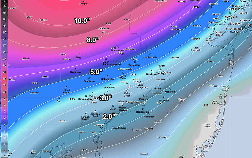
As for Thursday, the already highly-advertised snowstorm still continues to threaten. I’ll be covering this during the week. Food for thought is the current ICON model—
For a change of pace, also of interest is the Canadian Global model—
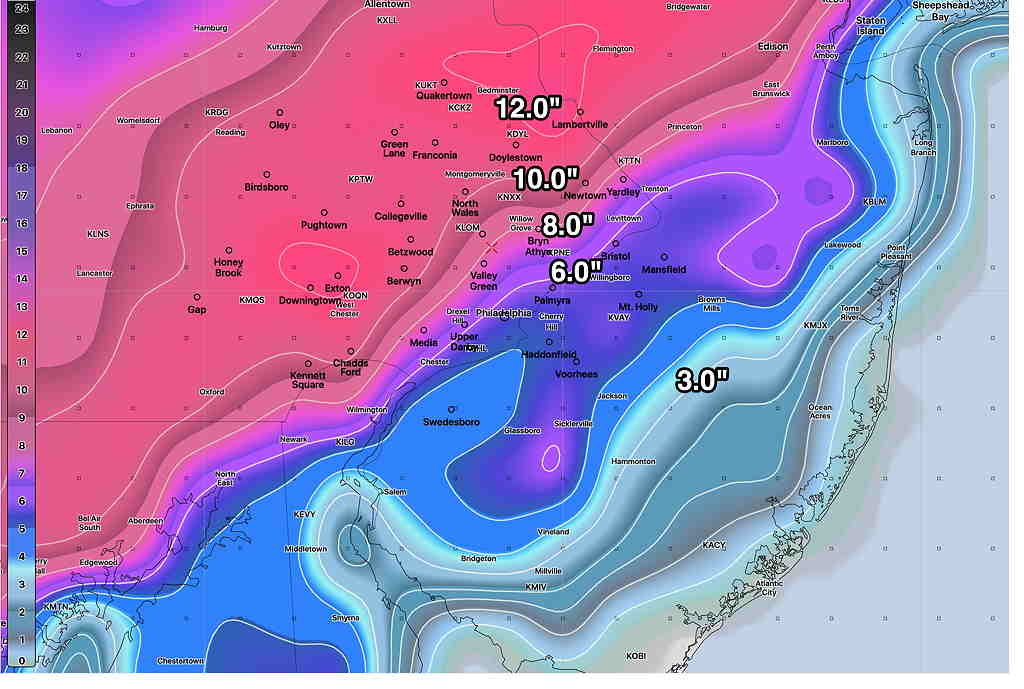
The ICON model, which I recently found access to, has been pretty good in recent months. The Canadian model tends to over-state snowfall in recent storms last year.
Stay tuned.
