The model runs from last night (06z – 2 AM EDT) show a change in the forecast for today, Saturday.
- More sun and less high cloudiness until about 4 PM, when clouds move in.
- High temps 88.4º sd 1.9º. My guess is that it might hit 90º.
- Increasing chance of scattered thunderstorms as early as 5 PM in PHL.
Sunday has an highly elevated chance of scattered thunderstorms throughout the day.
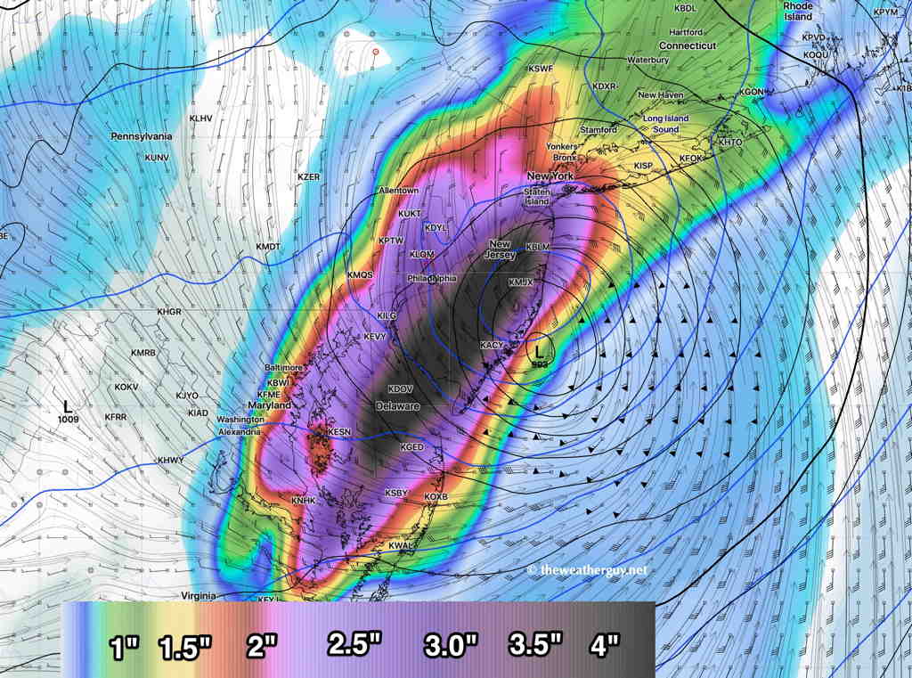
The storm with the difficult name to pronounce will hopefully be an easier forecast to track — Hurricane Isaias.
The track of Hurricane Isaias appears to be somewhat more westward, affecting more of our area on Tuesday—