[su_box title=”Winter Storm Outlook Update Tues 9 PM” box_color=”#defcdc” title_color=”#000000″]Reviewing today’s models, there isn’t much change from this morning’s update. The small disturbance that will accompany a warm front will bring some light snow Thursday night. Current QPF is 0.12 inches water, or 1-2 inches from midnight Thursday to daybreak Friday.
Most models have the large storm for late Saturday into Sunday tracking far enough inland that the precipitation will be mostly rain for PHL and immediate suburbs; the changeover to snow looks to be late enough to limit snow accumulations significantly. Stay tuned. [/su_box]
[su_box title=”Winter Storm Outlook Update Tues 8 AM” box_color=”#defcdc” title_color=”#000000″]The small disturbance that will accompany a warm front will bring some light snow Thursday night.
The large storm for late Saturday into Sunday is now forecast to track far enough inland that the precipitation will be mostly rain for PHL and immediate suburbs; the changeover to snow on Sunday may be late enough to limit snow accumulations significantly. This scenario has been one that has alternated with a more coastal track.
Stay tuned. [/su_box]
[su_box title=”One more thing… ” box_color=”#defcdc” title_color=”#000000″]While focusing on the weekend, I neglected to mention a warm front type snow that is forecast to occur this Thursday night into early Friday morning. There’s some question whether it will be snow or a mix, but tonight’s NAM has it as snow. An active week coming up. Stay tuned. [/su_box]
Previous post —
The first truly impressive storm of this winter season is forecast to affect our area in the late Saturday through Sunday timeframe.
This storm has been predicted by the long range models for well over two weeks. All models are currently on-board for some sort of winter precipitation, very windy conditions, followed by deep cold.
As always, there are differences among the models regarding the speed of the initial impulse, degree of intensification and the precipitation type. The GFS, the FV3-GFS and the ECMWF (European) are the most impressive.

As of today, it appears that precipitation will start as rain Saturday night, then change to a mix of sleet and rain and then a final changeover to all snow from west to east during the day Sunday.
As we know, the models didn’t accurately depict the the past weekend precipitation, so it’s a shot in the dark to predict snow totals 6 days in advance.
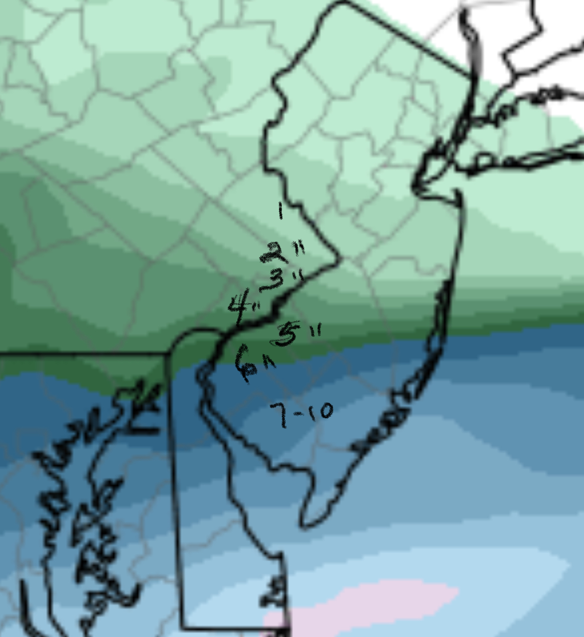
That said, a 6-10 inch snowfall (based on the latest ECMWF) with high winds is looking possible at this time, north and west of Philadelphia. Philadelphia may stay a mix for a longer period. This storm looks to be impressive, with high winds. Stay tuned.


