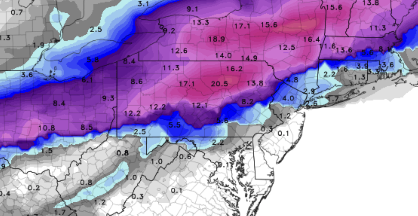
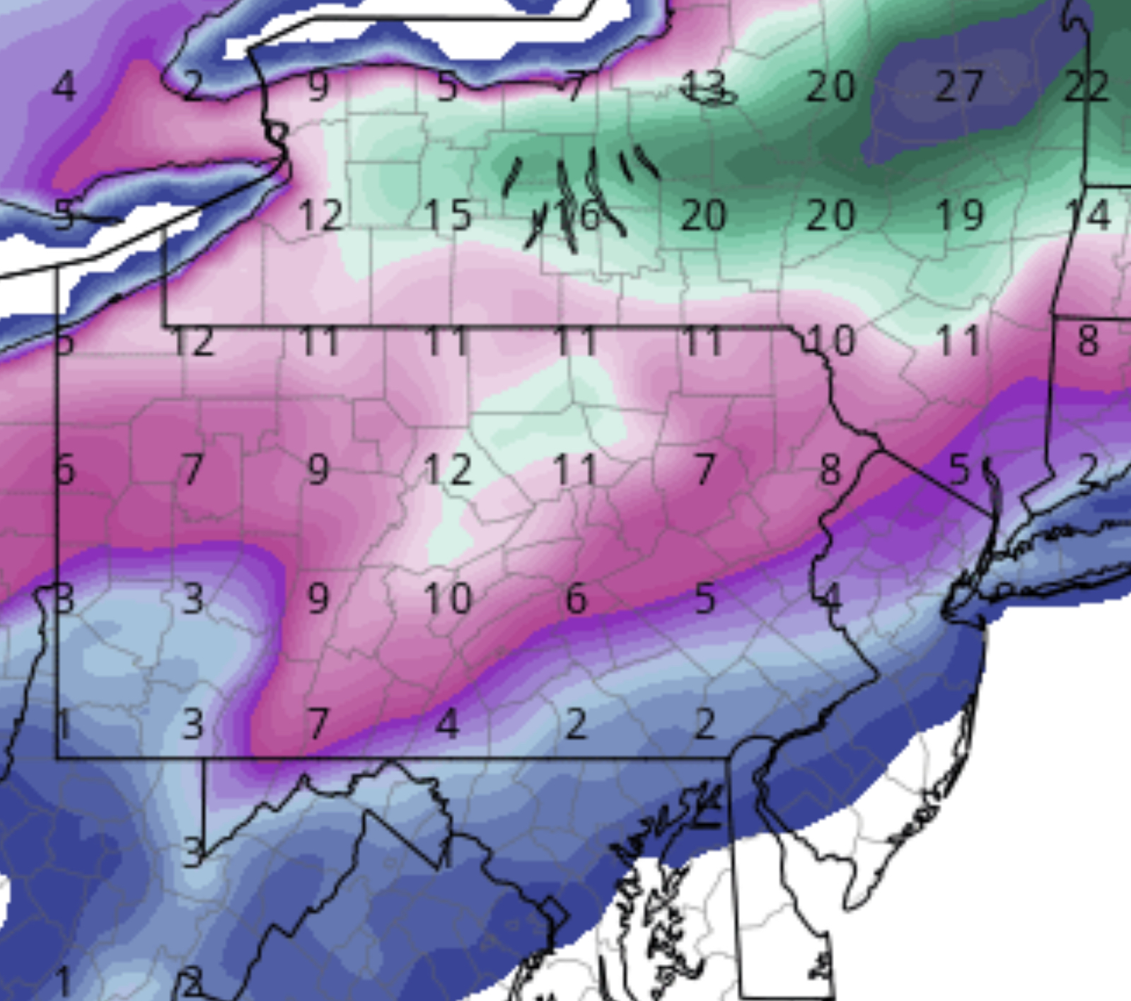
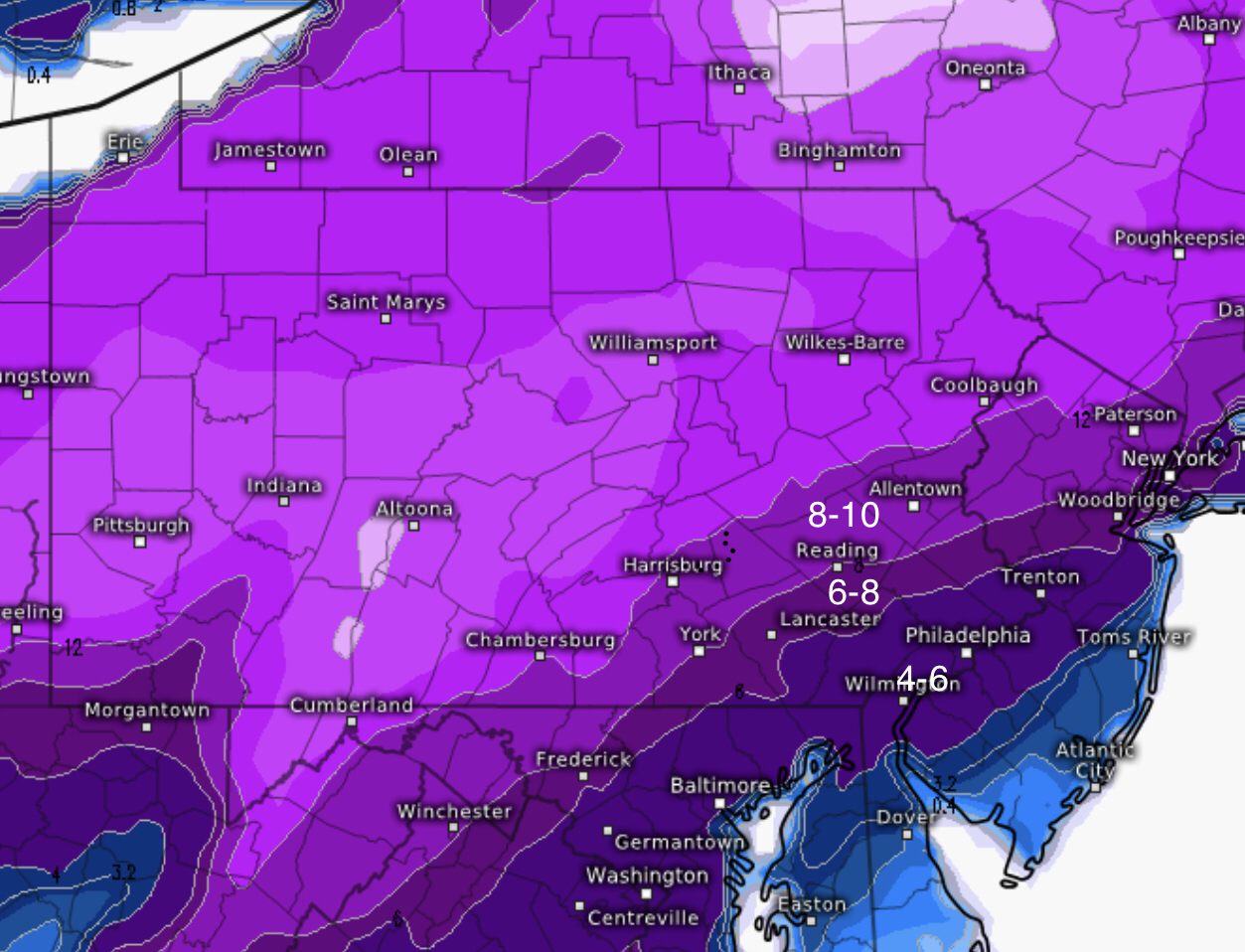
[su_box title=”Winter Weather Update Sat 11:30 PM” box_color=”#defcdc” title_color=”#000000″]The precipitation started a bit later than the morning models had forecast and some dynamic cooling allowed snow to fall for the first two hours. It’s changed to rain and the rest of the forecast remains intact. [/su_box]
[su_box title=”Winter Weather Update Sat 5 PM” box_color=”#defcdc” title_color=”#000000″]No accumulating snow expected here. Some timing changes. The short range models now show rain doesn’t start in and around Philadelphia until 6-8 PM. Rain ends about 10 AM Sunday. Temperatures drop below freezing about 2-3 PM on Sunday. [/su_box]
[su_box title=”Winter Weather Update Sat 11 AM” box_color=”#defcdc” title_color=”#000000″]This morning’s GFS comes in warmer and a more westward track. The severe weather forecasts were possibly justified about two days ago, but the models yesterday and today makes this a heavy rain storm with a sharp cold front for Philadelphia and even areas approaching Allentown.
Any snow flakes will be insignificant with surface temperatures in the mid 30s rising into the 40s. [/su_box]
The latest model NAM just becoming available. Here are the trends for Philadelphia and immediate suburbs –
- Last night’s GFS and NAM runs were similar. This morning’s NAM is warmer and faster.
- There’s a trend towards a warmer storm, partially due to track change but also due to less intensification, less phasing of jet streams.
- Earlier start and earlier end of precipitation.
- While I have no expertise, I think the “flash freeze” hype has been just that, and it was likely hype as early as yesterday’s model forecasts showing the precipitation ending before the frontal passage.
- Rain ends about 8-9 AM Sunday.
- Temperatures drop to freezing about 1 PM and continue to drop
Here are the specifics: Precip starts 3-5 PM. Some light snow possible at start, but a very quick change to sleet and then heavy rain. Little or no accumulation.
Heavy rain through 8 AM Sunday. Temperatures rise into the 40s or near 50. Rain ends 8-9 AM Sunday. Cold air delayed and moves in several hours after rain ends, significantly reducing the chance of a flash freeze. Very windy! Temperatures drop to freezing about 1-2 PM and continue dropping into the 20s. Near 10 at night.
Regarding the “flash freeze”, I think it became its own reality when the models predicted no frozen precipitation falling with when the front moved through. In my mind, a flash freeze occurs where there’s still active precipitation when the temperatures drop rapidly to below freezing. Sure, any standing water will freeze. Is that a “flash freeze?”


