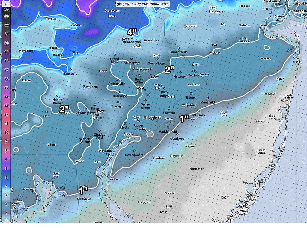
Despite the impressive snow falling at 3 PM, the revised forecast of only 1-2 (3) inches in the Philadelphia area and immediate northern and western suburbs remains on-track from this morning’s update.
Based on radar, the changeover has just moved north of the Delaware-PA state border.
The high winds (50-60 mph) are still expected this evening and night-time hours.
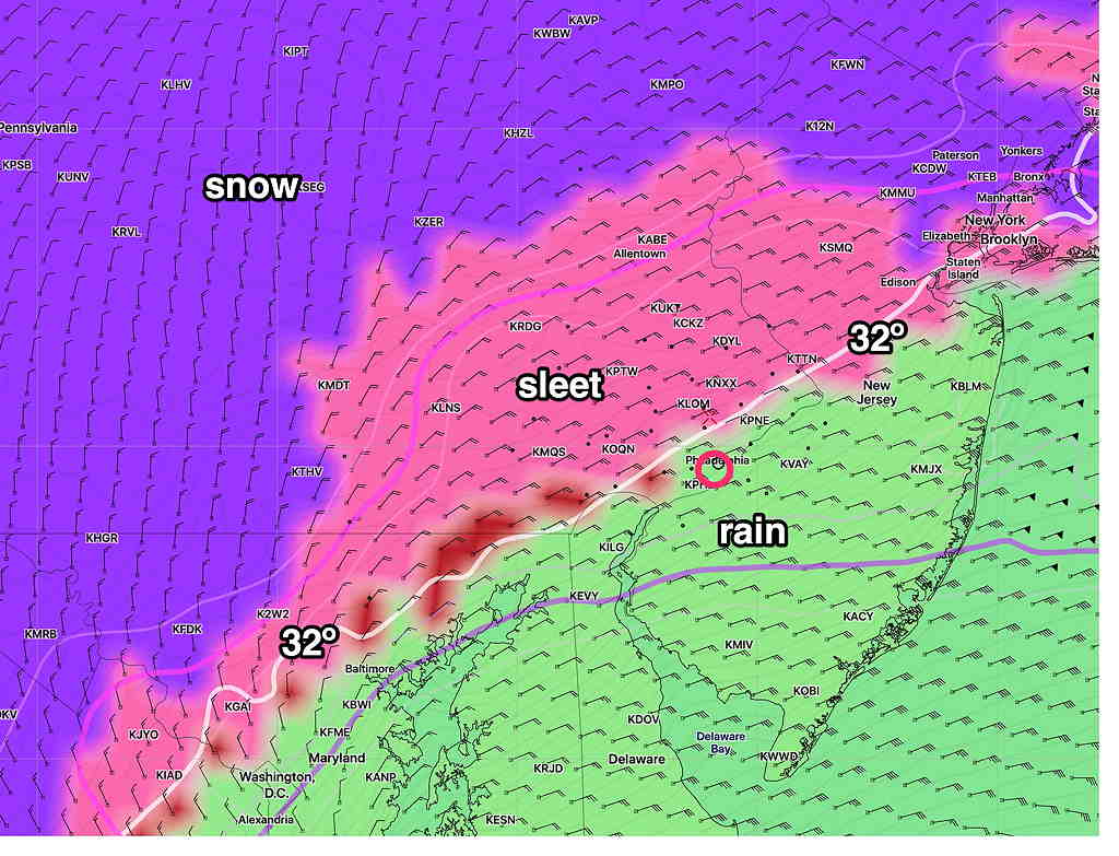
The latest NAM and NAM-NEST continue to show warm air entering the region at 6000 feet (800 mb) with a change to sleet, freezing rain and rain in the 6 – 8 PM timeframe. The higher resolution NAM-NEST shows a possible alternation of precipitation types during the evening hours, especially far north of the city. A changeover to back to snow will occur 2- 5 AM depending upon location. The snow will gradually taper during the morning hours.
The latest NAM NEST snow totals—
Latest NAM-NEST snow totals by 7 AM Thursday (Click on image for a larger view.)
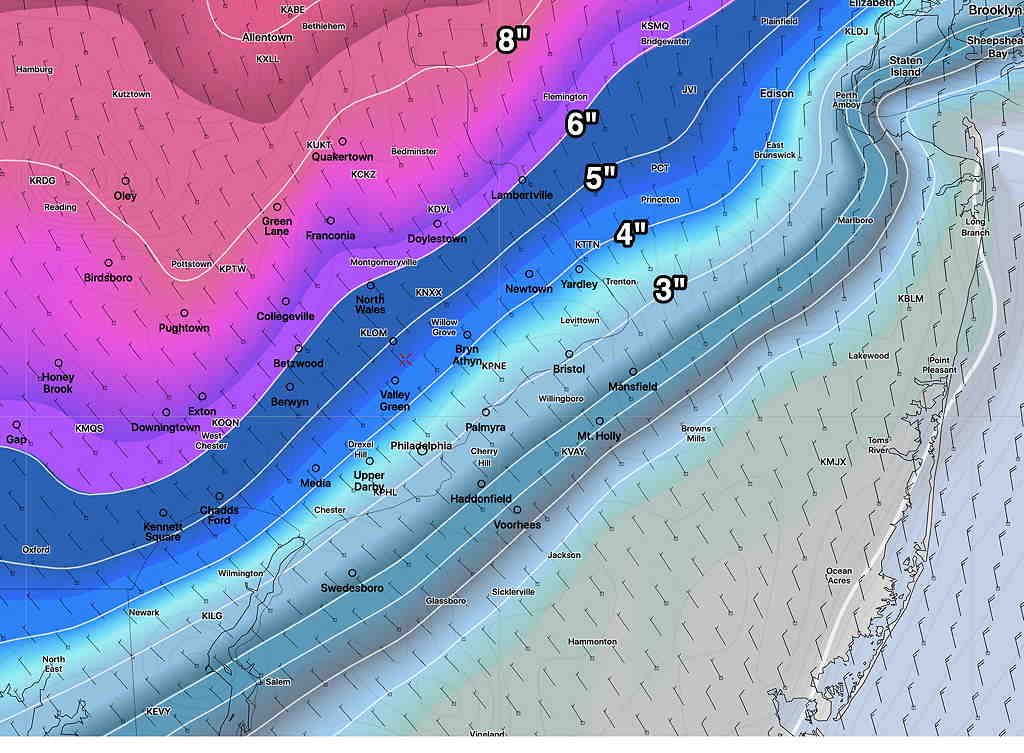
Tue 04:31 PM Update — This afternoon’s NAM captures the expected decrease in total final accumulation (3-5 inches in the PHL area immediate suburbs) due to a changeover to sleet and even rain for several hours during Wednesday evening. (It will change back to snow)—
NAM Precipitation Type at 11 PM Wednesday (Click on image for a larger view.)
NAM Snow totals by Thursday morning (Click on image for a larger view.)
I’ll be doing an update around 10 PM this evening with the latest model info.
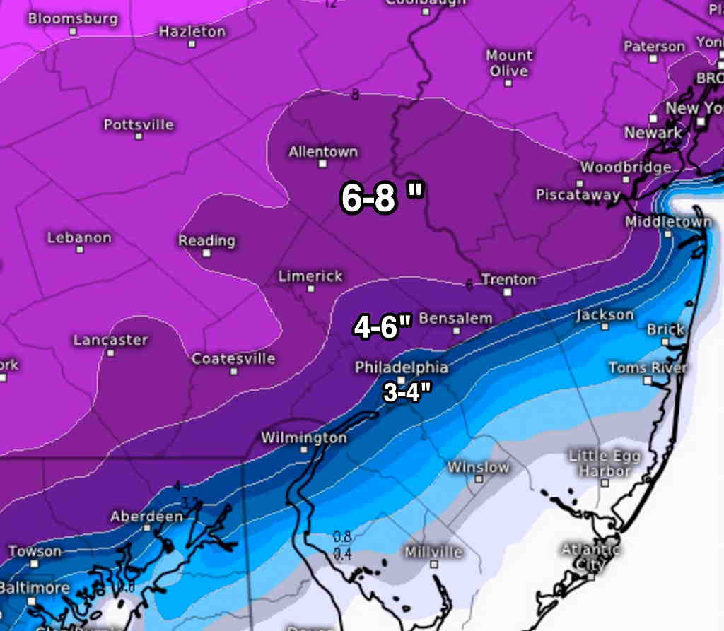
Another update: here’s the latest ECMWF (European) snow total forecast:
European (ECMWF) snow total forecast (Click on image for a larger view.)
from earlier today…
This morning’s later models (Canadian HRDPS and Regional GEM, GFS) continue with the trend of the NAM and ICON models from last night and this morning— of having more warm air aloft in the PHL area and immediate western suburbs reducing forecast snow totals
No time right now to provide a graphic, but snow totals have reduced to 3-5 inches in the immediate PHL area and immediate suburbs with a rapid tail-off lower going east.
Today’s forecast of snow flurries was always on the edge of not meriting a blog post. But I wanted to keep my skills honed, so it’s been the subject of my recent two posts.
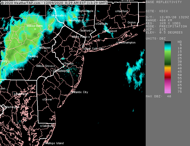
I’m ready to bring this to a close. Today’s models continue with the trend of the clipper system coming through, although none of the models just available show this current radar situation at 9 AM (which could be showing precip evaporating before reaching the ground).
Current 9AM Radar Loop (courtesy of weathertap.com) (Click on image for a larger view.)
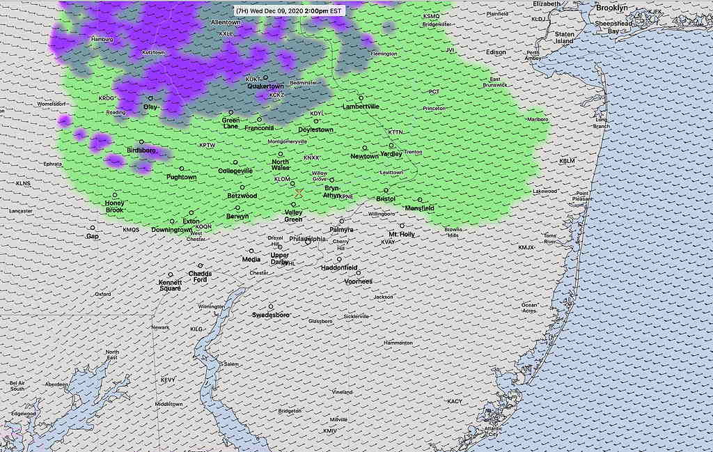
HRRR Precipitation Type forecast showing light rain sprinkles north of Philadelphia (Click on image for a larger view.)
Indeed, this morning’s models don’t show any precipitation reaching us until 12-2 PM, and being extremely light, mostly north of us, with the lowest layer of the atmosphere too warm for even snow flurries.
So, there’s a disconnect right now with current conditions and model forecasts. The non-event of possible light snow flurries could just become light rain sprinkles or just be a total non-event. Let’s see what happens.