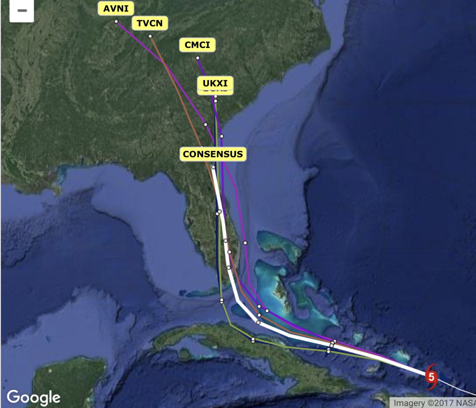
Last night’s models have moved the track a bit to the west, possibly making landfall near Naples FL and then moving up through west-of-center of the state. The storm is expected to hit Florida as a Category 4. The consensus track (white) on the graphic below is the current most likely track. The National Hurricane Center’s track is a bit east of this line.
Here’s the latest model tracks for Irma, showing the five best models for hurricanes. The white line is the consensus or average path through Monday afternoon.
Those who follow my blog know I’m more of a “snowstorm sorta weatherguy” than a “hurricane sorta guy”. That said, I’d like to chime in on hurricane Irma.
First, hurricanes are tough to predict– the track or path is difficult to predict well into the future and the future intensity is even more difficult to predict.
Anyone who has listened to the news knows that Irma is a Category 5 storm and is likely to be a Category 5 or Category 4 by the time it hits Florida. And yes, it does look extremely likely that it hit the southern part of Florida, maybe near the Keys, maybe near Miami and steer northward.
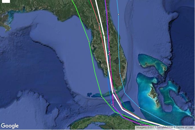
Here’s the latest as of today (Thursday) afternoon- The National Hurricane Center maintains an track that is on the eastern side of Florida, maybe off the coast a bit. They have maintained that track because Wednesday’s models were leaning towards a more eastern track.
Thursday’s models have changed a bit:
The ECMWF (European) model has the storm hitting the Keys and goes up through the center of FL with more of a delay.
The CMC (Canadian) takes it a bit faster and up through the center of Florida.
The NAVGEM (US Navy) model is still slower and takes a more western route through Florida.
The GFS model is still closest to the official NHC track, on the eastward side of Florida.
Historically, the ECMWF and the GFS are the most accurate for hurricanes. Additionally, something called a “consensus model” has a good track record.
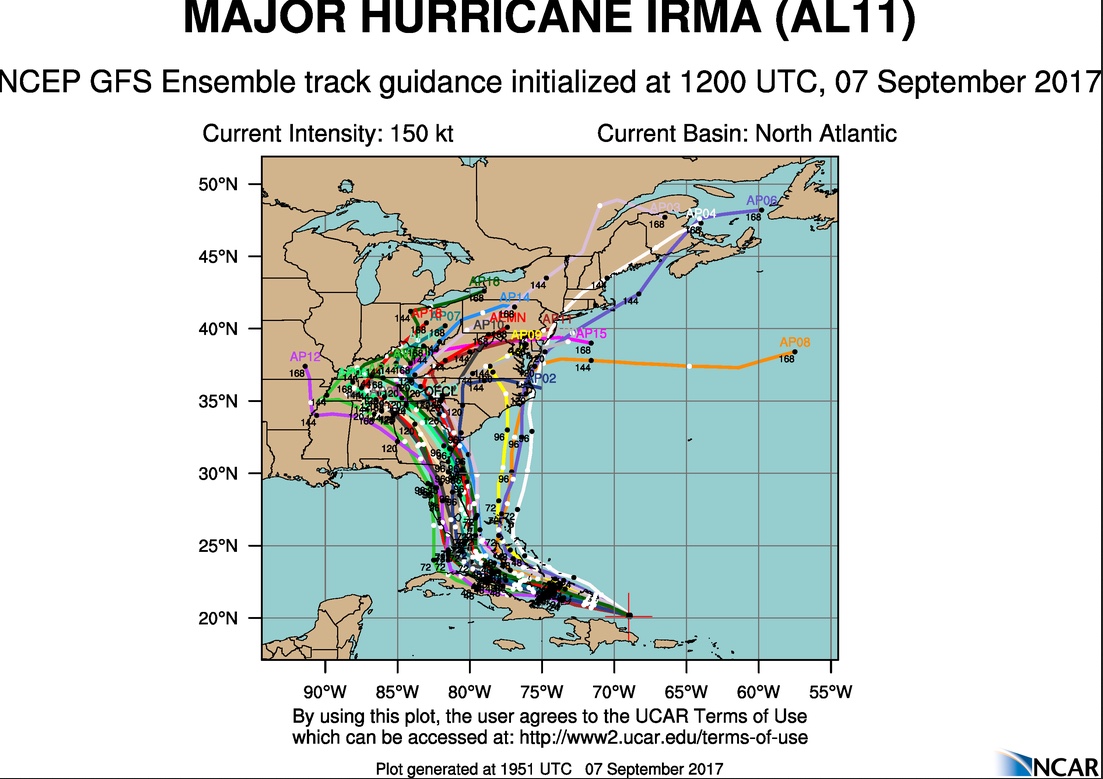
Here is the current GFS Ensemble (statistical) paths:
GFS Ensemble Tracks
So there’s still uncertainty about the exact track, but a track that affects some or much of Florida is extremely likely.