Forecast Review — Last night’s models, which had been more conservative with the forecast severe parameters, were more on target with their thunderstorm forecast than this morning’s models. We had several hours of clouds this afternoon which reduced the available energy when the storms arrived. It’s not the first time I’ve seen the 24 hour forecast be more accurate than the “latest models”.
With thunderstorms, sometimes you’ve got wait for the latest models.
Thu 07:12 AM Update — Regarding the thunderstorms being forecast for Thursday evening, the storms are forecast to move through about 5-7 PM. The severity parameters in the immediate PHL area are at low to moderate levels. The latest models have most of the stronger activity closer to and south of the PA-Delaware border. Localized heavy rain still possible. I’ll keep an eye on this.
The models have been on-board with moderate to heavy thunderstorms moving through our area about 10-11PM tonight.
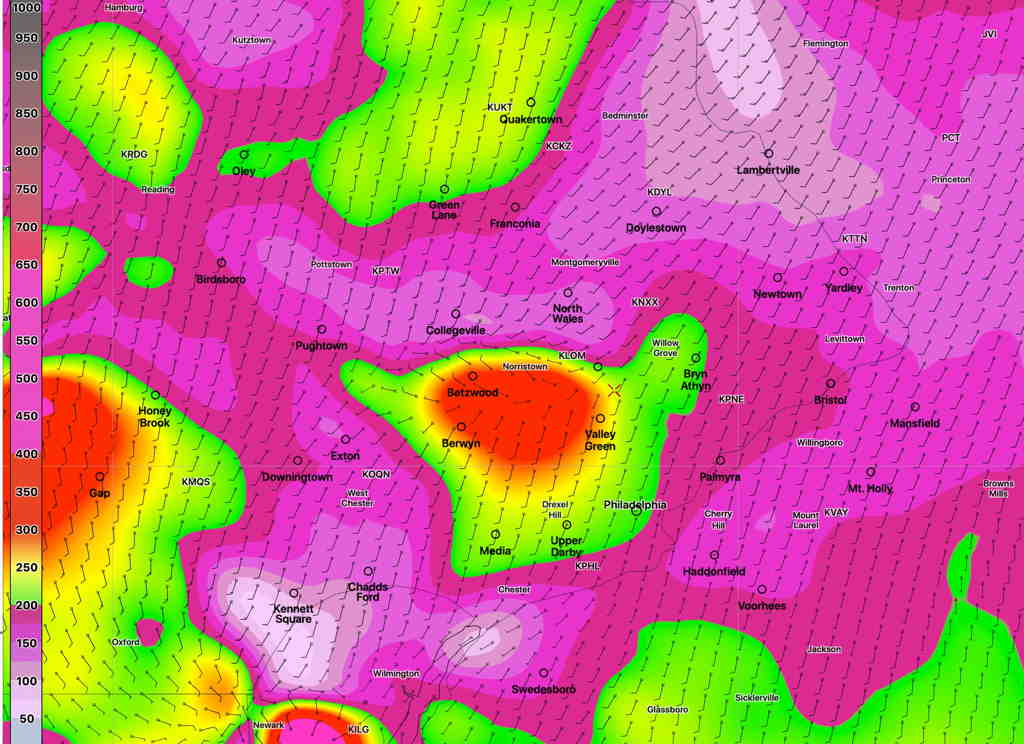
Severe parameters are in the moderate range, but precipitable water values (PWAT) are very high, so some heavy downpours are expected this evening. The storms are fast moving— expect some very gusty winds with these storms, as they quickly move through.
A front moves through Thursday early evening between 5 and 8 PM. I’ll be updating tomorrow morning on those storms.
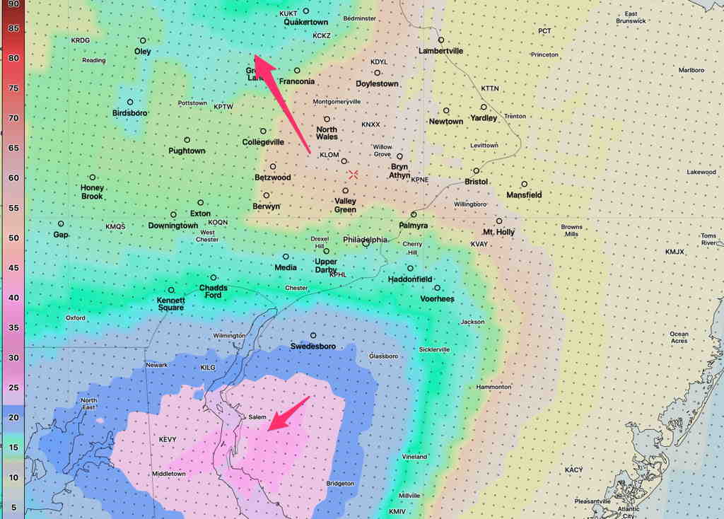
Addendum 9:07 PM: Tonight’s storms are expected to diminish in intensity as they move into NJ. Model blend thunderstorm probability at 10 PM—
1:00 PM Update- Storms approach 3-4 PM according to the latest HRRR
A quick post- models are on-board with thunderstorms today in the immediate PHL area, from 3-6 PM, moving northwest to southeast. Several models show closer to 4 PM. Severe storm parameters are in the moderate range. Some quick heavy rain possible, gusty winds.