Category Archives: Philadelphia Weather Outlook

FRIDAY RAINSTORM UPDATE

Updated Thu 10:59 PM — Tonight’s models have failed to clarify the most likely location of the heaviest precipitation tomorrow. The NAM NEST continues with the heaviest rain falling to the west of the low center, west of Philadelphia, while the RAP and HRRR have the heaviest rain in NJ.  The HIRESW models have very heavy rain right over Philadelphia.  (The GFS won’t be available until 11:40.)  Amounts continue to be 1.25-2 inches with some areas getting 3-5 inches. Rain starts 7-8 AM.
Updated Thu 04:40 PM and Thur 5:46 PM— The coastal storm is named Tropical Storm Fay.

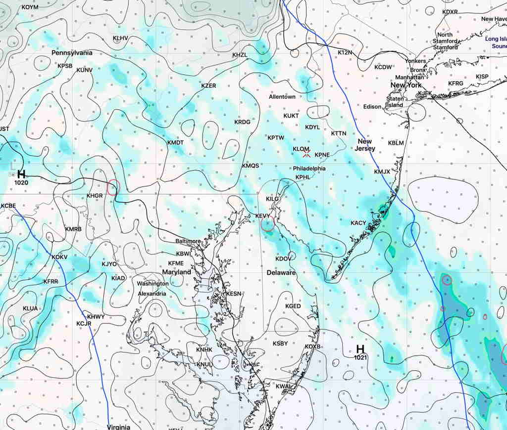
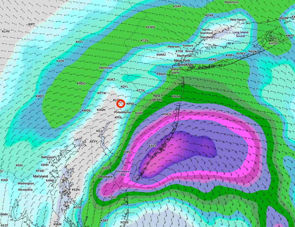
This afternoon’s NAM-NEST model as well at the Canadian High Resolution and German ICON model have moved the heaviest rain bullseye eastward into NJ. The afternoon GFS is not yet available. Still a lot of rain!

NAM-NEST (High resolution) accumulated rain Friday.  (Click on image for a larger view.)


The NAM model is further eastward with the heavy rain and somewhat captures the ICON and CMC models—

NAM model accumulated precipitation 

This is almost as challenging as trying to predict a snowstorm!

And the afternoon run of the GFS has just become available and maintains the the precip maximum over Philadelphia —
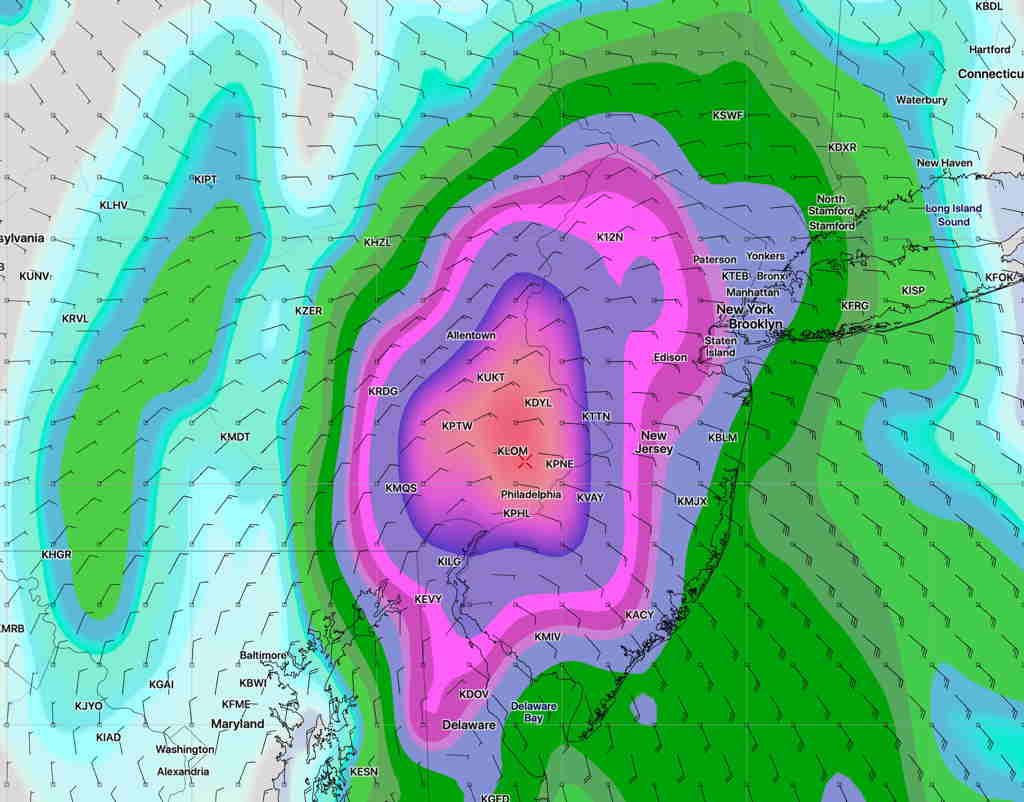
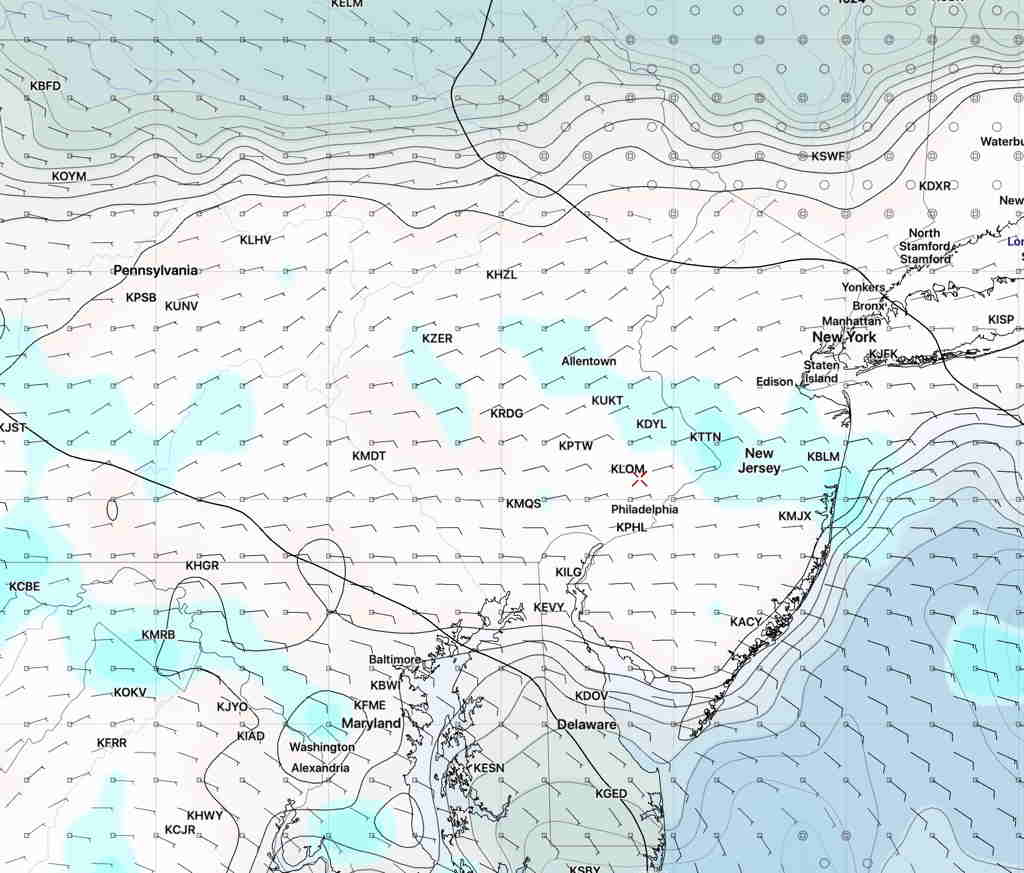
Afternoon GFS accumulated rain forecast. (Click on image for a larger view.)

from earlier today…

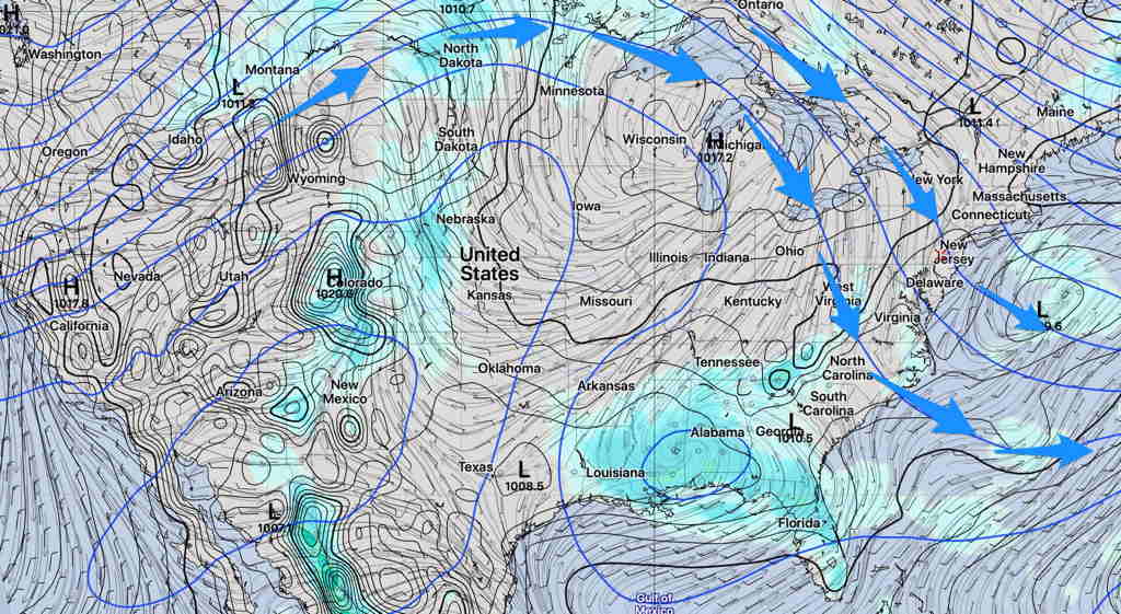
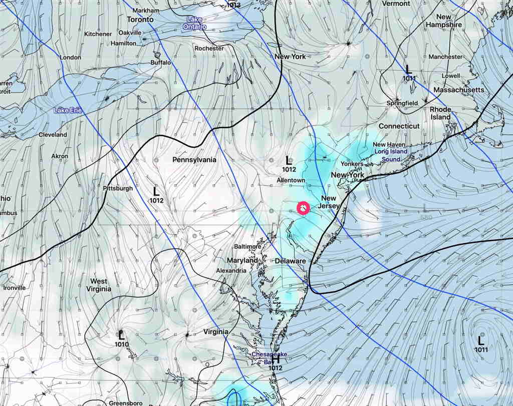
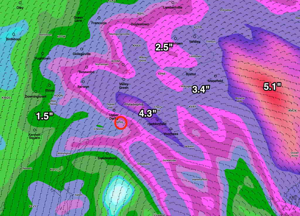
The models continue to bring the center of the semi-tropical low directly over our area.  As with most tropical systems, the amount of available moisture for rain will be high.   (Measured as the model parameter PWAT, or “precipitable water”.)

Here’s the current forecast amount of rain expected by 8 PM Friday—

GFS forecast accumulated rain by 8 PM Friday.   (Click on image for a larger view.)

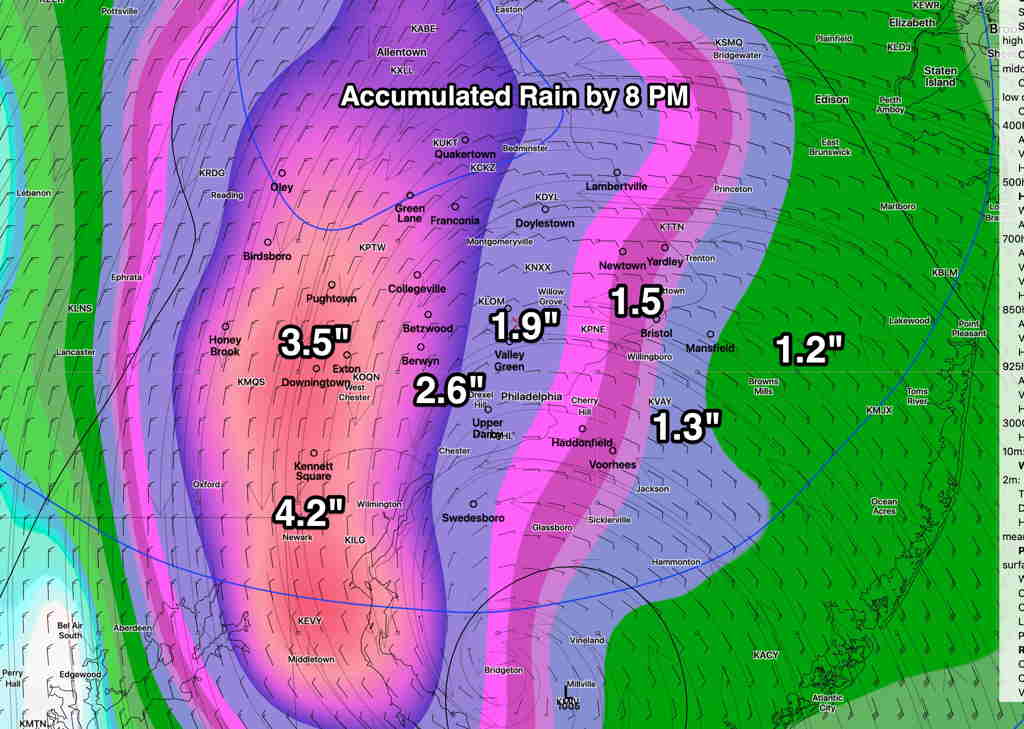
Please keep in mind that model rain predictions can’t be taken literally, especially in regard to the exact placement of the heaviest rain.  But it does give a good idea of the general amount of rain expected and the most likely area for the heaviest rain.

(The NAM-NEST model has a similar forecast to the GFS for the heaviest rain in the western suburbs.  The NAM has the heaviest rain bullseye in NJ. )

4TH OF JULY WEEKEND WEATHER OUTLOOK

[su_note note_color=”#ffffff”]Updated Thu 08:59 PM — Tonight’s model blend shows a high temperature on Friday of 94.6° sd 2.8° (Blue Bell) 96.6° sd 2.0° (Philadelphia Airport).[/su_note]
A  summertime pattern will deliver a fairly uneventful weekend forecast and fairly nice weather for the 4th of July weekend, although there are some questions about some cloudiness on Saturday.

Note that this pattern is not the usual Bermuda high off the east coast, but instead a high pressure ridge in the center of the country and a slight trough over our area .

SREF forecast Saturday (Click on image for a larger view.)

The trough’s upper cyclonic curvature will allow some typical late afternoon thunderstorms, very widely scattered almost every day.  Most areas will remain dry and the dry weather pattern I spoke of last week is still with us.

The highest temperatures will occur on Friday (Hi 94º) but a backdoor cold front from the northeast will move through Friday night as a result of a small wave in the upper flow.   This will give us an enhanced chance of widely scattered showers and thunderstorms Friday evening.

Saturday, after the passage of this front, will have northeasterly wind flow.  Some models (notably the GFS version 16, experimental) have some cloudiness Saturday afternoon with some afternoon showers.   High 87º.

GFS version 16 Pre-release Saturday 5 PM forecast (Click on image for a larger view.)

Sunday looks to be sunny and warmer, high near 89º.


SHOWERS, BUT MUCH PASSES US BY

Updated Wed 07:32 PM — Updated with latest HIREF model showing showers mostly to the east, not west.

Earlier this week, I mentioned that the closed, cut off upper air low pressure system might linger and that appears to be the case; it appears that it will affect our weather through at least Saturday.

The problem with all closed cut off upper lows is that the associated precipitation is difficult to accurately model and predict. So far this week, the models haven’t done all that well with the cloud cover prediction either.

So with that backdrop, I’m still tempted to try to talk about the showers over the next few days.

At least for tomorrow, Thursday, the models are suggesting we may get some much needed showers in the morning.

HIREF model precip forecast for 8 AM Thursday. (Click on image for a larger view.)


Same time tomorrow, different forecast:

GFS Precip forecast Thursday 8 AM  (Click on image for a larger view.)

However, the models are also predicting that any precipitation will be light and most of the showers will be west east of the immediate PHL area.   Our area gets less than 0.1 inches

So you’ll probably have to water your lawn soon if the models are correct about this.

There’s a somewhat greater chance of showers on Friday and Saturday, but again, the majority of the precipitation may miss the immediate PHL area.  I’m hedging here…upper cut off lows are tough to forecast.