Category Archives: Philadelphia Area Weather Forecasts

WEEKEND WEATHER FORECAST

Sunday Forecast Update

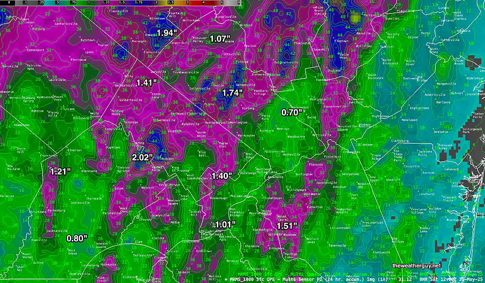
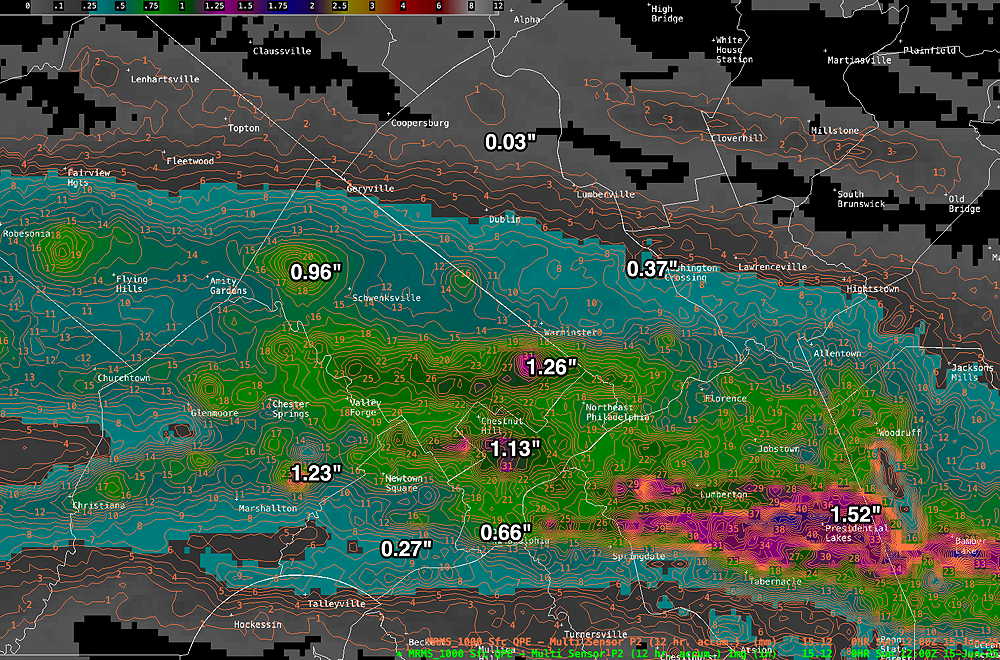
Posted Sunday 06/15/25 @ 9:35 AM — Last night’s NAM-NEST did well in predicting some of the heavier rain, although more fell in NJ than it had predicted.

Last night’s rain- MRMS (Pass2) rain-gauge measured rainfall combined with rain-gauge calibrated and interpolated radar-based summary of ACTUAL RAINFALL RECEIVED. Color shading is in inches. Line contour numbers are in mm. (25.4 mm= 1 inch)      (Click on image for a larger view.)
Very disappointing was yesterday’s experimental RRFS model runs, which showed little to no rain last night.

As for today, little in the way of any rain is expected during the day, although mist, some fog and overall damp weather is expected.


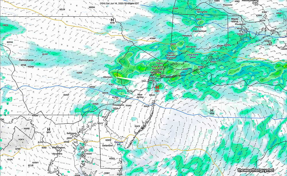
Posted Saturday 06/14/25 @ 8:27 PM —Sunday looks to be mostly cloudy with little in the way of rain in the Philadelphia region, based on the RRFS and HRRR,.

HOWEVER, at the other end of the spectrum is the NAM-NEST which has considerable rain in the morning and widely scattered showers during the day. This evening, the NAM-NEST forecast more closely matches the radar at this time lending credence to its forecast.

18z NAM-NEST forecast for 8 AM (Click on image for a larger view.)

The latest ECMWF-AI model is closer to the NAM-NEST forecast.

So we have much significant uncertainty. As I often say, the most useful forecast is knowing the times when there’s little certainty.

If the RRFS and HRRR are correct, rain is expected to stay to our far north and to our far south. There may even be some breaks in the overcast and bright spots at times, especially in northern sections of the area. If the NAM-NEST is correct, there will be more showers throughout the day, especially in the morning.

Forecast models leaned towards: NAM-NEST ECMWF-AI


Forecast Update

Posted Saturday 06/14/25 @ 9:17 AM — Last night’s 06z models (2 AM EDT) showed a trend towards less rainfall in the immediate Philadelphia area, not too different than the ECMWF forecast posted yesterday.

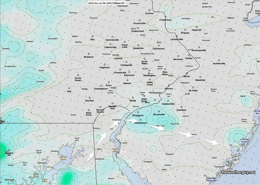
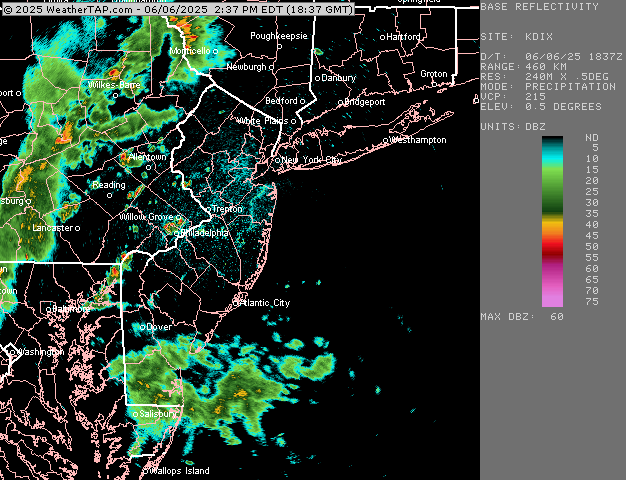
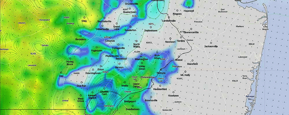
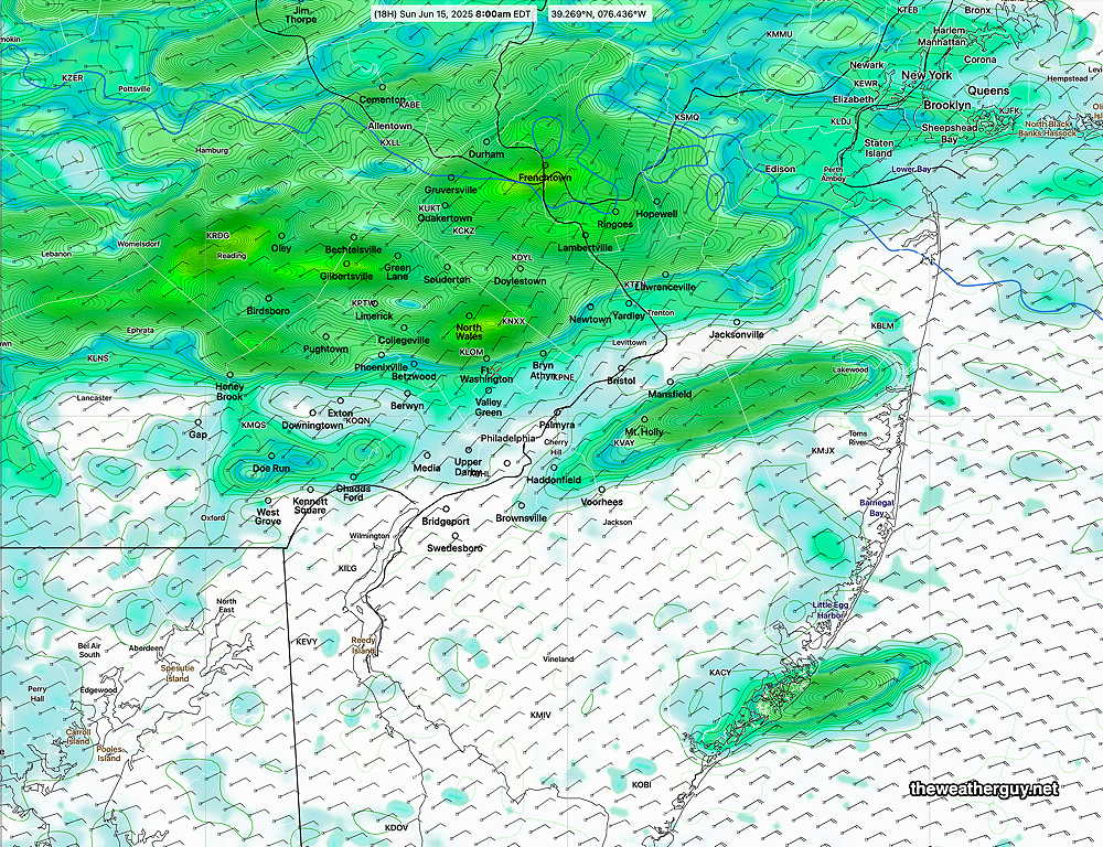
Here’s current radar around 9:30 AM—

Current (~9:30 AM) Composite NEXRAD radar with superimposed RAP model vertical motion (vertical velocity pressure “omega”) at low and higher levels of the atmosphere. Upward motion is supportive of precipitation; downward motion is inhibits precipitation. Green contours are 700 mb (10,000 ft) wind streams. Areas 1 and 2 are upward motions, area 3 is downward (inhibitory) (Click on image for a larger view.)

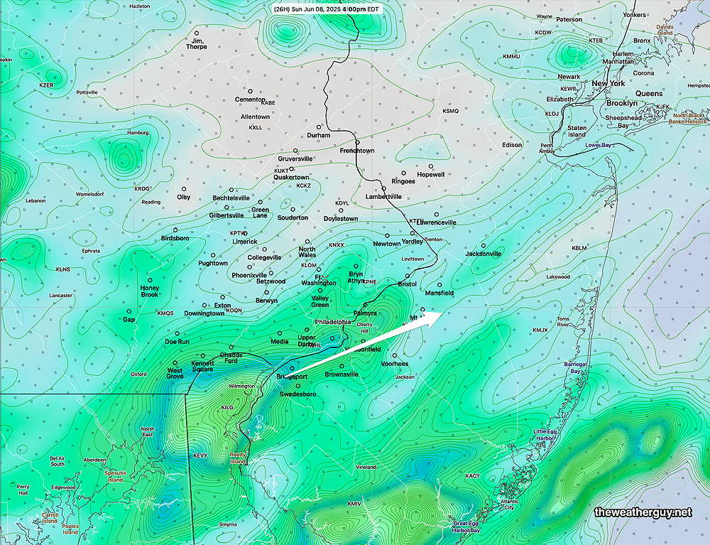
Both the HRRR and experimental RRFS show this trend. This general trend has been consistent with some, but not all of the models. Here’s the 06z RRFS—

06z RRFS forecast for noon. Only light precipitation in our area. Most of the heavier rain stays to our north.

It should be noted that the Canadian HRDPS shows much heavier rainfall here around mid day. For now, we’ll ignore the HRDPS forecast.


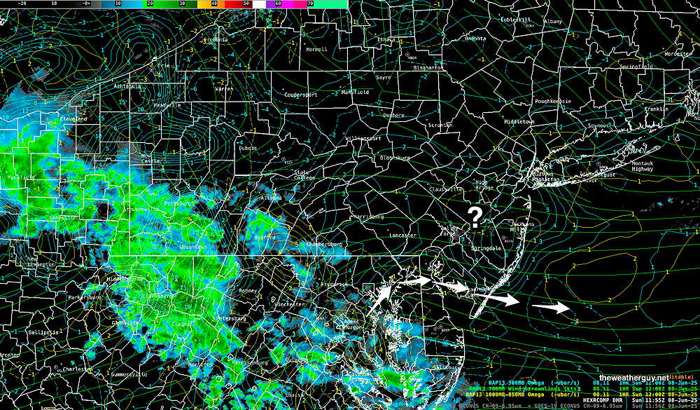
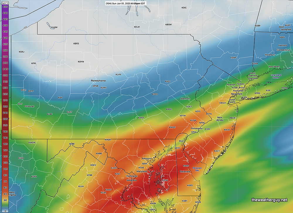
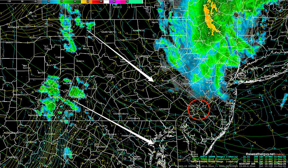
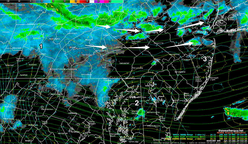
Previously Posted Fri @ 5:53 PM —A cold front has dropped south of our area today and become stationary. An easterly flow of cooler (but somewhat damp) air has moved into the region. The water vapor image from this afternoon captures the current scenario—

Satellite water vapor image from mid afternoon with superimposed RAP model 500-1000 mb thickness lines (yellow), Mean Sea Level Pressure isobars (black contours) potential vorticity (fine violet contours) with superimposed MRMS RADAR. I’ve drawn the approximate location of the stationary front. Waves of low pressure will move near this stalled front over the weekend. Periods of showers are expected now, both Saturday and Sunday, but it won’t be raining the entire time. (Click on image for a larger view.)

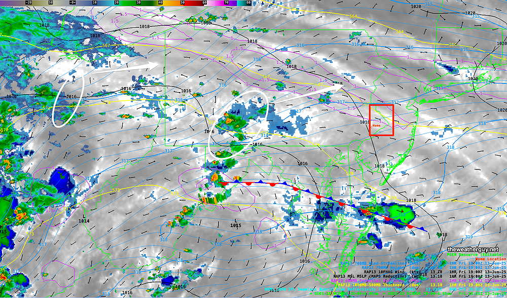
I should point out that the amount of sunshine we had today was greater than predicted by several models, and it sets into question whether the the current pattern is being properly modeled.

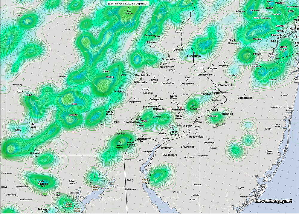
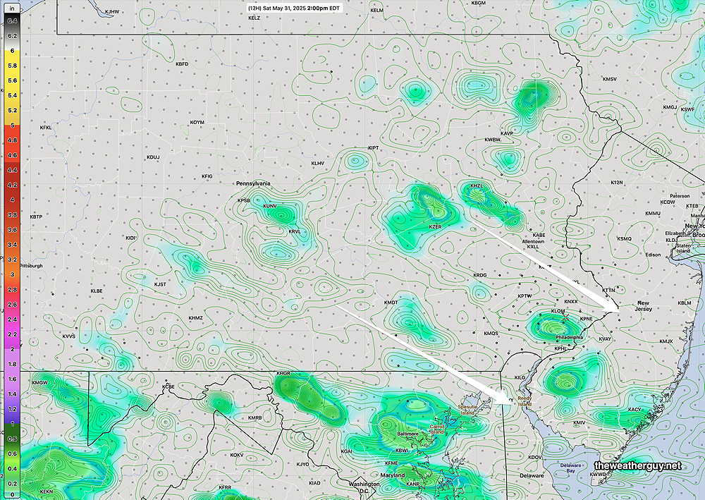
I’m going to provide several graphics of model forecasts at 2 PM Saturday to illustrate the wide range of rain coverage.

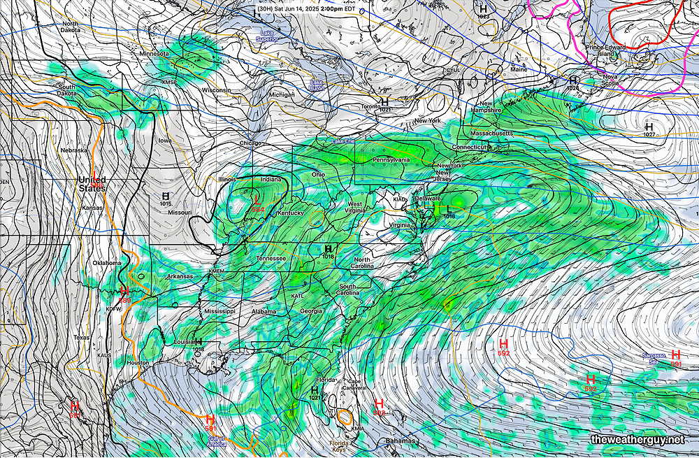
The most recent GFS forecast for 2 PM Saturday captures the extent of the rainfall, but I think it’s relatively low resolution suggests more rain than will actually fall.

Todays 12z GFS forecast for 2 PM Saturday. (Click on image for a larger view.)

A similar resolution ECMWF captures the more intermittent coverage of the rain—

12z ECMWF forecast for 2 PM Saturday. (Click on image for a larger view.)

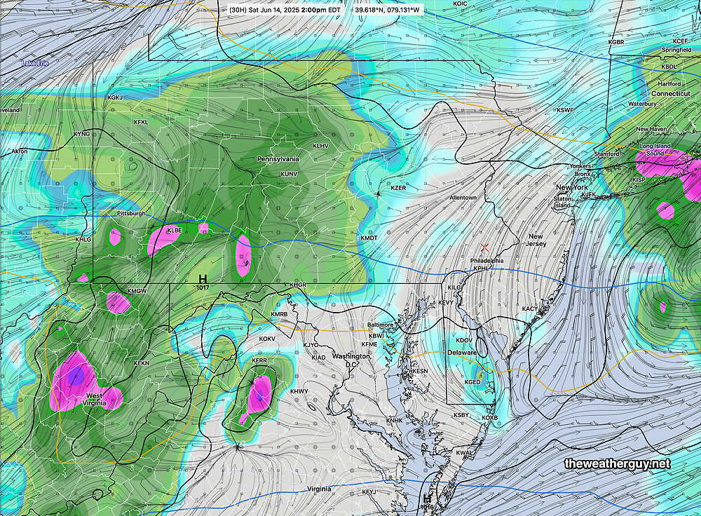
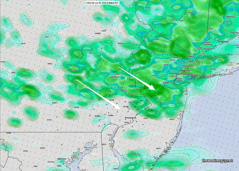
The much higher resolution HREF model captures the more intermittent nature of the rainfall—

18z HREF model forecast rain and statistical spread (contours) for 2 PM Saturday. (Click on image for a larger view.)

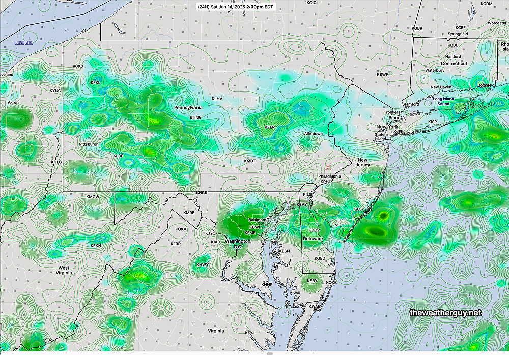
Finally, here’s the latest REFS (experimental) model forecast for 2 PM Saturday.

12z REFS forecast for 2 PM Saturday. Rain and statistical spread (fine contours) (Click on image for a larger view.)

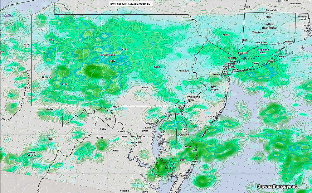
From all of these models, it should be apparent that there’s a wide range of rainfall coverage for Saturday, and with the exception of the GFS, the Philadelphia region and South Jersey appear to get the least rainfall.

Saturday Forecast

Cloudy with periods of showers throughout the day. Rain won’t be continuous and there should be breaks in the action. Fog and mist possible.

NBM high temperatures: Blue Bell, PA 69º Philadelphia, PA 71º
High uncertainty (based on standard deviation): ± 3.6º

Sunday Forecast

Cloudy with intermittent showers. Rainfall not as widespread as Saturday with plenty of breaks in the showers.

NBM high temperatures: Blue Bell, PA 67º Philadelphia, PA 68º
Low Uncertainty (based on standard deviation): ± 1.3º


WEEKEND WEATHER FORECAST

Uncertainty

Posted Sunday 06/08/25 @ 8:07 AM — I’ve been talking about an uncertain/low confidence forecast for this weekend and today, Sunday, is driving home that point.

Last night, the forecast for rain today had already been pushed from morning into mid-afternoon. The 06z models continue to show clouds at 8 AM, despite it being sunny now.

Current radar this morning is deceptive—

Radar ~ 8 AM with RAP model winds and Omega superimposed. The rain near DC is moving in our direction, BUT the winds at 10,000 feet have this rain moving abruptly to our east and south, possibly affecting south Jersey. (Click on image for a larger view.)

The latest REFS forecast (which did well yesterday) captures the same radar scenario as above, with minimal rain in Philadelphia even at 7 PM tonight—

00z REFS forecast rain plus statistical spread (contours) at 7 PM tonight. (Click on image for a larger view.)

However, even the REFS (along with the HRRR) show cloudiness right now, not the sun which is clearly visible through high cirrus.

The latest European AI model just became available and it accurately shows the the high cirrus. It maintains a forecast of clouds by afternoon with some light rain by 3-6 PM here in Philadelphia. So this AI generated forecast is what I’m going with today.


Forecast Update

Posted Saturday 06/07/25 @ 9:49 PM — A quick update. It now appears that the rain will not make into our area until 2-3 PM Sunday. The rain will be quite light at the start. The heaviest rain late Sunday will be east of the I-95 corridor.

18z REFS forecast for 4 PM Sunday (Click on image for a larger view.)

Posted Saturday 06/07/25 @ 9:46 AM — The REFS was spot-on with its forecast for rain to move in around 8:30 AM Saturday. I’m going to continue with REFS model forecast for the balance of Saturday and Sunday.

Saturday— continued cloudy with intermittent showers and possibly thundershowers. Shower activity picks up after 3 PM—

06z REFS model forecast- rain and statistical spread (contours) at 3 PM Saturday. (Click on image for a larger view.)

Sunday— cloudy. The latest REFS shows rain moving in earlier than previously forecast, as early as 9- 11 AM

06z REFS forecast for Sunday at 10 AM. rain and statistical spread (contours) (Click on image for a larger view.)

Originally Posted Fri 5:40 PM —This weekend’s forecast has clarified somewhat. As mentioned in yesterday’s post, there’s been a great deal of model spread (uncertainty) with the weekend forecast in recent days and that I’d likely lean towards the model that did the best forecasting today’s weather. Today’s best forecast was from the experimental (and hopefully soon to be released) REFS ensemble model. (The HRRR, NAM-NEST and NBM kept areas near the city and eastward dry.)

The REFS’s forecast from yesterday morning for today at 4 PM is shown below along with a radar loop from today below –

REFS forecast from 12z (8 AM) Thursday morning for today, Friday at 4 PM. The REFS (and the RRFS) were the only models that clearly showed rain as far east as the city and parts of NJ. The other models, the NBM, NAM-NEST and the HRES kept the rain to our northwest.
Here’s a radar loop from around 3 PM Friday. A closer fit to the REFS forecast with showers in Philadelphia and NJ. While the REFS did well, it still didn’t capture the showers in Cape May County. (Click on image for a larger view.)

So staying with the REFS, here’s my current forecast for Saturday and Sunday, with help from the ECMWF-AI model and the NBM

Saturday Forecast

Cloudy with periods of rain and thundershowers throughout the day. Skies may brighten a bit towards evening as the rain ends.

NBM high temperatures: Blue Bell, PA 79º Philadelphia, PA 82º
Higher than normal uncertainty (based on standard deviation): ± 3º

Sunday Forecast

Some bright spots, possibly some sun through clouds early. Increasingly cloudy by afternoon. Rain and thunderstorms moves in between 3 and 5 PM from the southwest and continue into the evening.

NBM high temperatures: Blue Bell, PA 75º Philadelphia, PA 577º
Very high uncertainty (based on standard deviation): ± 3.5º


WEEKEND WEATHER FORECAST

Posted Sunday 06/01/25 @ 10:37 AM — Ordinarily, I find the the expression “sunshine through high cirrus clouds” to be a useful description of a day’s cloud cover when the predominant cloud type is cirrus. Many people might not notice that the sunshine is filtered by high clouds.

Today, the appropriate sky forecast description is sunshine through smoke. The smoke from wildfires in Canada has made its way to our area in a reduced way. Here’s the latest HRRR smoke model forecast for this afternoon showing plumes of smoke —

Today’s HRRR smoke model forecast for 6 PM. While the 100 x 10 minus 6 kg/m2 doesn’t approach the 480 level we saw a few years ago. the sky will not be the bright blue we’d expect to see with a clean air mass. (Click on image for a larger view.)

Saturday Weather Update

Updated Saturday 05/31/25 @ 9:48 AM — Latest RREF shows the scattered showers as early as 1 PM.

Posted Saturday 05/31/25 @ 9:30 AM — We had the heavy rain last night; rainfall amounts and severity here were not as great as had been forecast possible.

Total rainfall received—

MRMS rain-gauge measured rainfall combined with rain-gauge calibrated and interpolated radar-based summary of ACTUAL RAINFALL RECEIVED. Color shading is in inches. Line contour numbers are in mm. (25.4 mm= 1 inch)      (Click on image for a larger view.)

Additional showers are expected with the passage of a cold front this afternoon. Currently, these showers are in northwestern PA—

RADAR at 9:15 AM with superimposed RAP model parameters. (Click on image for a larger view.)

Most models show two areas moving towards us, as shown above, with the heaviest rain to our north and more so to our south.

Here’s the current HREF forecast for this afternoon—

Forecast for 2 PM this afternoon. Scattered showers, nothing severe. (Click on image for a larger view.)

A dry day for Sunday with sun mixing with instability cloudiness.

The weather really warms up next week, with temperatures in the mid to upper 80s Tuesday through Thursday.


Heavy Rain Possible Tonight

Posted Friday 05/30/25 @ 6:11 PM — One more thing. Helicity and vertical shear values become highly elevated between 10 PM and 1 AM. The potential for severe thunderstorms and even a tornado is possible, most likely in western suburbs.

Posted Friday 05/30/25 @ 6:11 PM — I’m a little short on time for this forecast, so I’m simply going to focus on Friday night at this point.

Showers and thunderstorms are developing to our south and will move in as early as 8-9 PM and will quickly become widespread by 10-11 PM.

HREF 18z forecast simulated radar 9 PM and 11 PM (Click on image for a larger view.)

Flood Watches have been issued for parts of the area. Total rainfall by 8 AM Saturday—

18z HREF forecast accumulated rainfall by 8 AM Saturday. Note that the exact locations and amounts are often not correct, but suggest possibilities. (Click on image for a larger view.)

Following a break Saturday morning, more rain is expected Saturday afternoon. I’ll update tomorrow morning.