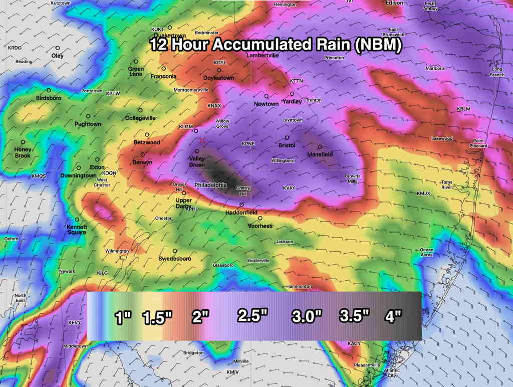
Updated with latest model blend (NBM) accumulated rain graphic.
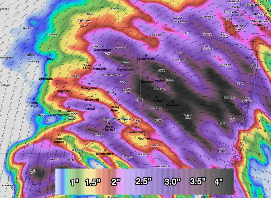
The models that are run at 2 AM EDT (06z) continue with a similar forecast as last night. Rain will be starting shortly, if it hasn’t already started in your area. Precipitation amounts look to be a generalized 1.25-2 “ of rain with some local areas having 3-4”. (I’ll post a graphic shortly.)

The only change noted in the latest models is a tapering in the rain about 2 PM around here, vs the previous forecasts which had the moderate rain going into the early evening hours. It appears that the main slug of precipitation shifts northward into northern NJ and northeastern PA.
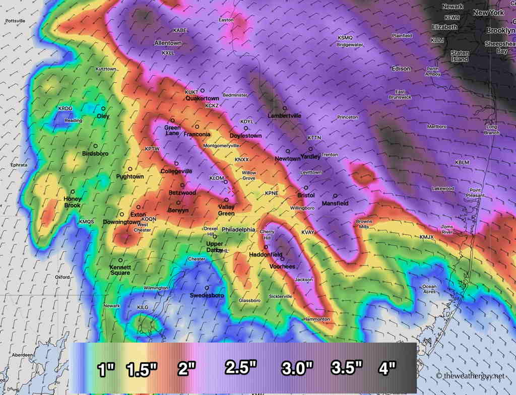
Here’s the most recent (06z) NAM NEST (High resolution) accumulated rain forecast with a somewhat different area of precip maximum:


