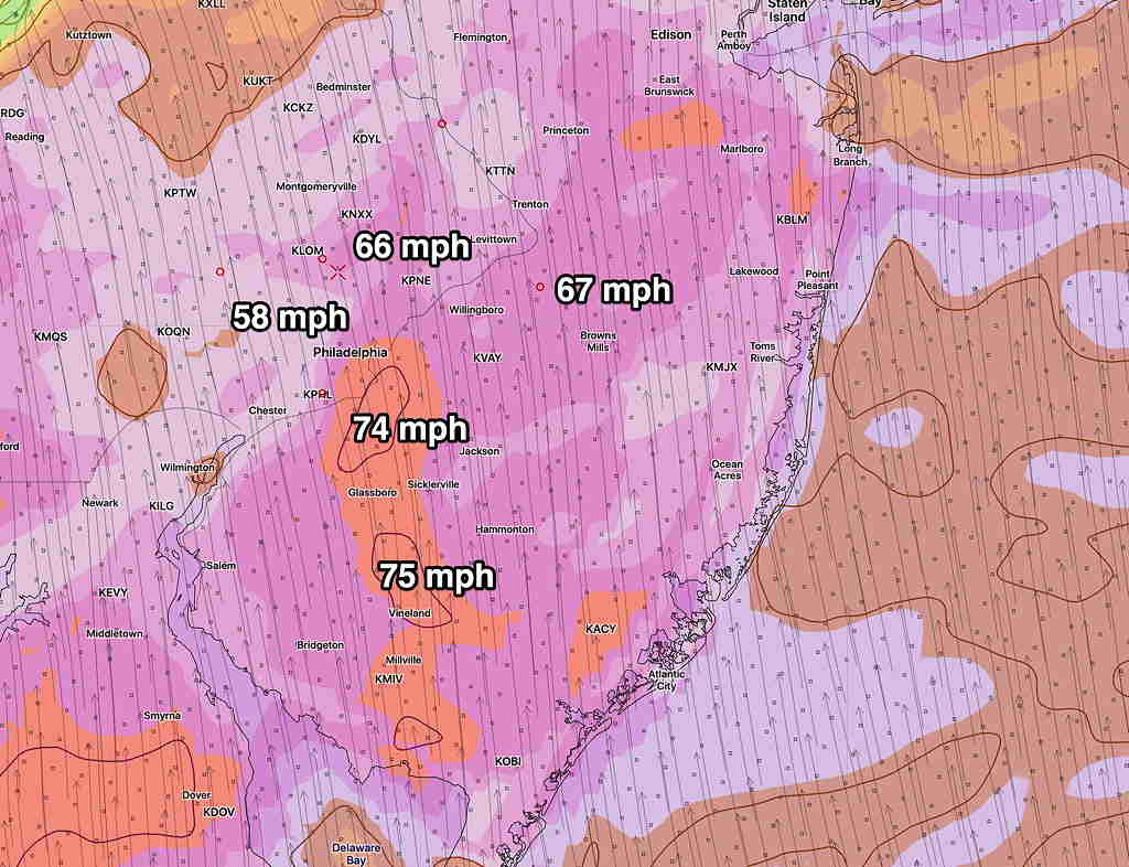
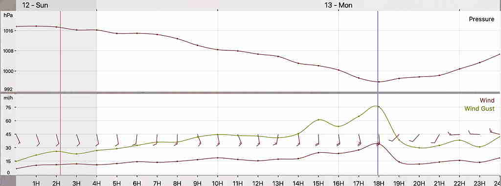
Brief Update Sun 10 PM— The latest short-range high resolution models are just becoming available based on the most recent upper air measurements done at 8 PM EDT tonight.
Based on the HRRR (High Resolution Rapid Refresh), the highest wind gusts will be around 1PM Monday. Here is the latest —


Gusts over 45 as early as 6AM.
Winds and wind gusts are difficult to forecast accurately, but I haven’t seen model numbers like this in a long time.
Latest rain accumulation is 2+ inches or rain.
Stay tuned; I’ll update early Monday morning.
