Last night’s models (they’re re-run again at 1AM, EST and become available between 3 AM and 6AM) had a wide range of snow totals.
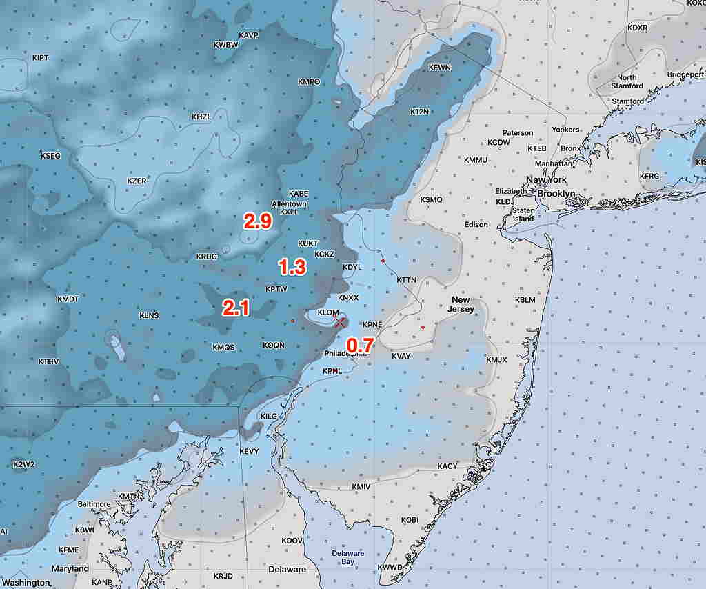
The NAM had extremely high QPF values, which I think is an outlier, although in the ‘old days’ of doing my forecasts I would have taken it more seriously, The high resolution NAM NEST had the following snow totals by 11 PM tonight—

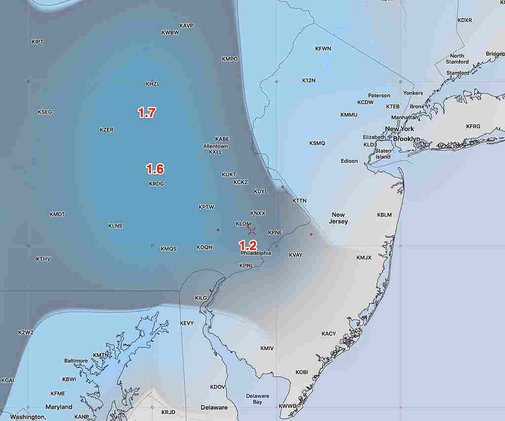
The statistical version of the GFS, the GEFS, which is a lower resolution model had the following—

Last night’s European (ECMWF) had a similar map as the NAM NEST above, with a coating in the city.
I’ll be posting some of the latest models from this morning (HRRR and NAM NEST) when they become available, before I head out the door for work.
