
#Philadelphia #weather #PAwx #PhillyWx
Monday Eve Heavy Rain Update
Posted Monday 07/14/25 @ 9:42 AM — This morning, I wanted to wait for the latest model runs before posting. As mentioned yesterday, a weak, slow moving upper level trough will move across our area and act as a trigger for somewhat more organized thunderstorm development today.
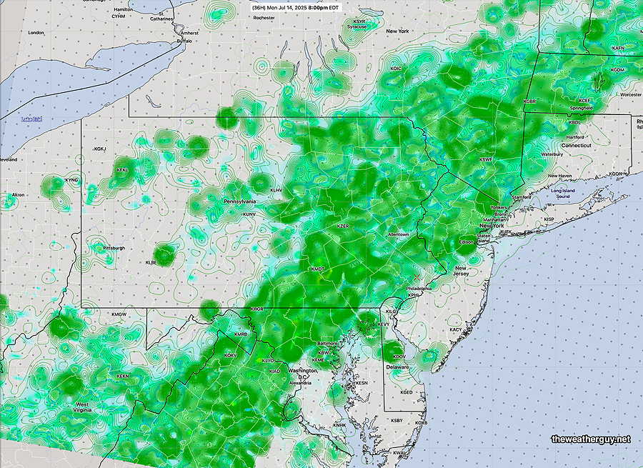
The timing has shifted somewhat later, now into the evening hours, moving in as early as 6 PM with maximum activity between 7-8 PM and midnight. However, it should be pointed out that the AI versions of the ECMWF and GDPS have widely scattered activity possible for most of the afternoon into the evening, especially western sections.
It may get hung along the Jersey coast with showers lingering here near the city well into Tuesday morning.
Heavy rain will be the ‘feature’ of today and tonight’s activity and the REFS is showing areas receiving as much as 1″-4″. Aside from the heavy rain and lightning threat, severe activity looks to be low.
A considerable amount of cloudiness is expected today from the city westward, but areas in NJ may see considerable sunshine. High temperatures will be in the mid 80s, not likely hitting 90º unless the cloud cover forecast is wrong. High humidity expected with dew points in the 70s. The NBM shows 88º for today.
While not a severe thunderstorm day, I thought I’d compile a severity table to give a sense of what elements are missing today for severity to be likely—
| Severity Parameter (HRRR) | Sept 1 , 2021 Tornado Outbreak (example of highly severe) | 4-1-23 Tornadoes (Example of severe) | 08-07-23 18z HRRR Bow Echo | 07-08-25 18z HRRR & Impact | Today 07-14-25 HRRR & Impact | Notes |
| CAPE Joules/kg | 3500-4200 ⚑⚑⚑⚑ | 2100 ⚑⚑ | 2600 ⚑⚑ | 2680 ⚑⚑ | 2900 ⚑⚑ | Western Areas |
| Helicity m^2/s^2 | 1350 ⚑⚑⚑⚑⚑ | 655 ⚑⚑ | 726 ⚑⚑ | 403 ⚐ | 161 ⚐ ⇩ | |
| Vertical Shear 1/sec | 40-46 ⚑⚑⚑ | 40-45 ⚑⚑⚑ | 30 ⚑ | 20 ⚐ ⇩ | 18 ⚐ ⇩ | |
| Precipitable Water | 2.7″ ⚑⚑⚑⚑ | 0.83” ↓ | 2.1″ ⚑⚑ | 2.6″ ⚑⚑⚑⚑ | 2.3″-2.5″ ⚑⚑⚑⚑ | Heavy rain potential |
| Lifted Index º K | minus 6º ⚑⚑ | minus 9.3º ⚑⚑⚑ | minus 9.9º ⚑⚑⚑ | Minus 8.3º ⚑⚑ | Minus 7.0º ⚑⚑ | |
| HRRR Hail inches | 1.9 ⚑⚑ | 1.4 ⚑ | 1.8 ⚑⚑ | 1.8 ⚑⚑ | 1.8 ⚑⚑ | |
| Peak Wind Gusts mph | 40-50 ⚑⚑ | 40-50 ⚑⚑ | 65mph ⚑⚑ | 51.6mph ⚑⚑ | 30 mph ⚐ | western areas |
| Storm Motion Shear Vector Alignment | Aligned – ~ 90º ⚑⚑ | Almost aligned ⚑⚑ | aligned ⚑⚑ | Somewhat aligned ⚑ | Not aligned ⚐ ⇩ | |
| 250 mb Jet Stream Wind mph | 63 ⚑ | 135 ⚑⚑ | 74 ⚑ | 41 ⚐ ↓ | 24 ↓↓ |
Originally Posted Sun 8:11 PM —This week’s weather will continue to be warm/hot and very humid through at least Friday. With the exception of Monday, most of the weather will consist of random areas of thunderstorms developing from small, localized mesoscale disturbances.
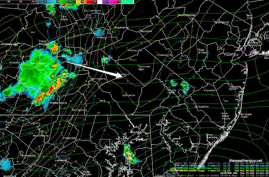
On Monday, a weak, slow moving disturbance and upper trough will create somewhat more organized storms, especially towards evening. Some of that activity has been developing in Central PA this afternoon and may move into our immediate area, especially western sections this evening—
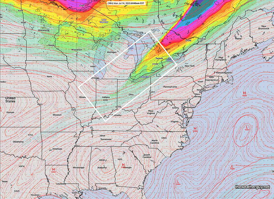
The upper trough and diminishing jet streak is visible with the GFS forecast for Monday morning—
Following any morning showers, Monday should become partly to mostly sunny through high clouds. Showers and thunderstorms move in from the west between 4 PM and 9 PM, but may lose upper support as they try to move past the city into NJ.
The rest of the week looks just like typical summer weather. Highs near 90 and VERY humid with scattered late day storms, too difficult to predict in advance.
Updates during the week. Stay tuned.
Models used for this forecast: GFS GDPS-AI, ECMWF-AI , REFS, RRFS