
#Philadelphia #weather #PAwx #PhillyWx
Friday & Weekend Outlook
Update Fri 5/23 8:51 AM — The latest RRFS model runs keep most of the day dry with clouds and breaks of sun. Scattered showers become more numerous after 5 PM into the early evening.
Posted Thursday 05/22/25 @ 5:43 PM — Rain continues to rotate around the main area of low pressure. This system will eventually move off to the northeast over the next 48 hours.
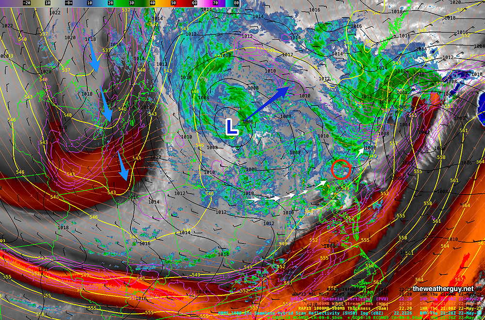
Friday: Relatively cold air aloft will move in behind the system during the first two days of the weekend. Looking at the best match for Friday’s forecast, it appears that we may see some sun at times Friday morning. Cold air aloft will cause enough instability for clouds to form with scattered showers in the afternoon, especially mid to late afternoon.
It will be windy and gusty. Cool! High near 65º
Saturday: Cold air aloft will result in considerable low clouds (stratocumulus) especially by later morning and during much of the afternoon. There’s still a chance of light scattered showers. It will be windy and gusty. High near 65º
Sunday: More sun, but still periods of some cloudiness. Still breezy/windy. High near 67º
Monday: Mostly sunny. High near 68º
Thursday and Friday
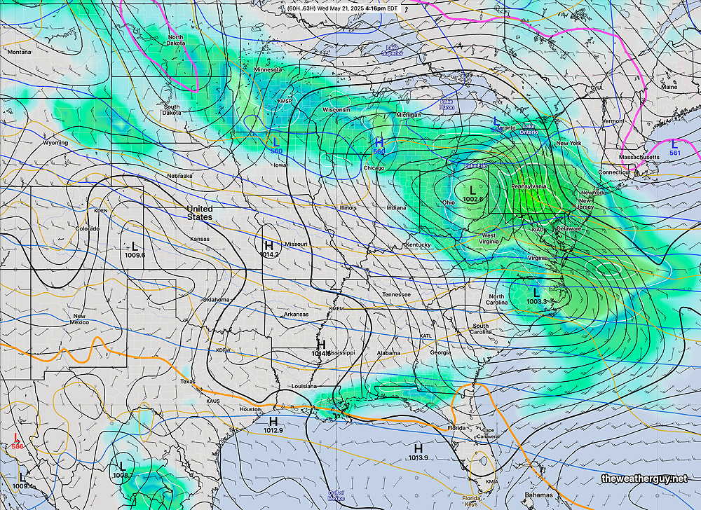
Posted Wednesday 05/21/25 @ 7:43 PM — A secondary coastal low is expected to form tonight and will bring heavier rain tonight into Thursday.
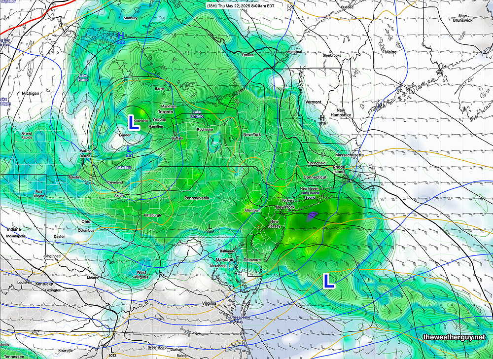
A line of heavier rain is moving through Central Pennsylvania this evening and will arrive here later this evening.
Thursday will have periods of rain on and off during the day and into the evening hours.
Friday will still be cloudy, windy and chilly with a chance of showers, especially in the afternoon.
The weekend will feature gradual clearing. Plenty of clouds on Saturday and even Sunday may have some cloudiness develop mid day due to instability. Monday looks to be the best day. It will be chilly and windy much of the weekend; it won’t feel like the beginning of summer.
Wednesday Thursday Forecast
Posted Tuesday 05/20/25 @ 6:02 PM —Rain moves in from the southwest, reaching us between 7 and 9:30 AM on Wednesday.
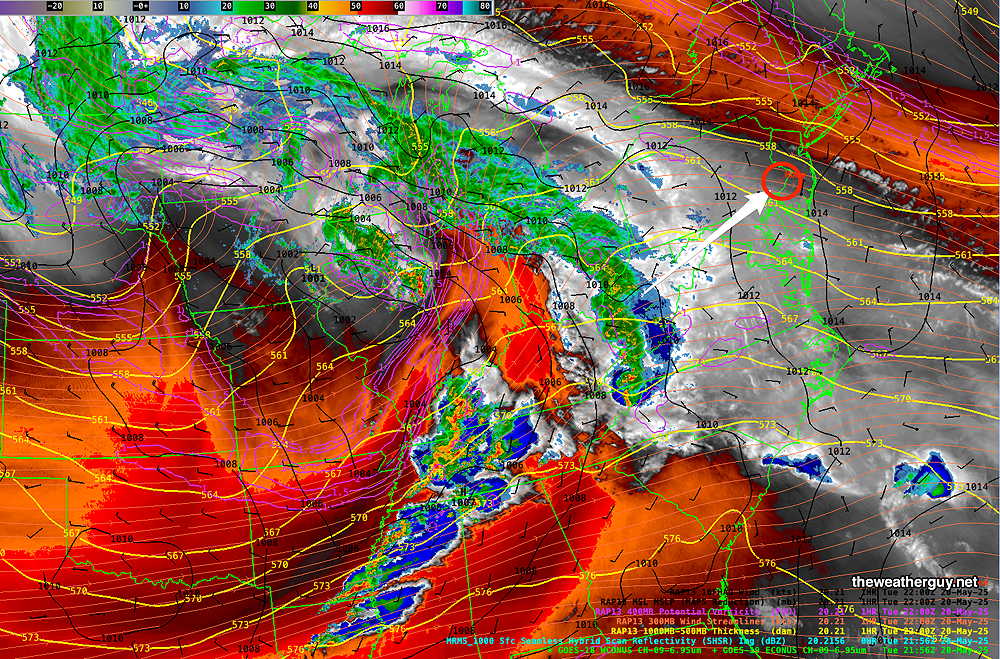
(The onset of the rain has moved later with each model run.) Wednesday looks rainy for most of the day, perhaps with some breaks at times. Heaviest rain likely during the afternoon hours.
A possible break in the action Wednesday evening, then more rain, on and off through much of Thursday. Thursday’s rain will likely be more showery and intermittent than Wednesday.
It will be windy and become gusty, especially Wednesday night into Thursday morning.
About 1 inch or more of rain is expected.
Improving conditions on Saturday through Monday. Saturday will be quite cold and windy.
So, no more MRMS rain totals and fancy model superimposed water vapor until….
I don’t want to get political here. But what’s going on makes me angry and sad.
Tuesday Update
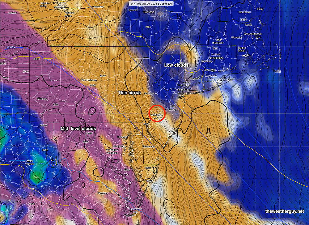
Posted Monday 05/19/25 @ 8:36 PM — We had much more cloudiness for much of the morning and early afternoon today than forecast by any model. Skies eventually cleared.
For Tuesday, the approaching system has slowed down and it appears that any rain will wait until daybreak Wednesday.
In the mean time, we’ll start sunny Tuesday morning, but we’ll be sandwiched between low clouds to the north and advancing middle level clouds to the southwest. So we’ll go with sunshine in the morning and sun through high cirrus clouds in the afternoon. It wouldn’t take much for the cloud forecast to be off tomorrow.
It should be much less windy on Tuesday compared to Monday.
Rain on Wednesday into Thursday. Over an inch is forecast. See this morning’s forecast immediately below for the weekend sneak peak.
This Week & Memorial Day Weekend
Originally Posted Mon 9:42 AM —Currently a low pressure system is gathering strength and moisture near Nebraska and will move eastward—
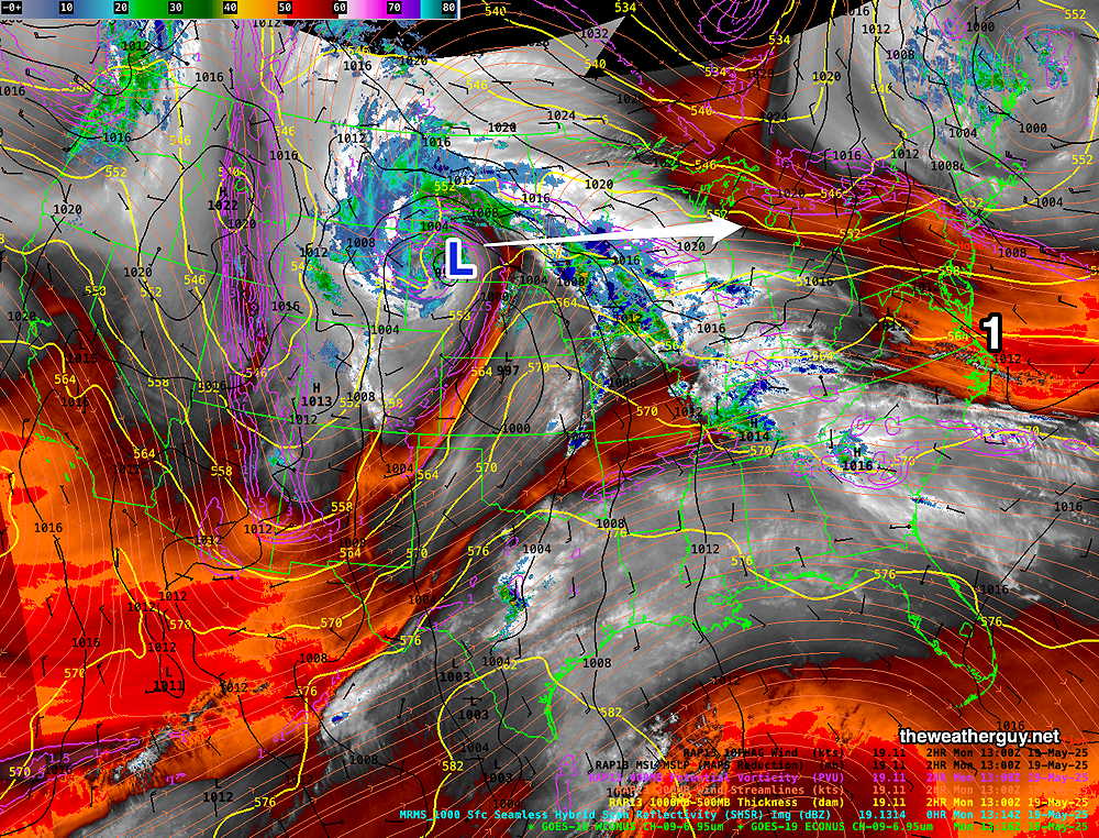
A secondary low will develop along the eastern Mid-Atlantic from this system. Rain will move in, about 5 AM Wednesday morning and linger in some form at least through Thursday evening and even Friday.
Over an inch of rain is expected with this system.
The big question is the Memorial Day Weekend. The AI model (ECMWF-AI Single) is showing a cut off closed low hanging back, bringing chilly temperatures and the chance of showers even through Saturday.
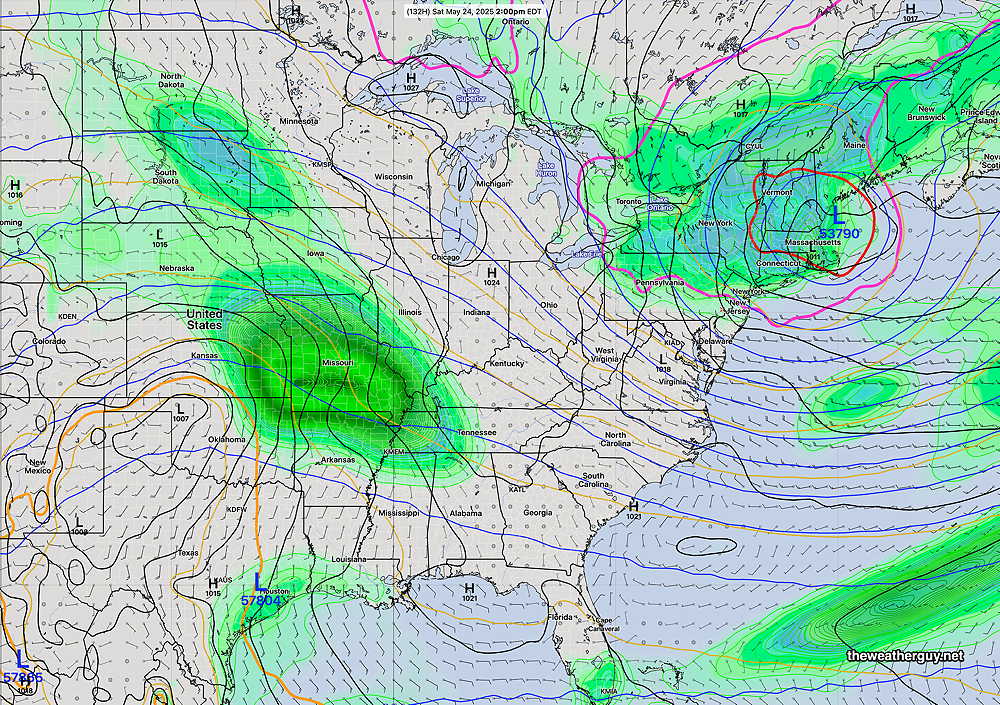
Things look better for Sunday and Monday.
Due to the highly unbalanced political environment on X, I’ve considerably cut back auto-posting there. To receive all my forecast postings, I recommend following me on mastodon.social or bluesky.social