
#Philadelphia #weather #PAwx
Friday & Weekend Outlook
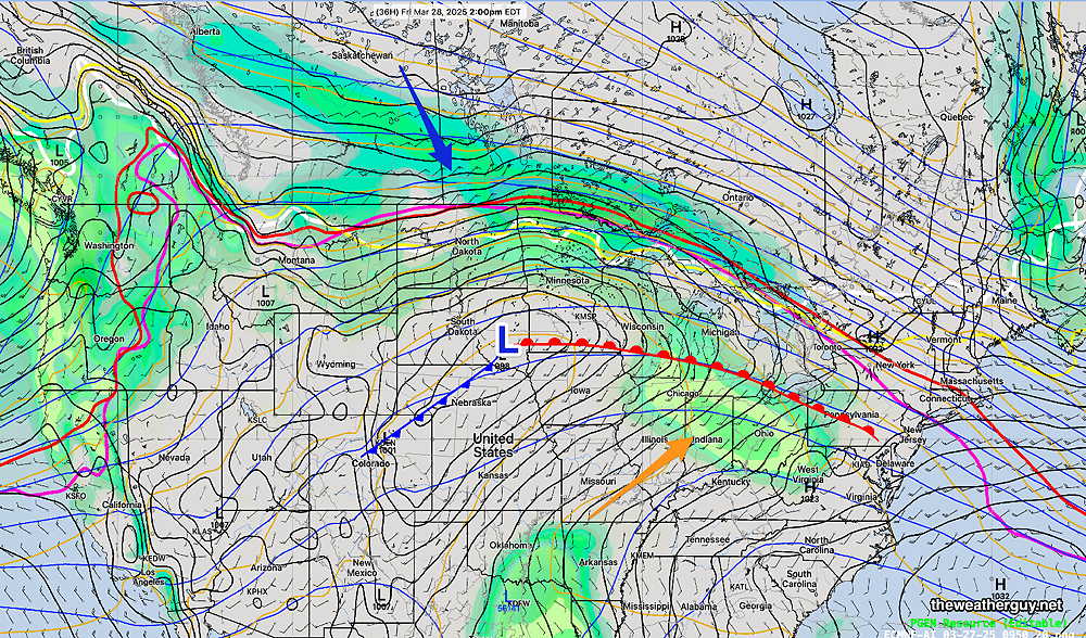
Posted Friday 03/28/25 @ 8:38 AM — Over the past several days, there have been significant changes in the model forecasts for this weekend. Here’s a brief summary—
- The warm front will become stationary far north of our area. This area will be the focus of most of the rain for this weekend. Much of the rain will stay to our north. What had looked to be a wet latter half of Sunday, now appears to be much dryer.
- Rain from the system will affect our area on Monday and Monday evening instead of Sunday evening into Monday.
Current water vapor image—
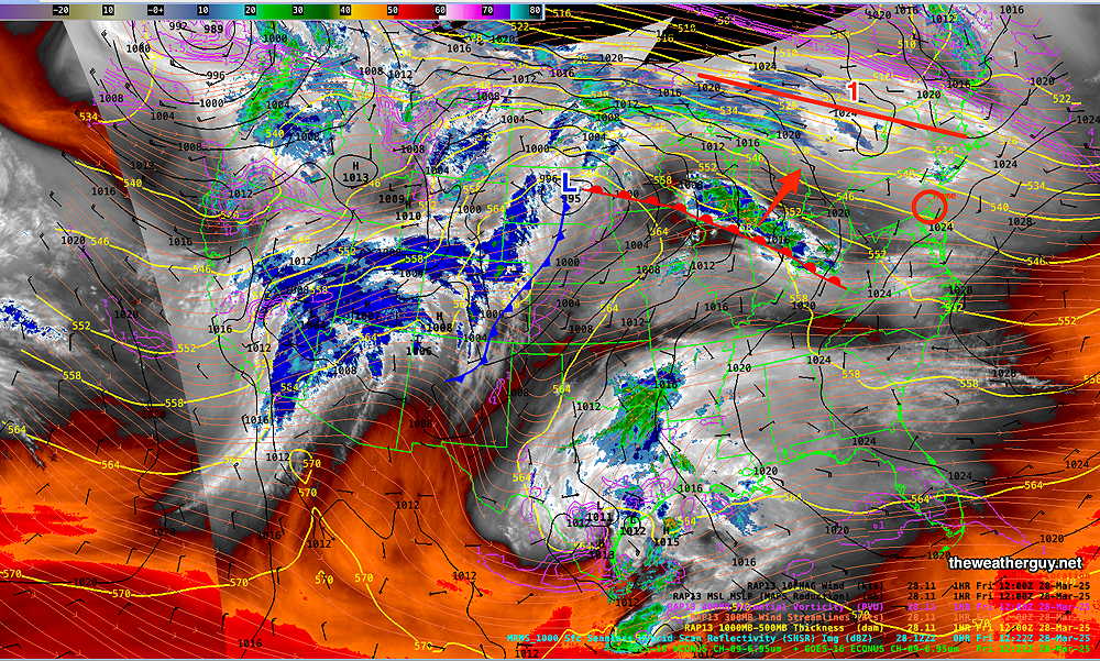
As for today, Friday, most models still have the showers associated with the advancing warm front to pass us to the northwest. The ECMWF-AI, the HRRR and the NAM-NEST keep a forecast of very light showers Friday evening, anytime between 6 PM and midnight.
I’ll post my regular “Weekend Weather Forecast” late this afternoon with an update.
Thursday and Friday Outlook
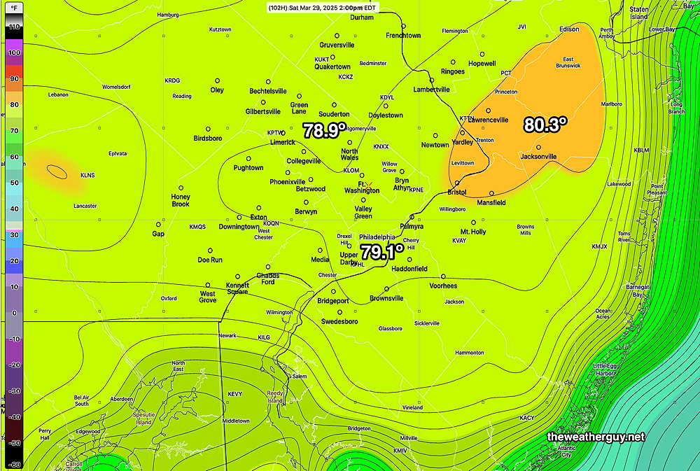
Posted Thursday 03/27/25 @ 10:04 AM — I’m finally hearing the words “near 80 degrees” for Saturday in the TV/Radio forecasts. The ECMWF-AI model has been predicting these temperatures since Tuesday.
For today, Thursday, it will be sunny and continued windy and somewhat chilly.
To get to 80 degrees, a warm front will need to pass through our area Friday night.
Earlier this week, the models only showed showers to our far northwest with this warm frontal passage. The latest models are showing some showers breaking out as early as Friday afternoon ahead of the front.
Here’s the latest HRRR which is forecasting showers and thunderstorms as early as 4 PM Friday afternoon—
Thursday and Weekend Outlook
Posted Wednesday 03/26/25 @ 5:15 PM — Showers formed, mostly to the north of the Philadelphia area today, and radar showed precipitaton over Philadelphia which evaporated before making to the ground. Significant shower activity broke out at the Jersey Shore this afternoon from the upper air disturbances discussed in this morning’s update.
Thursday is still showing cooler temperatures,(53º-55º) but plenty of sunshine. Still somewhat windy and gusty.
A warm front moves through Friday night and the ECMWF-AI-Single and Canadian RGEM models are still showing 80º+ for our area on Saturday.
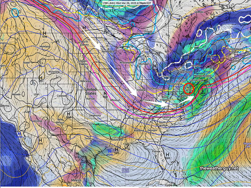
Rainy weather moves in late Sunday afternoon and continues through Monday. the Phillies opener may be affected.
Wednesday Forecast Update
Posted Wednesday 03/26/25 @ 9:48 AM — Several models (ECMWF, Canadian RGEM, German ICON) are showing some fast moving instability showers moving through here early afternoon. There will be some sunshine in the [late] afternoon, according to the HRRR, but not as much as forecast yesterday. So clouds and some sprinkles is a better bet for late morning and early afternoon.
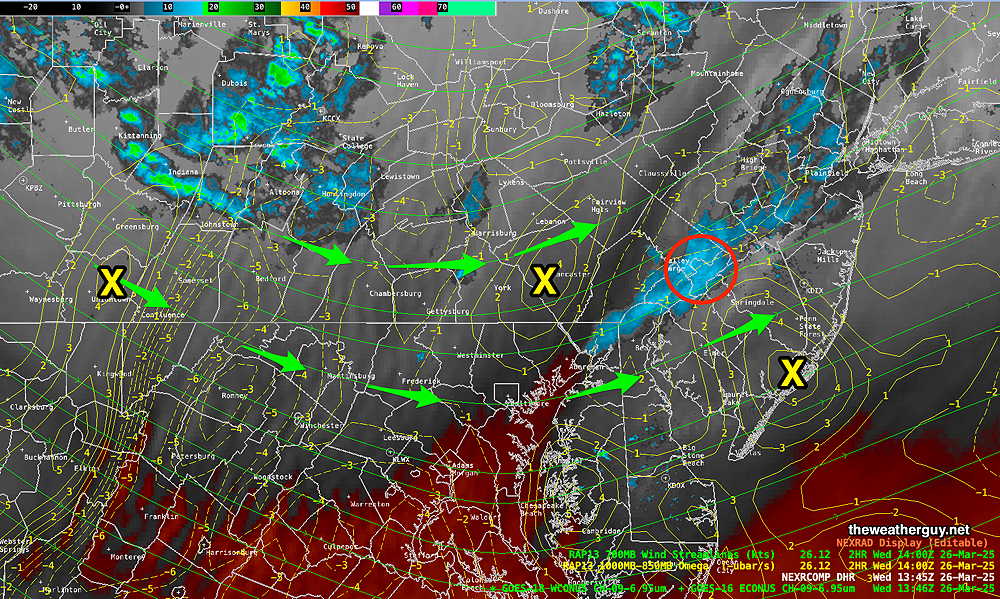
Current Water Vapor shows showers likely to pass to our north, but positive upward motion just to our west may produce showers here between noon and 1 PM and in NJ—
Wednesday through Saturday
Posted Tuesday 03/25/25 @ 6:04 PM — The fast moving low pressure system expected to form this evening will remain to our south. Rain may extend north into South Jersey, but the Philadelphia area will remain dry. Colder weather for Wednesday and Thursday with high temperatures around 50º with sunny skies. A warm up Friday. A big surprise for Saturday- high temperatures may approach 80º!
A rainy period develops Sunday into next Monday.
Winds Return for Tuesday
Posted Monday 03/24/25 @ 5:50 PM — Windy conditions, especially Tuesday morning, with gusts 25-30 mph. Highs return to about 57º-58º after a cold morning. Some clouds move in late afternoon.
Posted Monday 03/24/25 @ 8:58 AM — Based on radar and the latest HRRR, the rain will be ending about 2 PM-3 PM around Philadelphia and about 5 PM to 6 PM at the Jersey Shore. (The Canadian RGEM has the rain ending about 3-4 PM here with some sun possibly by 6 PM. )
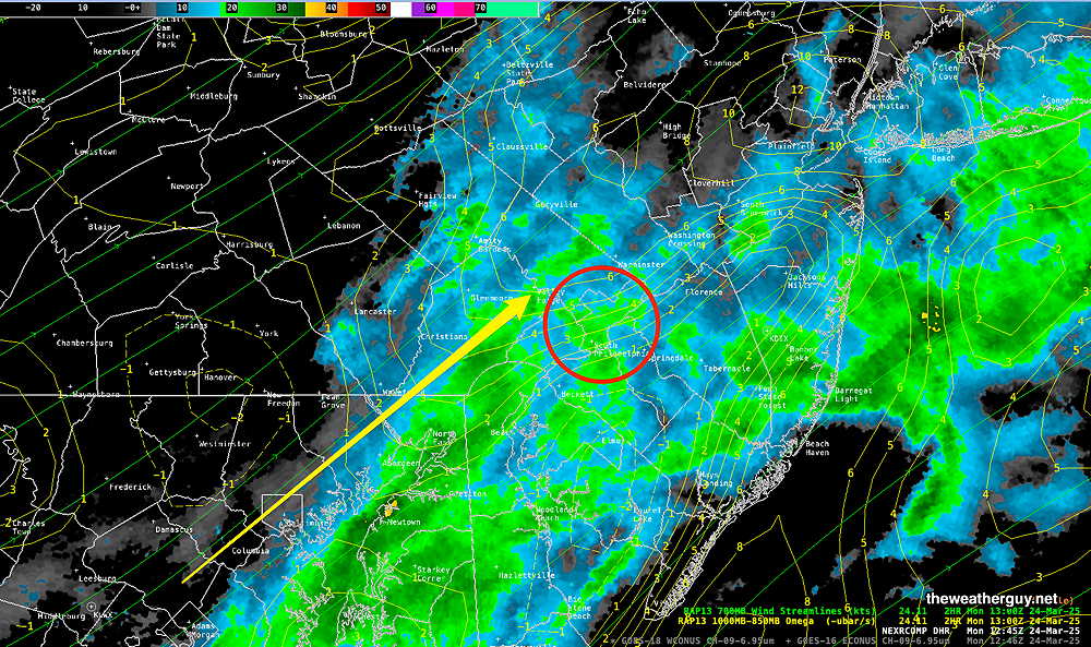
As for that potential ‘experiment’ with the ECMWF-AI model, its forecast for some rain here is now late Tuesday night, with light rain ending for the daytime Wednesday. The GFS has moved closer to the ECMWF-AI with some rain in NJ late Tuesday night.
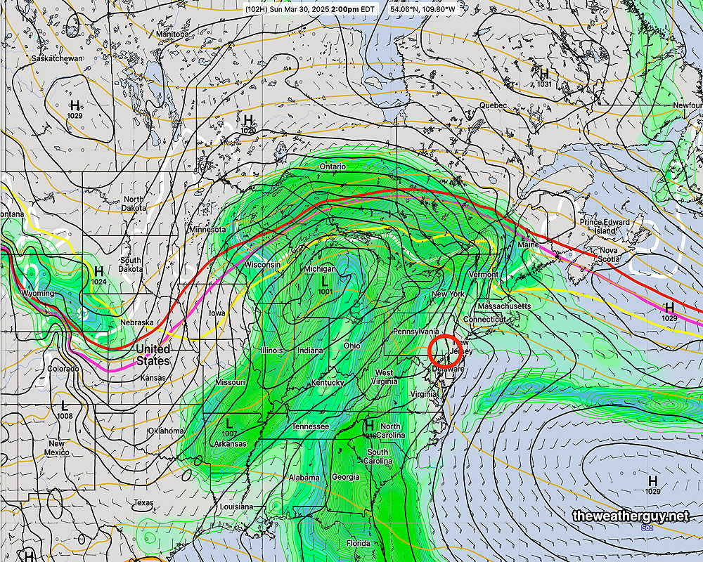
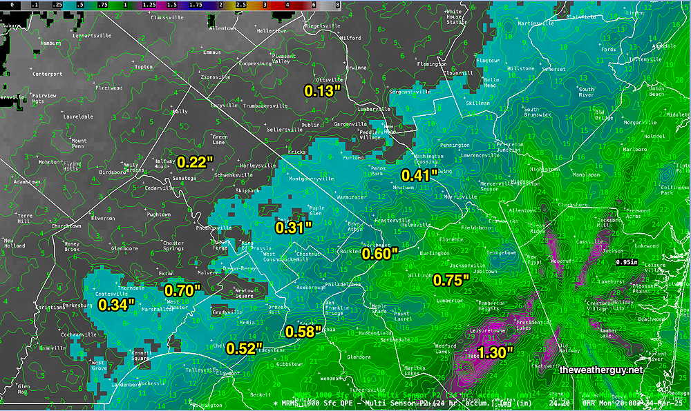
Originally Posted Sun @ 4:25 PM — —Low pressure and an associated cold front will move through on Monday. Rainfall looks to be in the 0.45″ range, but several models have as much as 0.75″ of rain falling over our area. Rain starts before daybreak Monday and continues through at least 4 PM, when any remaining precipitation will become light and widely scattered.
Overall, this coming week looks to be colder than recent weeks with a persistent dip in the jet stream over the Central and Northeastern US.
The current satellite water vapor image with superimposed RAP model parameters and MRMS radar shows the setup that will be persistent—
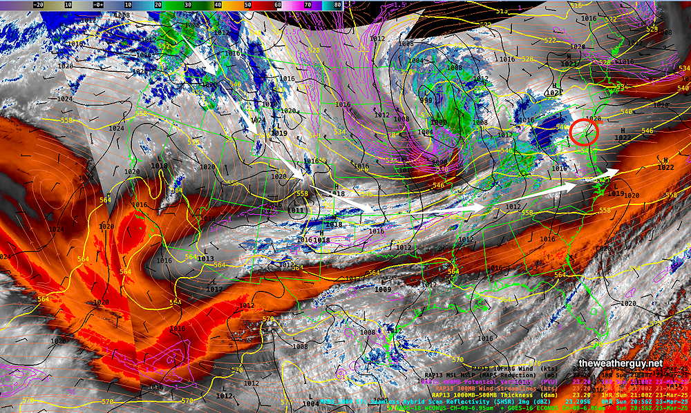
Of interest is the energy in the Pacific Northwest diving southward into the upper trough. The latest ECMWF-AI model shows another storm developing Wednesday which lends itself to another “AI model Experiment“.
Basically this AI model shows much more development of this Wednesday low pressure system than the either the GFS or ECMWF—
Yet another system associated with a warm front approaches Friday or Saturday. Temperatures look to moderate by next weekend.